Farther with the Farmers

  • Itinerary and Highlights
  • Farther with the Farmers
  • The Farmer's Daughter
  • Jackson's Blog
Looking back at Torrent Bay from the Abel Tasman Track.

Looking back at Torrent Bay from the Abel Tasman Track.

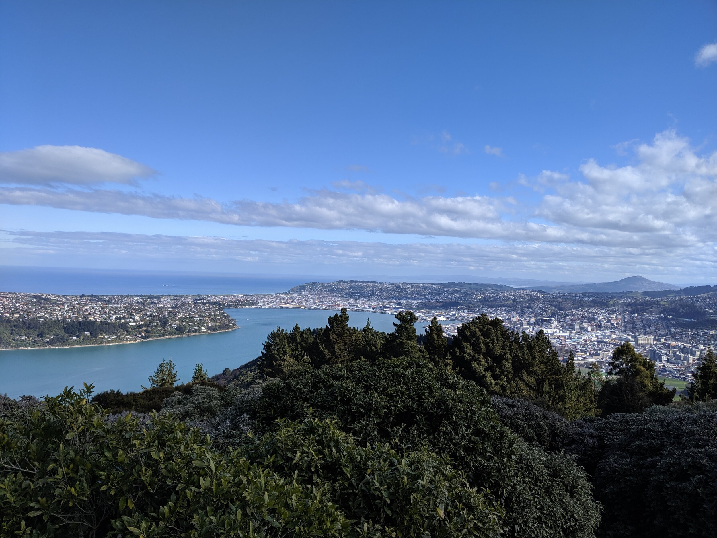
Marlborough Wine Country and Abel Tasman National Park

November 22, 2019 by Brooke Farmer

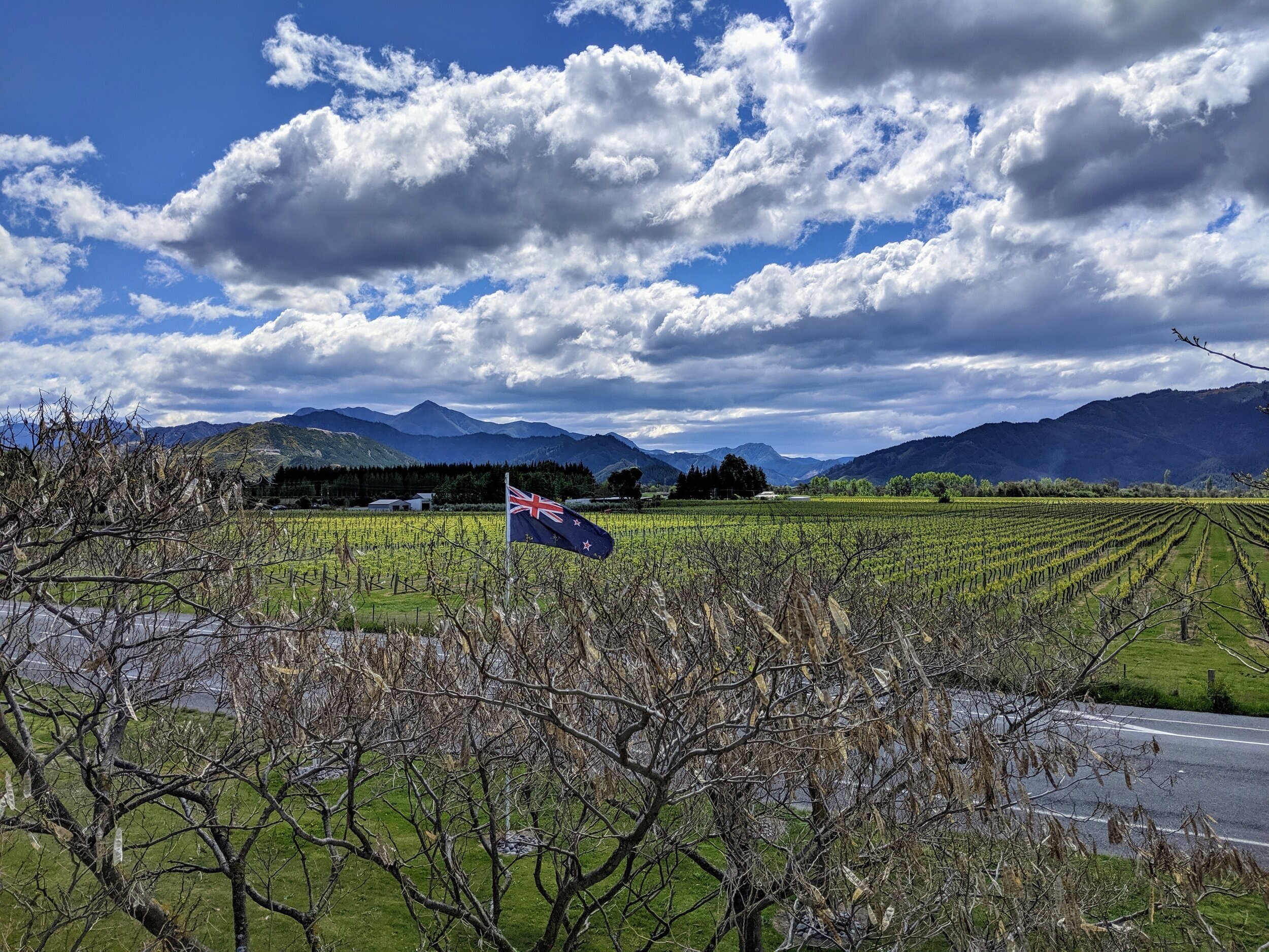
It may seem illogical that we chose to do an overnight trip back to the South Island from Wellington when we could have easily done it when we were transitioning from the South to the North Island at the end of September.  My first draft of our NZ itinerary had us doing that until I checked the average weather for late September in Marlborough and Abel Tasman National Park, our two destinations. Marlborough is New Zealand’s most famous wine region, specifically for the Sauvignon Blanc produced there.  Abel Tasman is a coastal national park on the northwest corner of the South Island that is only accessible by foot, boat, or kayak. In order to access the parts of the park we wanted to see we knew we wanted to do a combination of those three modes of transport. Visiting wineries, taking a water taxi, and kayaking are all things I want to do when it’s above 60 degrees if at all possible and the odds of that in late September in NZ are pretty slim.  So, we re-oriented and decided we could pop back down to the South Island from Wellington and hold off until the end of October. We figured out an itinerary that only had us gone for 3 nights without sacrificing any of our must-do list.  

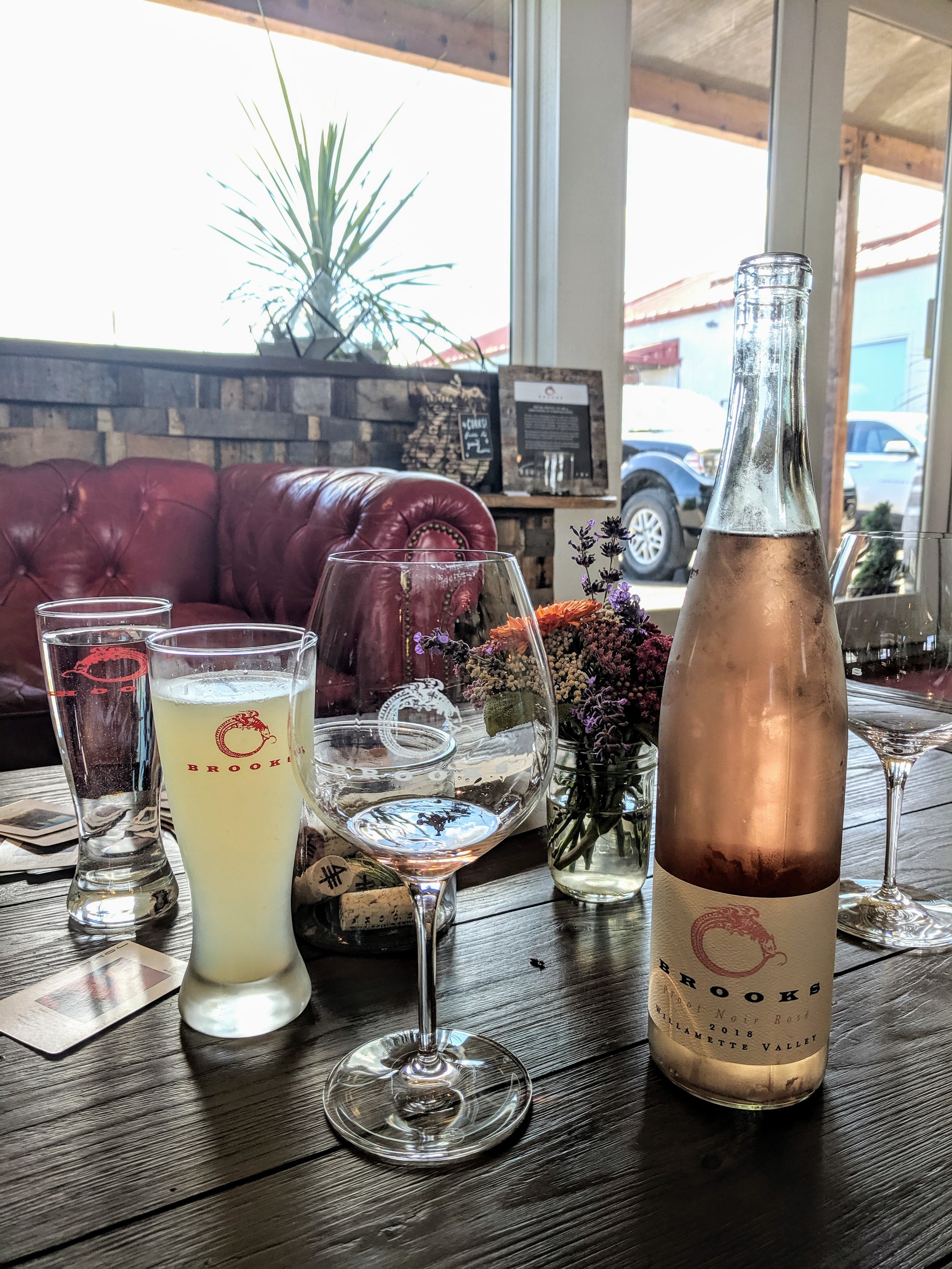
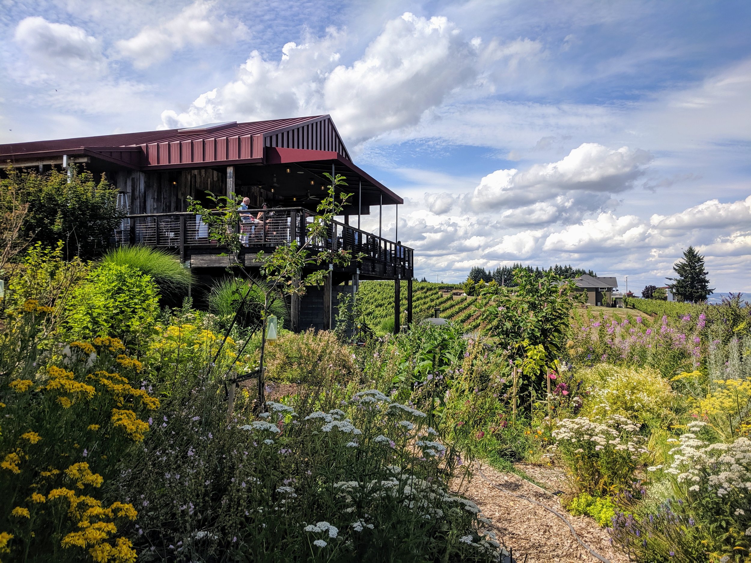
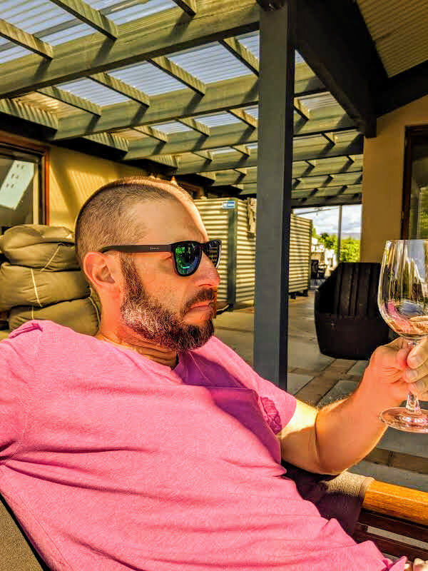
We left Wellington after lunch on Tuesday Oct. 22nd and took the ferry back across the Cook Strait, picked up our rental car in Picton and made the quick drive down to Blenheim, the main jumping off point for the Marlborough wine region.  The weather wasn’t great the day we arrived, but the forecast looked better for the next day. We had booked a self-guided bicycle tour that picked us up from the hotel to make sure we could enjoy the wine tastings and not worry about having to drive.  Many of the cellar doors (same as a tasting room) are located in an area that is easily accessible by some inter-connected bike trails that require little time riding on the roads. I had booked an all-day tour (on bikes from 10 to 5) and was starting to worry that would be too long.  The staff at Explore Marlborough made sure we had the right bikes and gave us a map, complete with personal recommendations for lunch, and sent us on our way. We started our day with a tasting at Hunter Wines, then cycled along a gravel trail along the Wairau River to our second stop at Hans Herzog.  At that point it was past lunch time so we headed to Geisen for another tasting and a platter lunch. Platters in New Zealand are like giant charcuterie boards and usually include cheese, meat and/or seafood, chutneys, sauces, crackers and lots of bread. We opted for a meat, cheese, and seafood platter and it was amazing.  

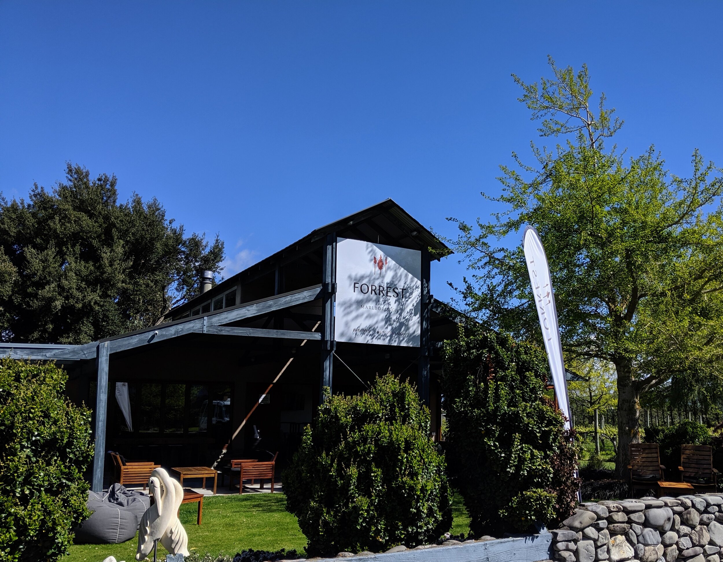
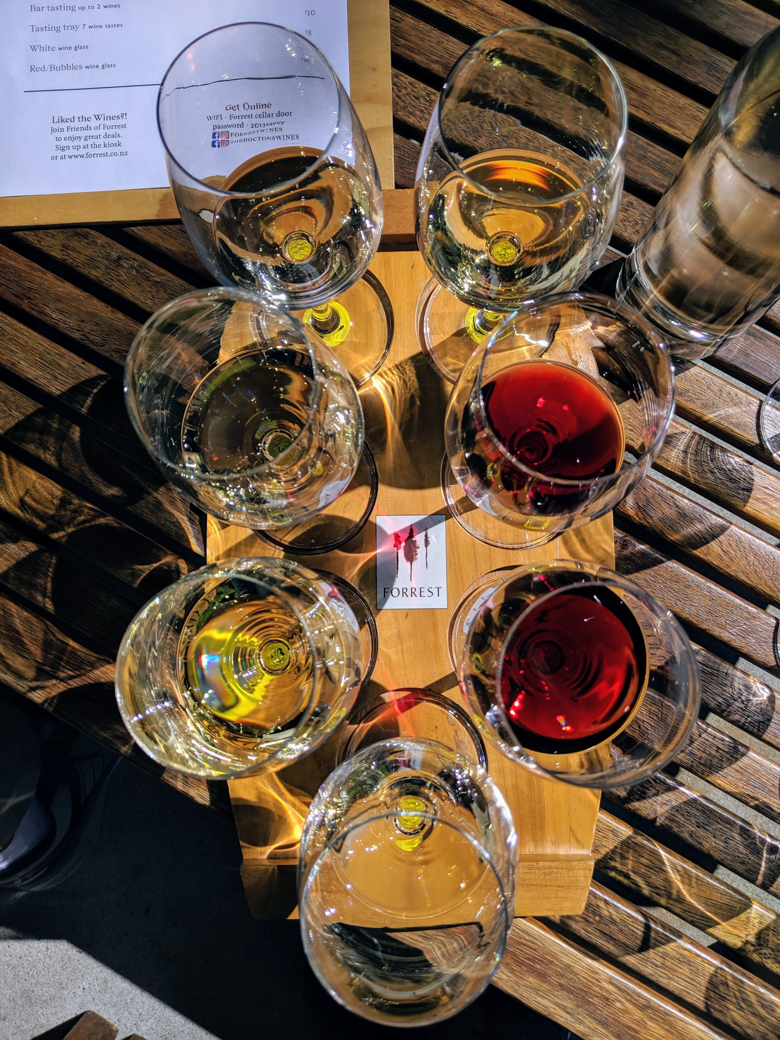
After our lunch and tasting at Geisen we went across the street to Wairua River Winery and then finished up at Forrest, which was founded by doctors who wanted to have something to do when they retired.  By taking our time at each cellar door and riding a total of 11 miles between them we definitely needed the full seven hours of our bike rental. The weather was great compared to what we’d been experiencing in Wellington and it was a fun and relaxing day for all, not just those of us that were able to enjoy the fabulous wines.  We definitely prefer the NZ white wines over their reds. They make a lot of pinot noir here, but it just doesn’t compare to the ones produced in California. What is much better about visiting NZ wineries over those in the US is the price for a tasting. All but one of the places we stopped only charged $5 NZ ($3.50 US) for a tasting of 5-7 wines.  And, none of them required reservations for tastings. With the exception of one winery (I won’t say which) all of the hosts at the cellar doors were very laid back and weren’t pretentious about their wines.

 Vineyards in Marlborough Wine Country with Richmond Range in the background.

Vineyards in Marlborough Wine Country with Richmond Range in the background.

 Cellar door at Forrest Estate Wines.

Cellar door at Forrest Estate Wines.

 Tasting paddle at Forrest Estate Wines.

Tasting paddle at Forrest Estate Wines.

 Cameron enjoying the tasting at Forrest Estate Wines.

Cameron enjoying the tasting at Forrest Estate Wines.

 Vineyards in Marlborough Wine Country with Richmond Range in the background.  Cellar door at Forrest Estate Wines.  Tasting paddle at Forrest Estate Wines.  Cameron enjoying the tasting at Forrest Estate Wines.

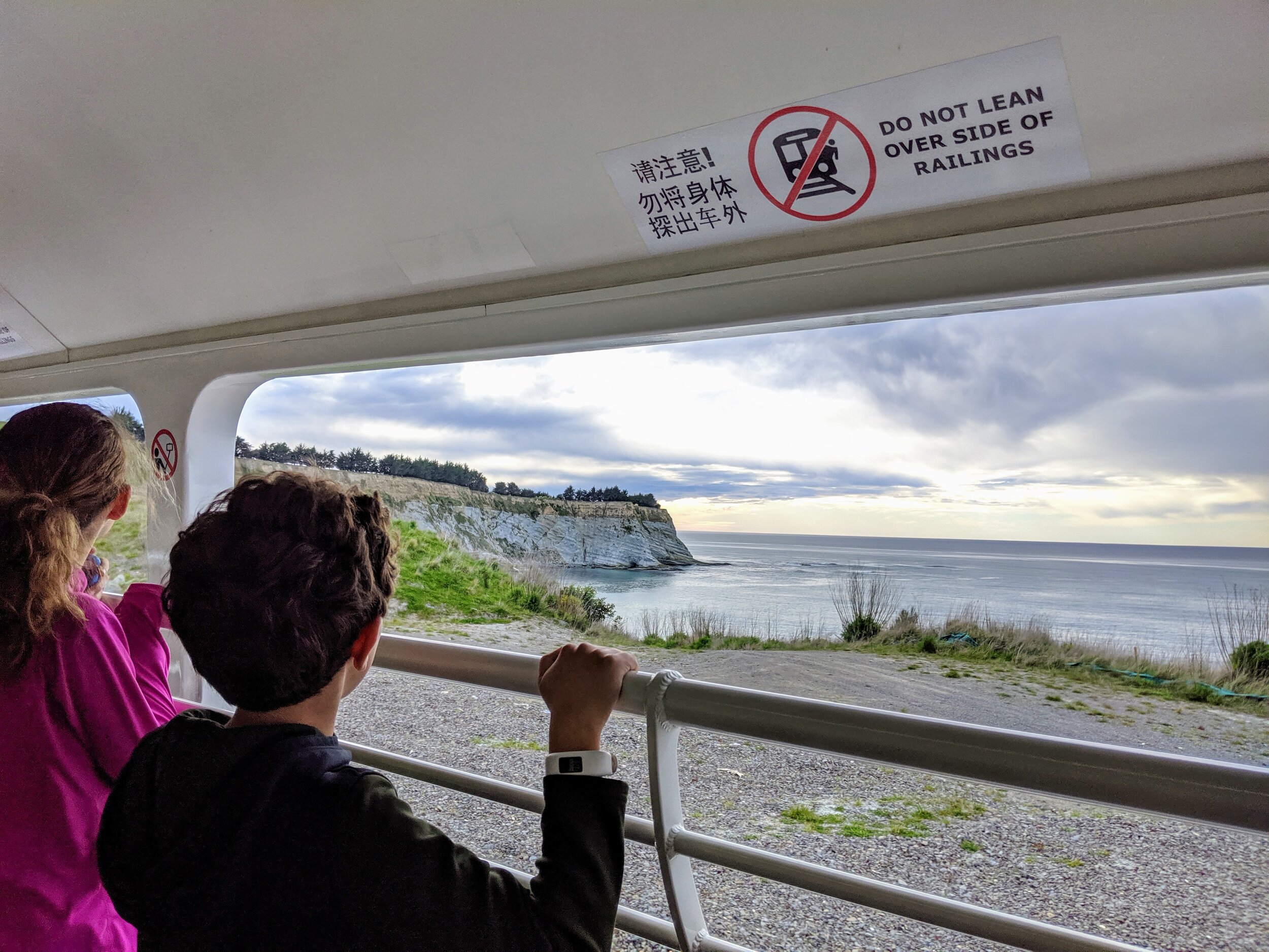
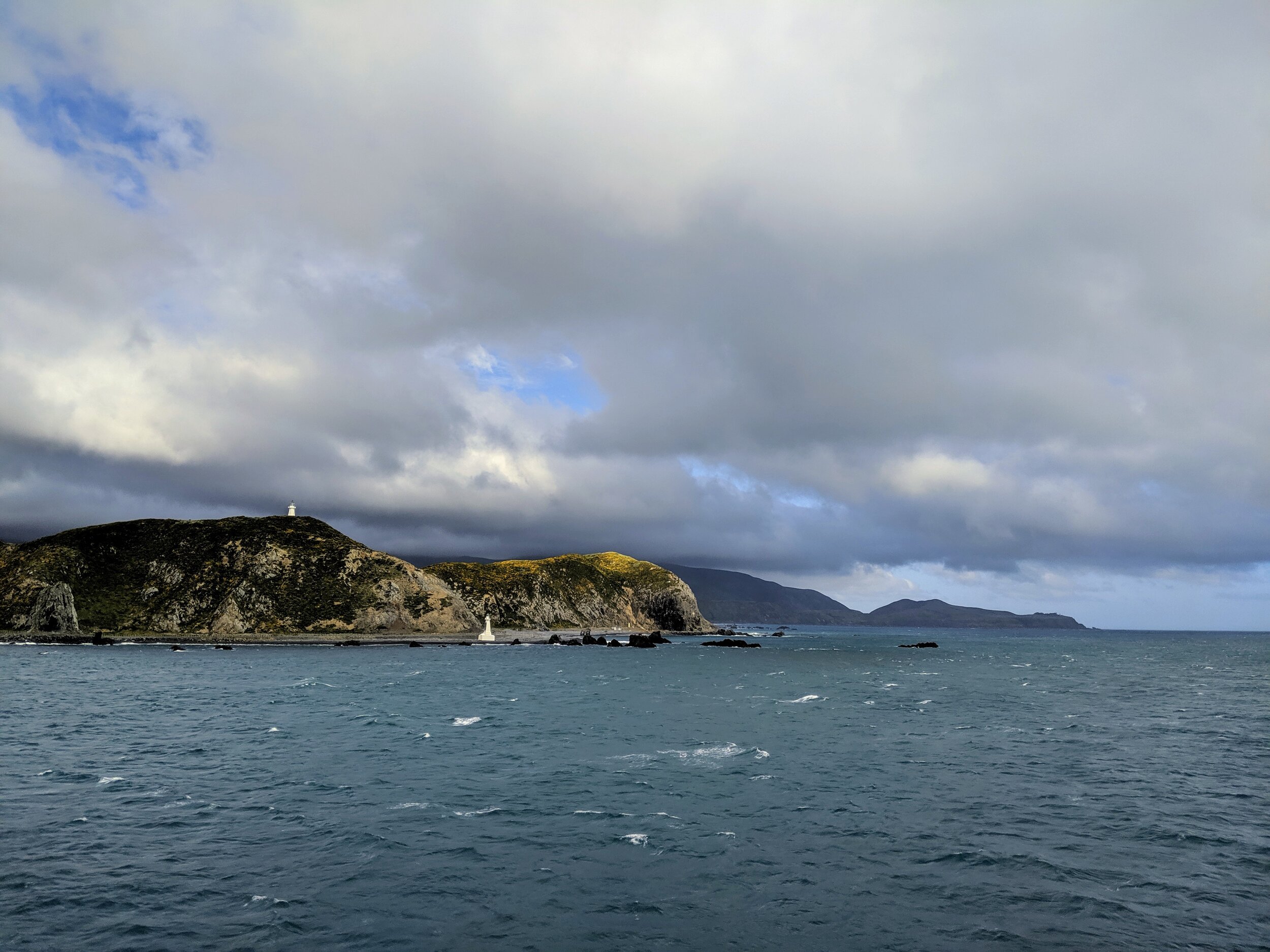
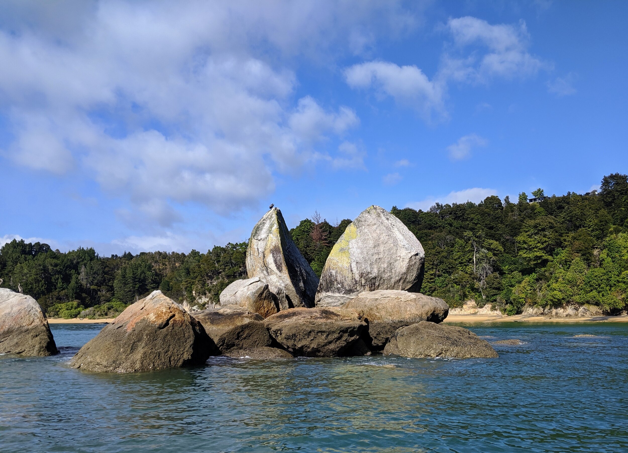
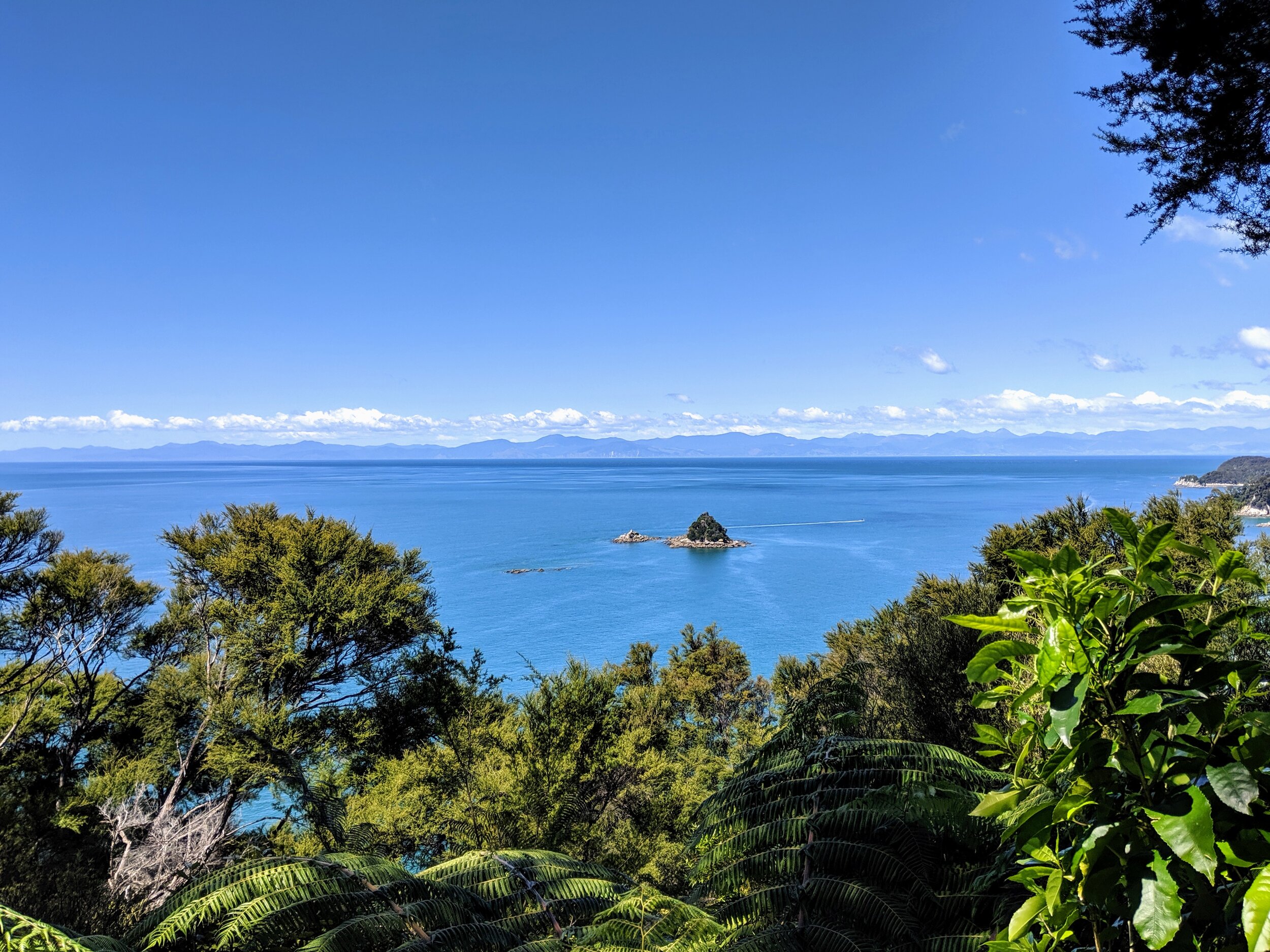
After a really great dinner that included the best curry I’ve ever eaten, we packed up and went to bed early as we had to be on the road at 6 AM the next day to make sure we caught the water taxi into Abel Tasman. Even though there are many tour companies that offer water taxi/walk/kayak packages in the park, none of them matched up with what we hoped to accomplish in our short amount of time there. So, I pieced together an itinerary that got us everywhere we wanted to go, but required a rigid time frame that depended on catching the 9 AM water taxi from Marahau. The weather for that day showed early rain and then a clearing to mostly sunny skies and temps in the 60s. As we got to Nelson, the closest city to Abel Tasman, the sky was black and we could see rain along the coast exactly where we were headed. As we arrived in Marahau it was still raining pretty hard and we had accepted that we would probably get wet on the water taxi. Luckily, the rain moved out right as we were boarding at 9:00 and our ride from Marahau to Anchorage was calm and sunny. The water taxi is a combination of a boat tour and point to point transportation so the captain made sure that we took the time to see Split Apple Rock and the seal colony on Adele Island before heading north into the heart of the park.

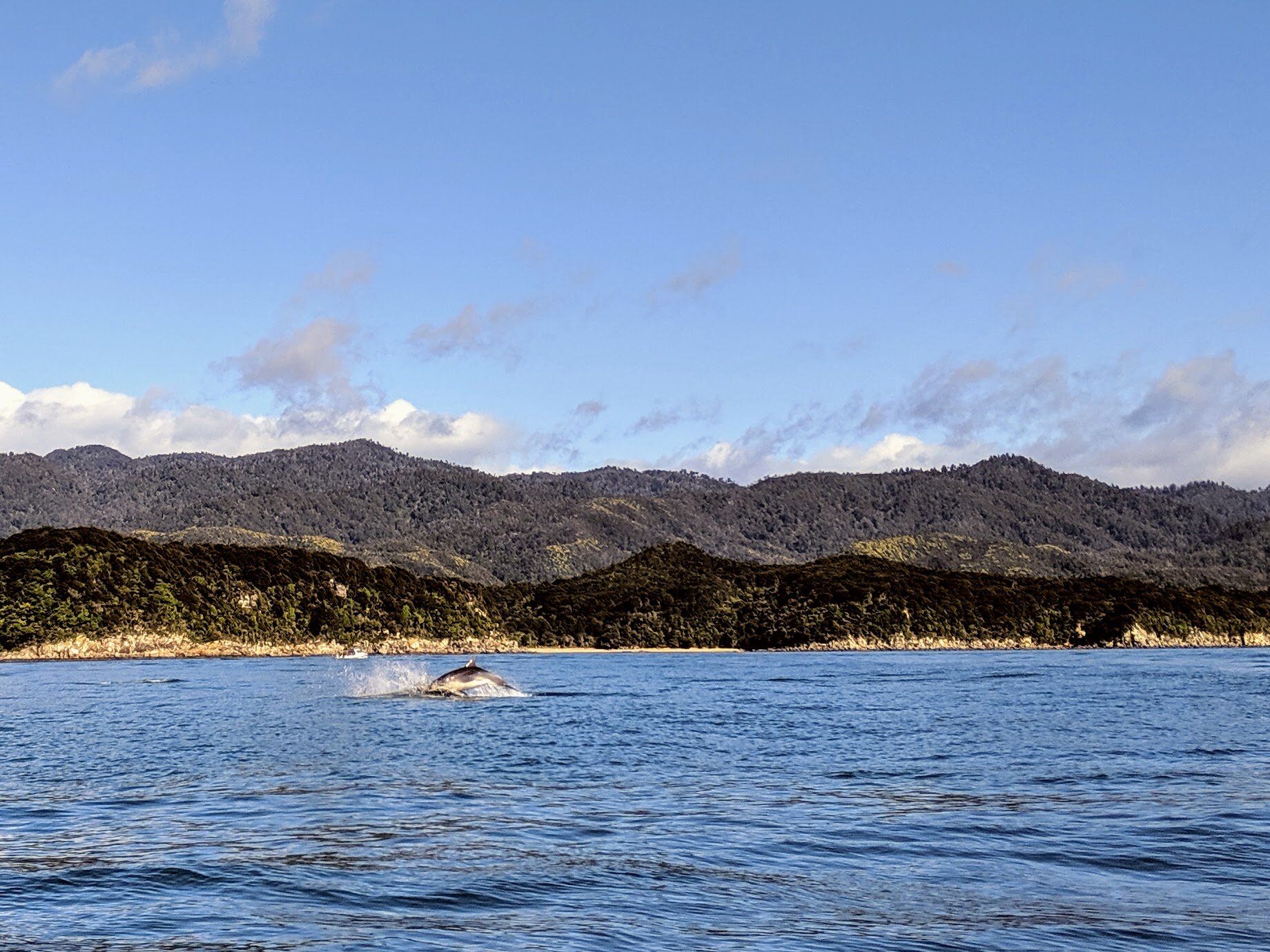
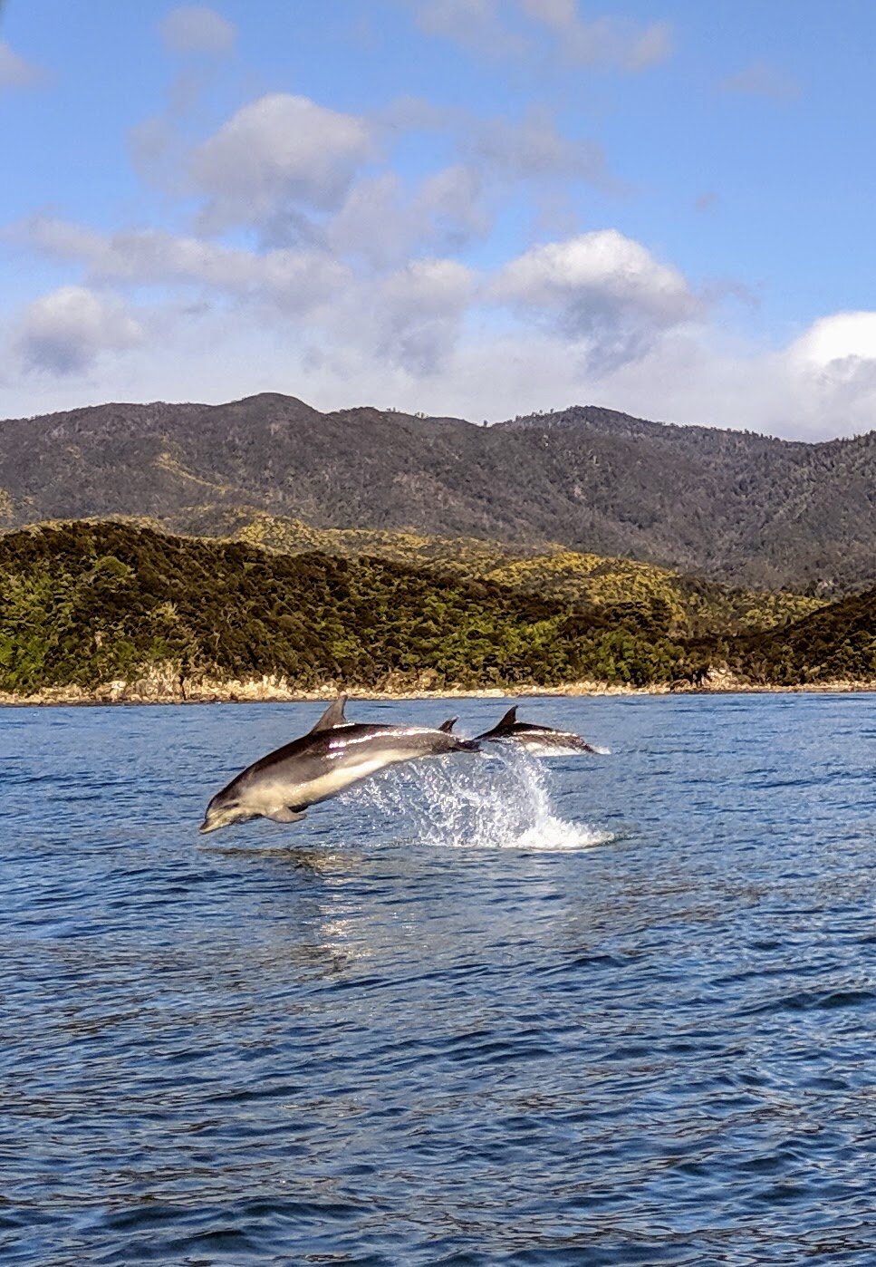
As we approached Anchorage the captain spotted some birds working the water a little further offshore and decided to take a detour and see if there were any dolphins or porpoises feeding on the same fish.  He was correct in his assumption as we were soon surrounded by a huge pod of bottlenose dolphins, some of which started playing in the wake of our boat. There were easily 35-40 dolphins in the pod so it quickly drew the attention of other water taxis and boats.  We spent a solid ten minutes riding next to and within the pod and really enjoyed the playful dolphins swimming on all sides of us.  

 Split Apple Rock in Abel Tasman National Park.

Split Apple Rock in Abel Tasman National Park.

 Fur seal in the water off Adele Island “waving” at us.

Fur seal in the water off Adele Island “waving” at us.

 Bottlenose dolphins in Tasman Bay.

Bottlenose dolphins in Tasman Bay.

 Bottlenose dolphins in Tasman Bay.

Bottlenose dolphins in Tasman Bay.

 Split Apple Rock in Abel Tasman National Park.  Fur seal in the water off Adele Island “waving” at us.  Bottlenose dolphins in Tasman Bay.  Bottlenose dolphins in Tasman Bay.

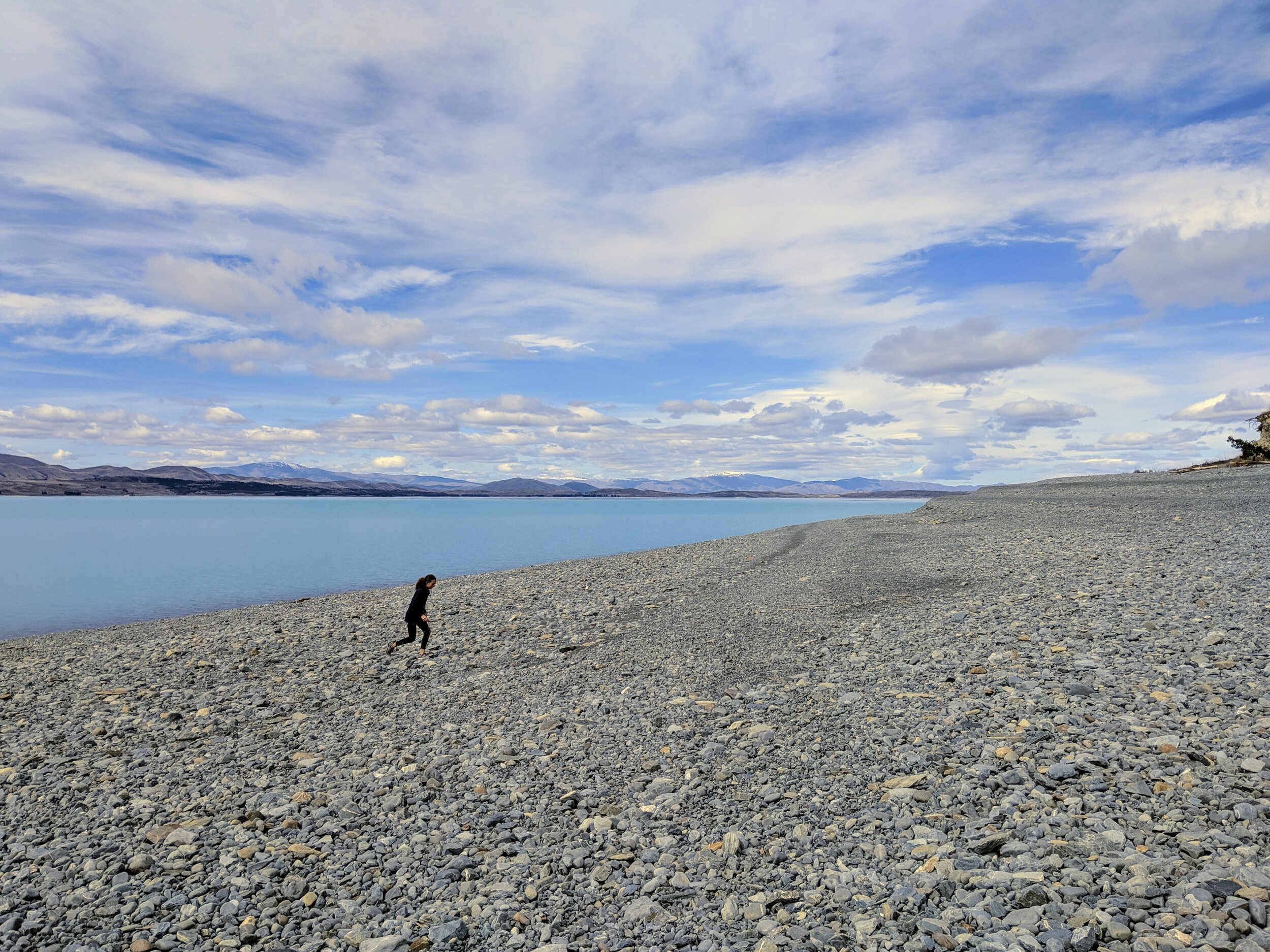
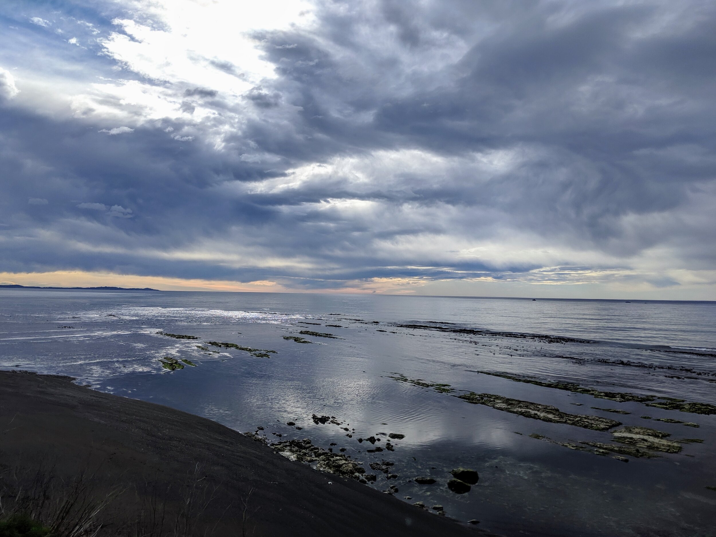
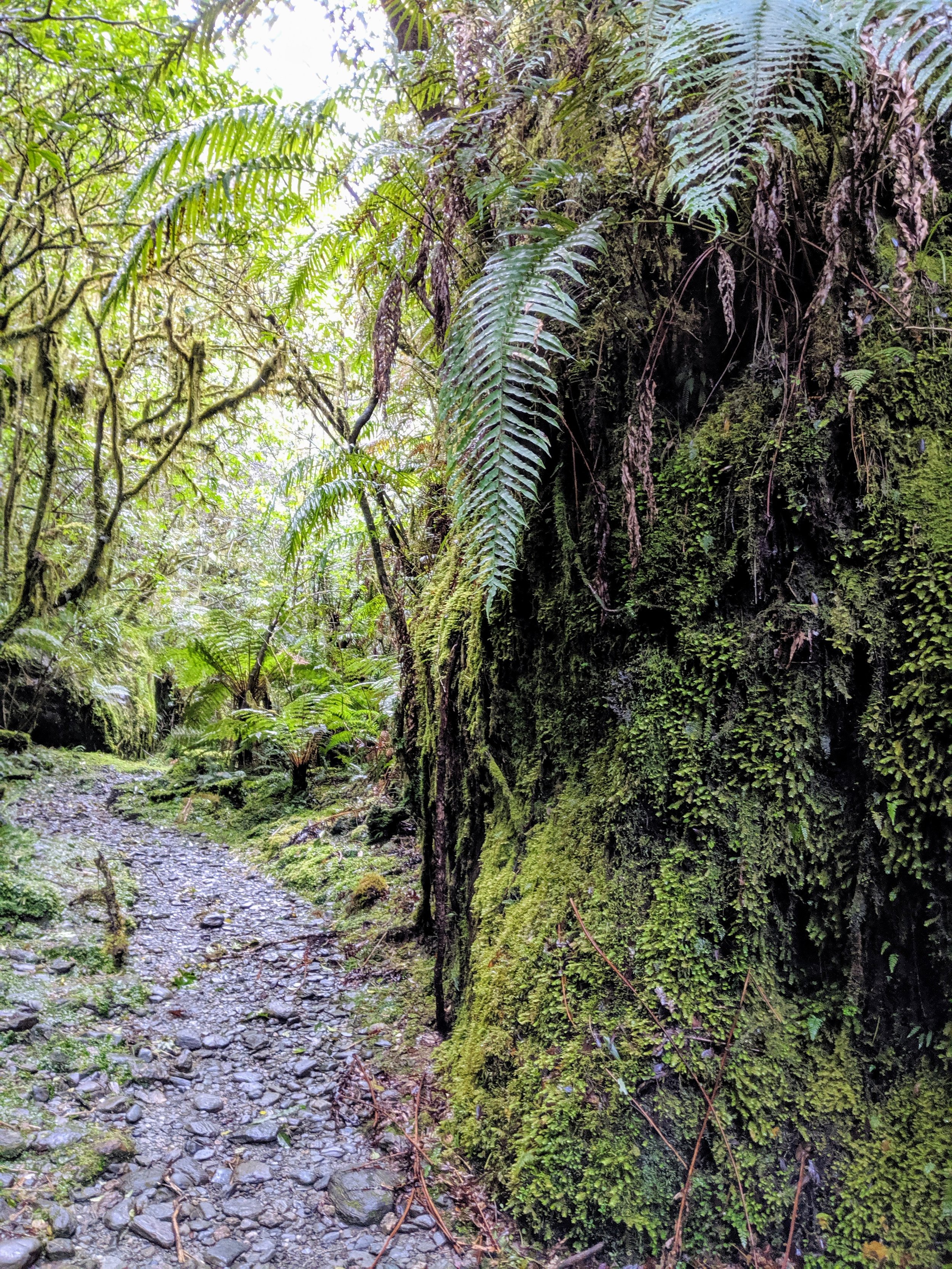
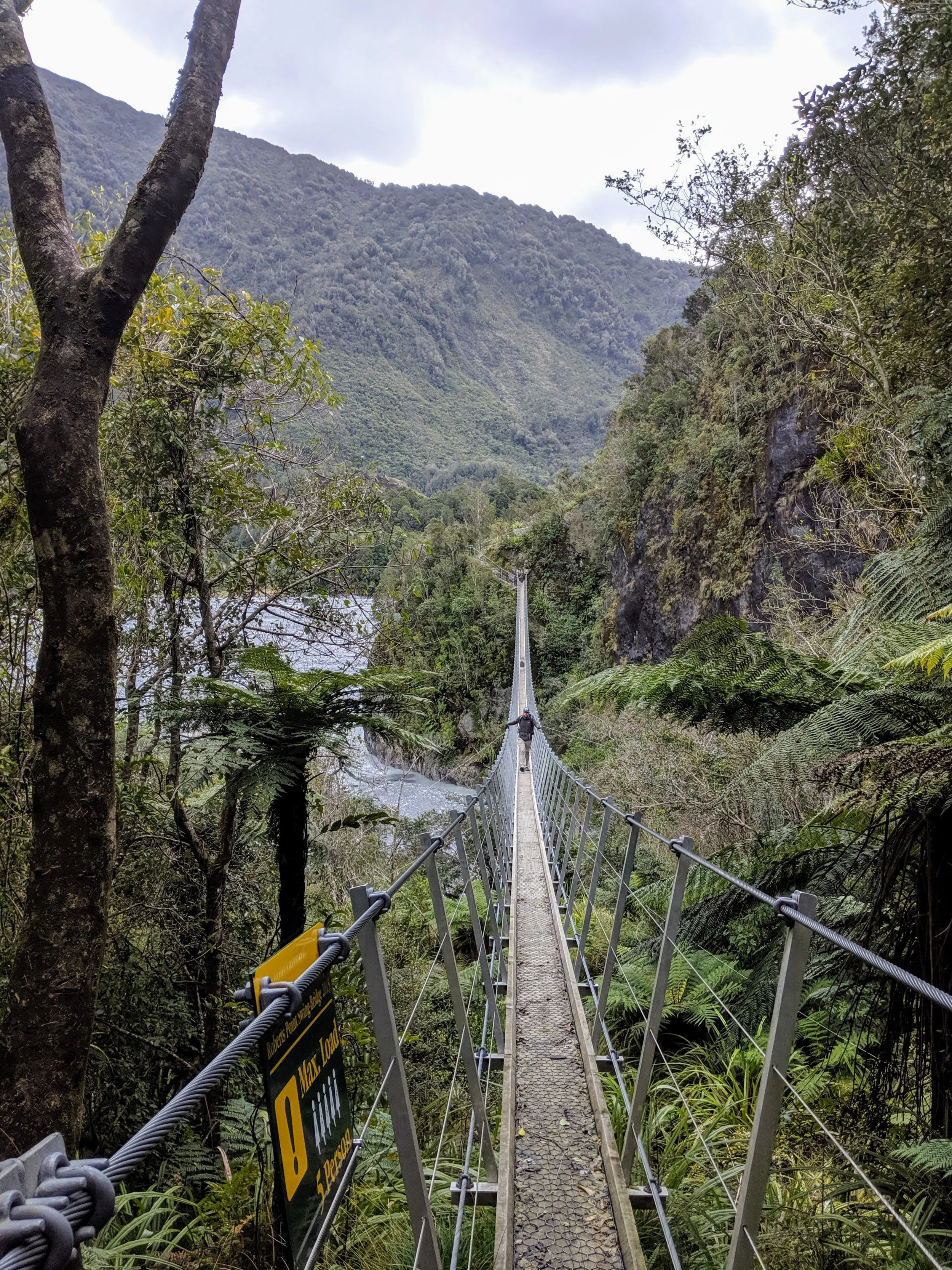
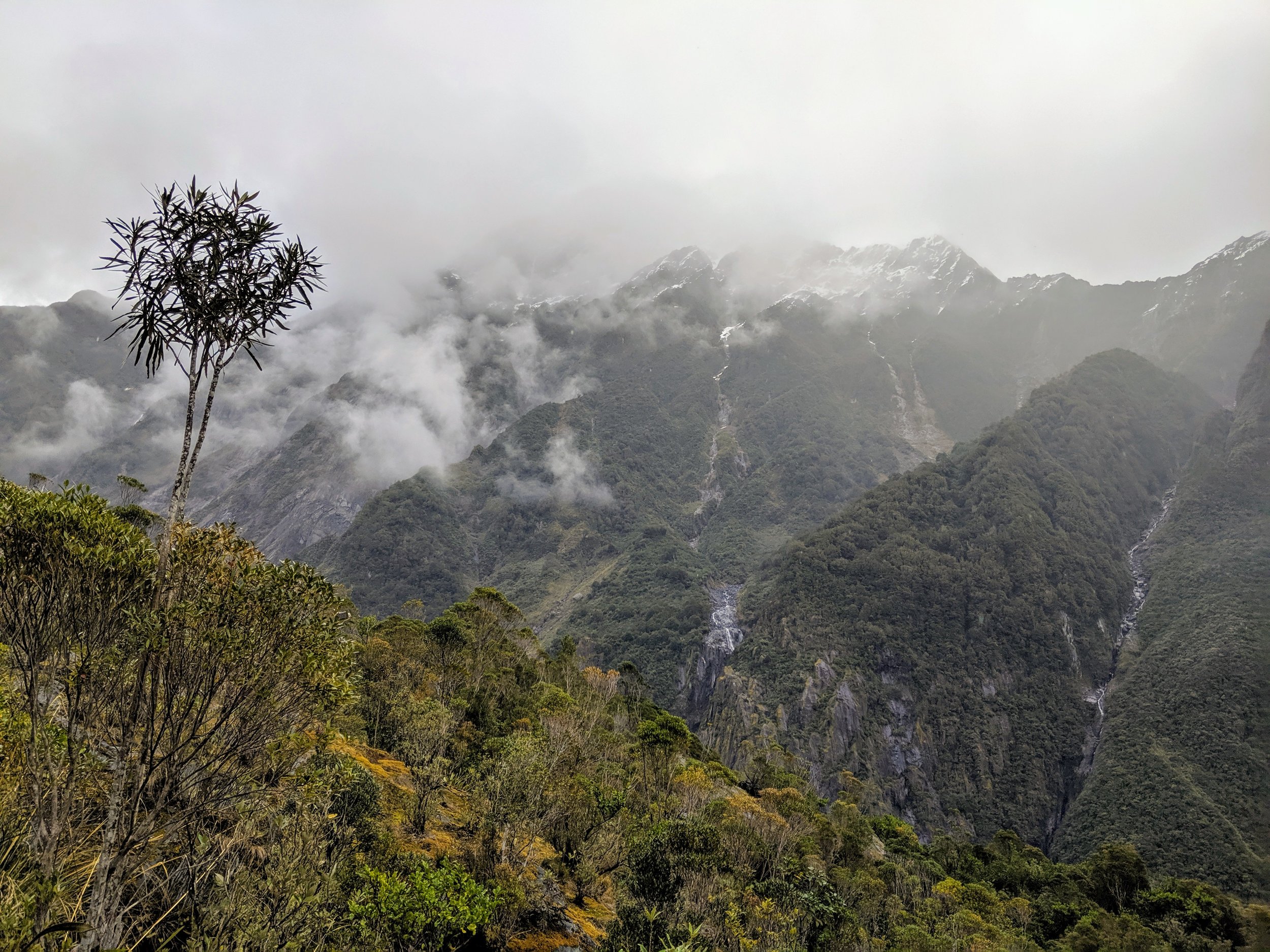
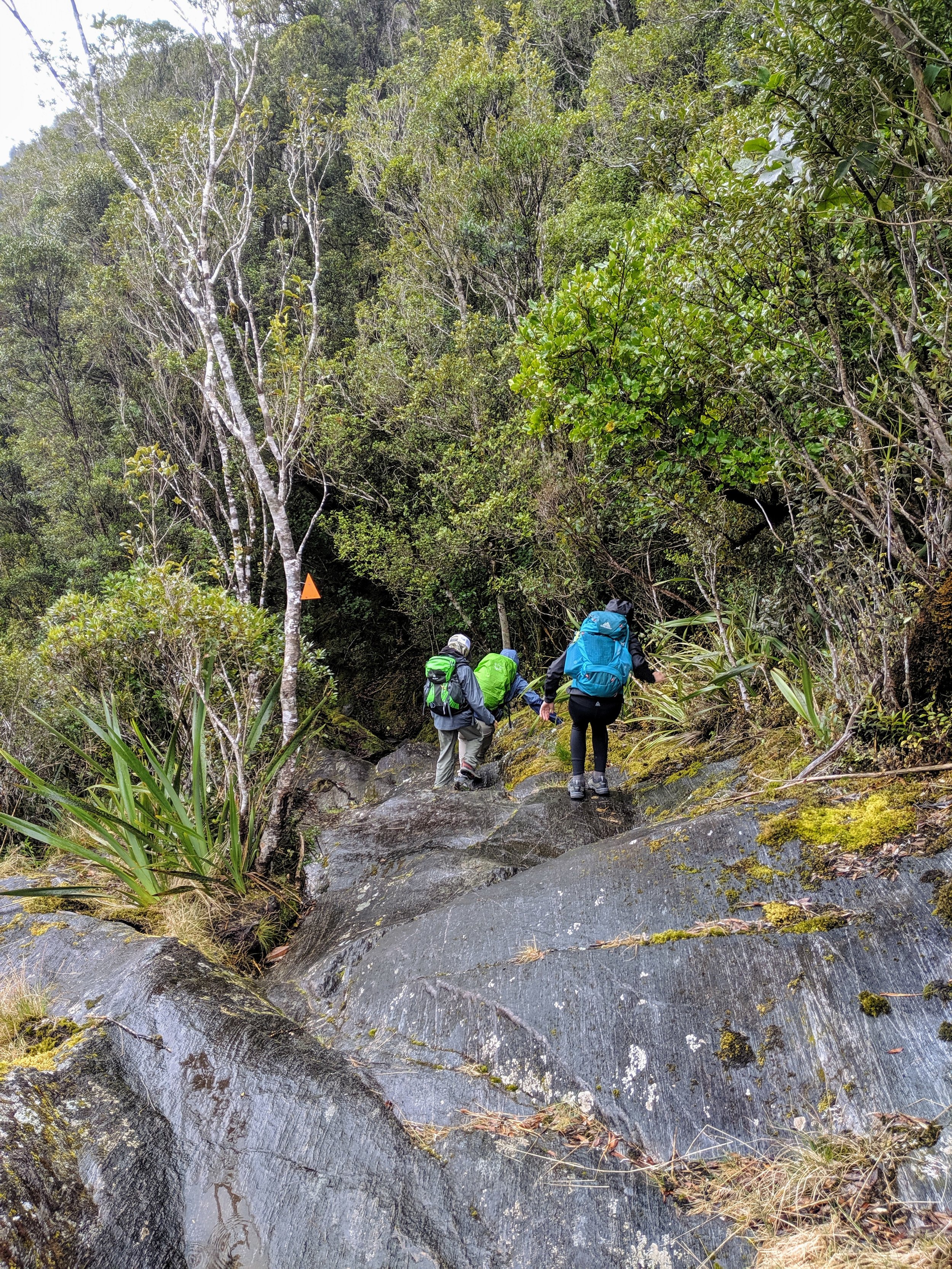
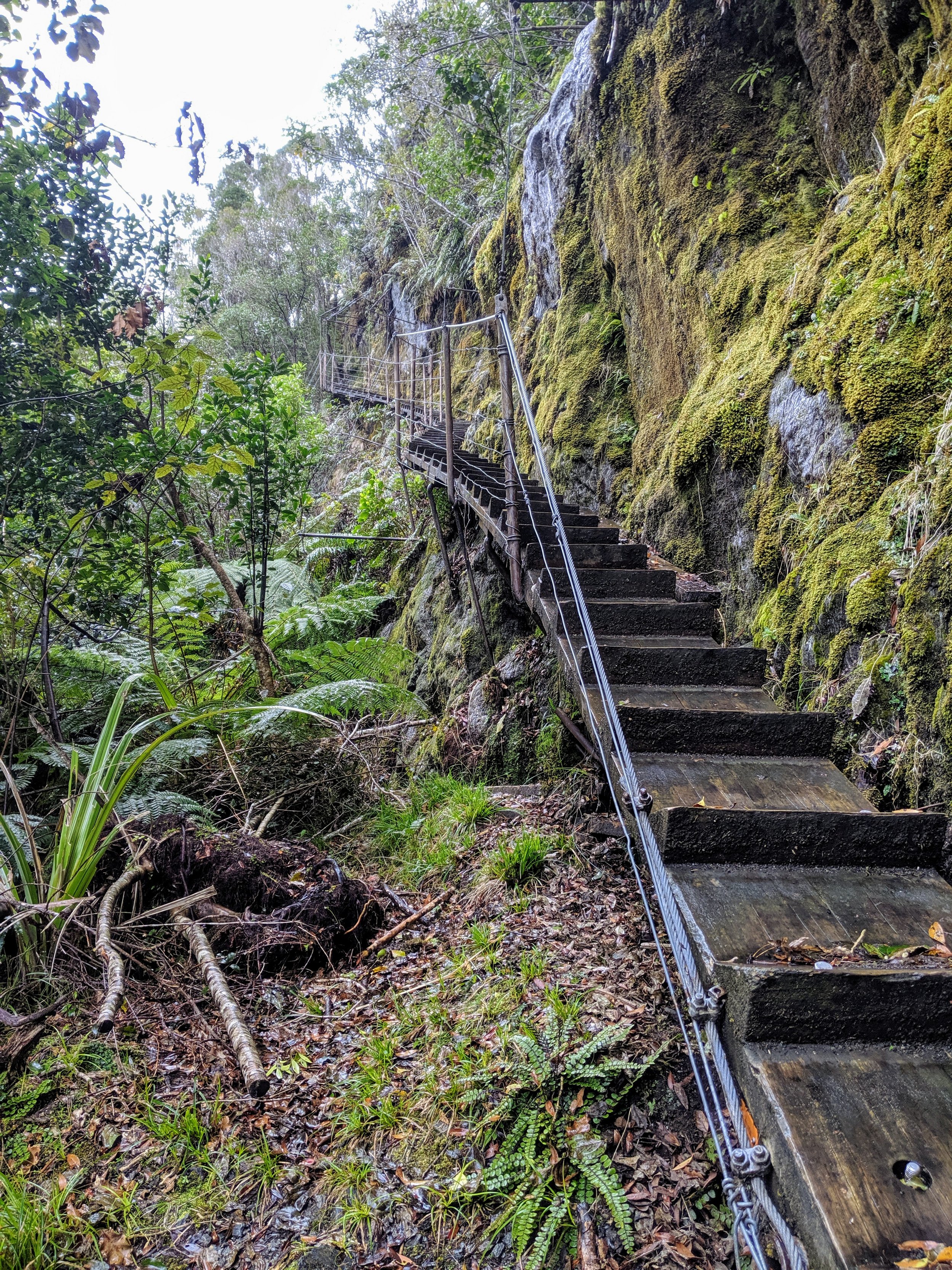
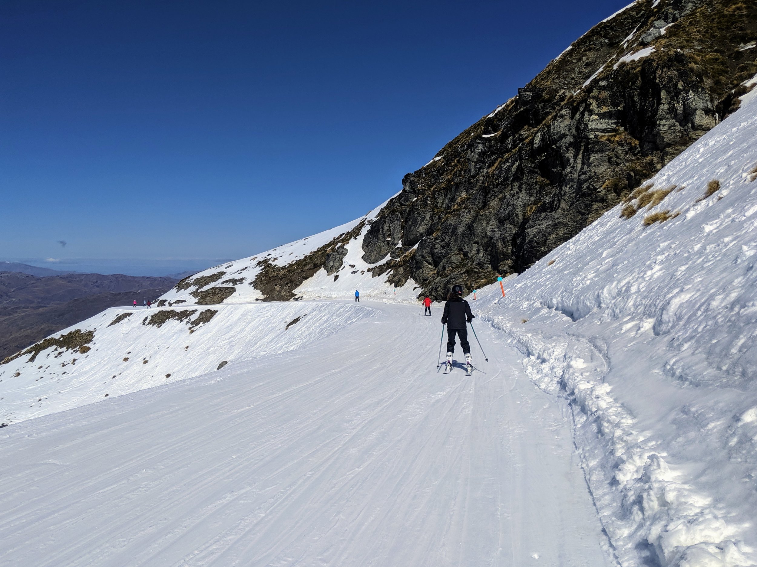
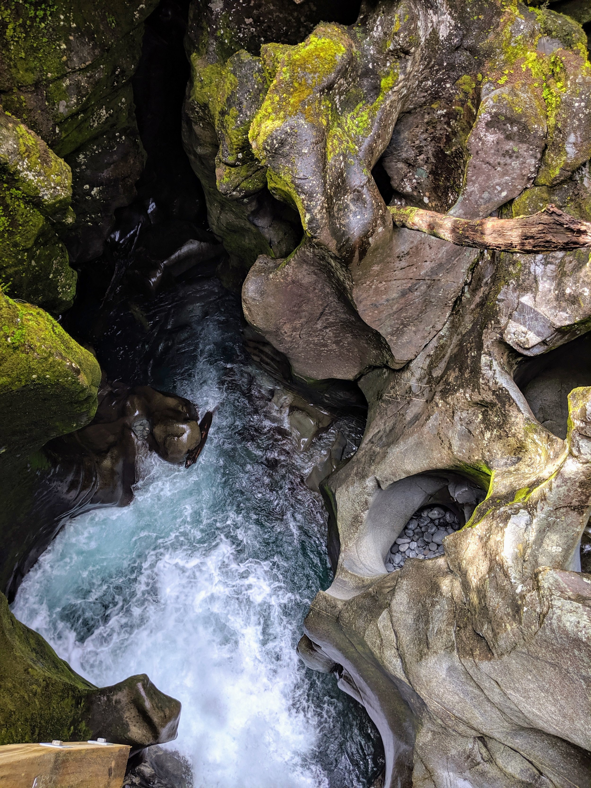
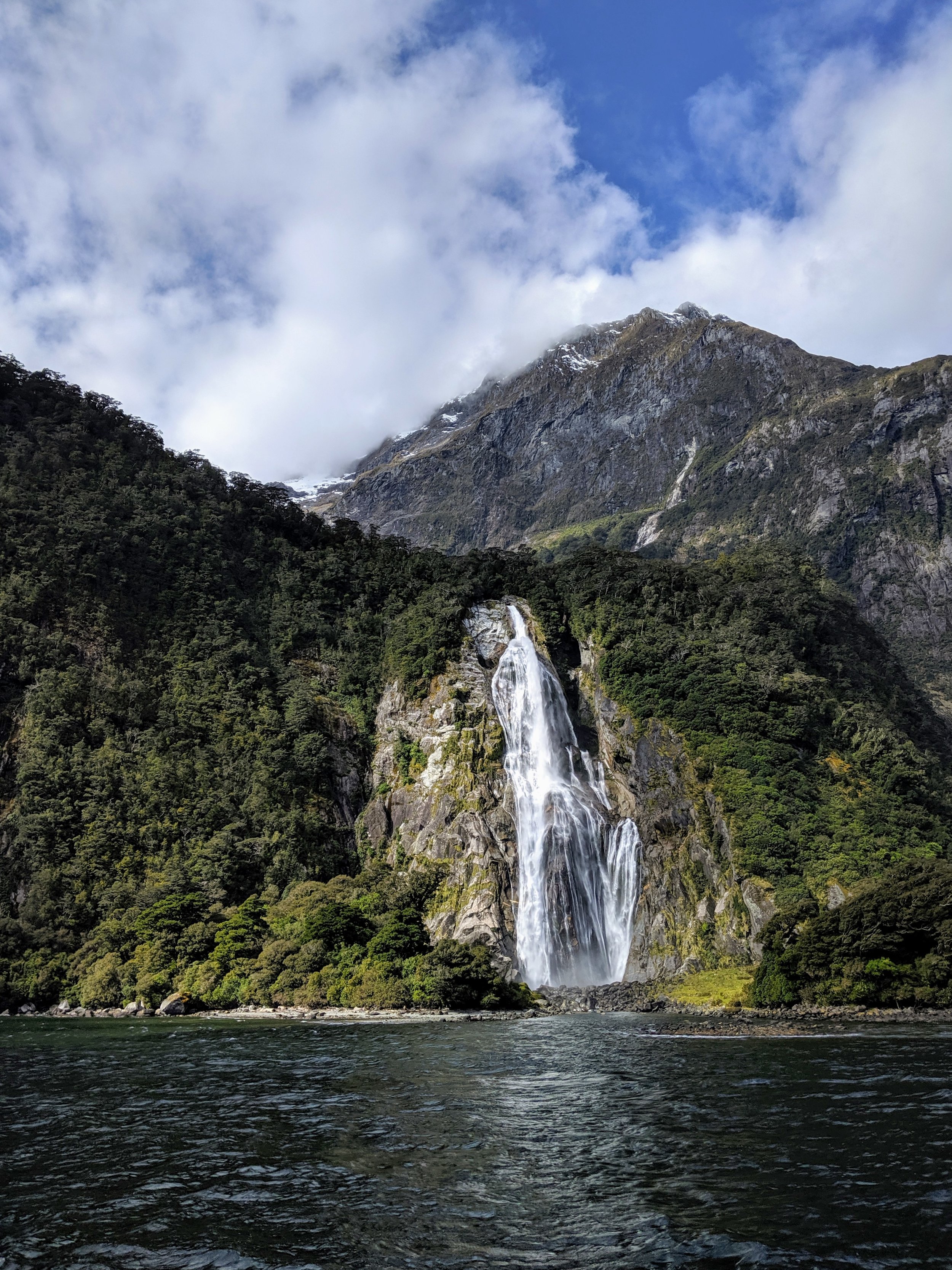
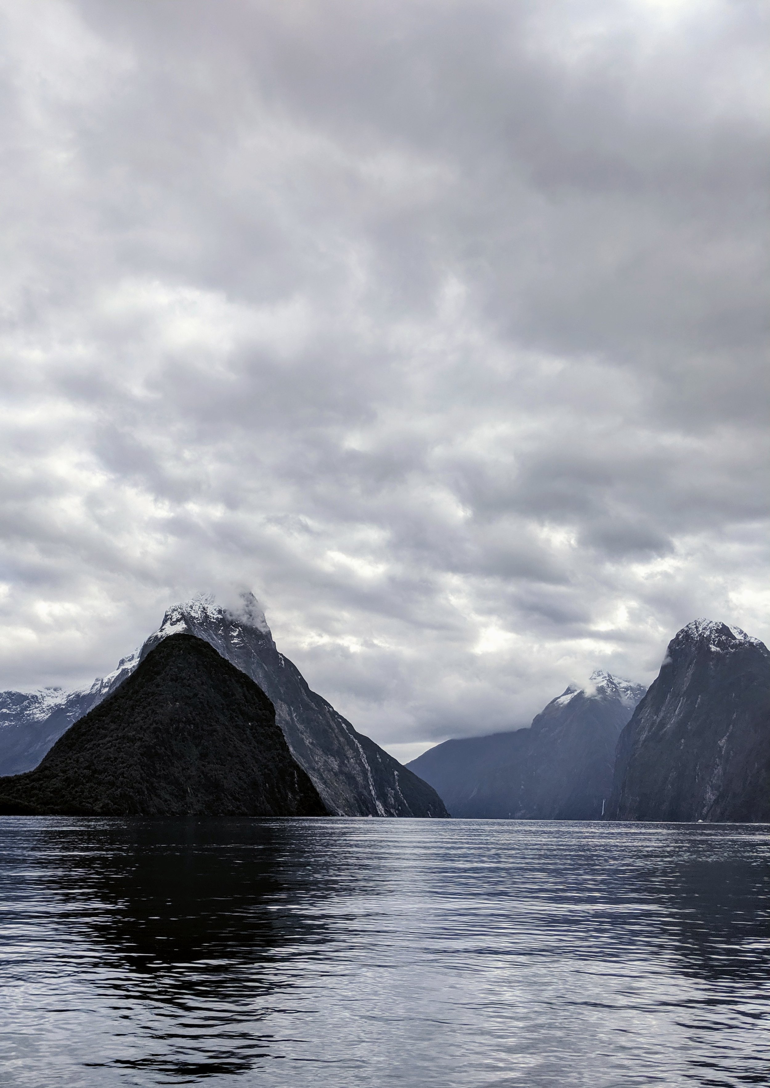
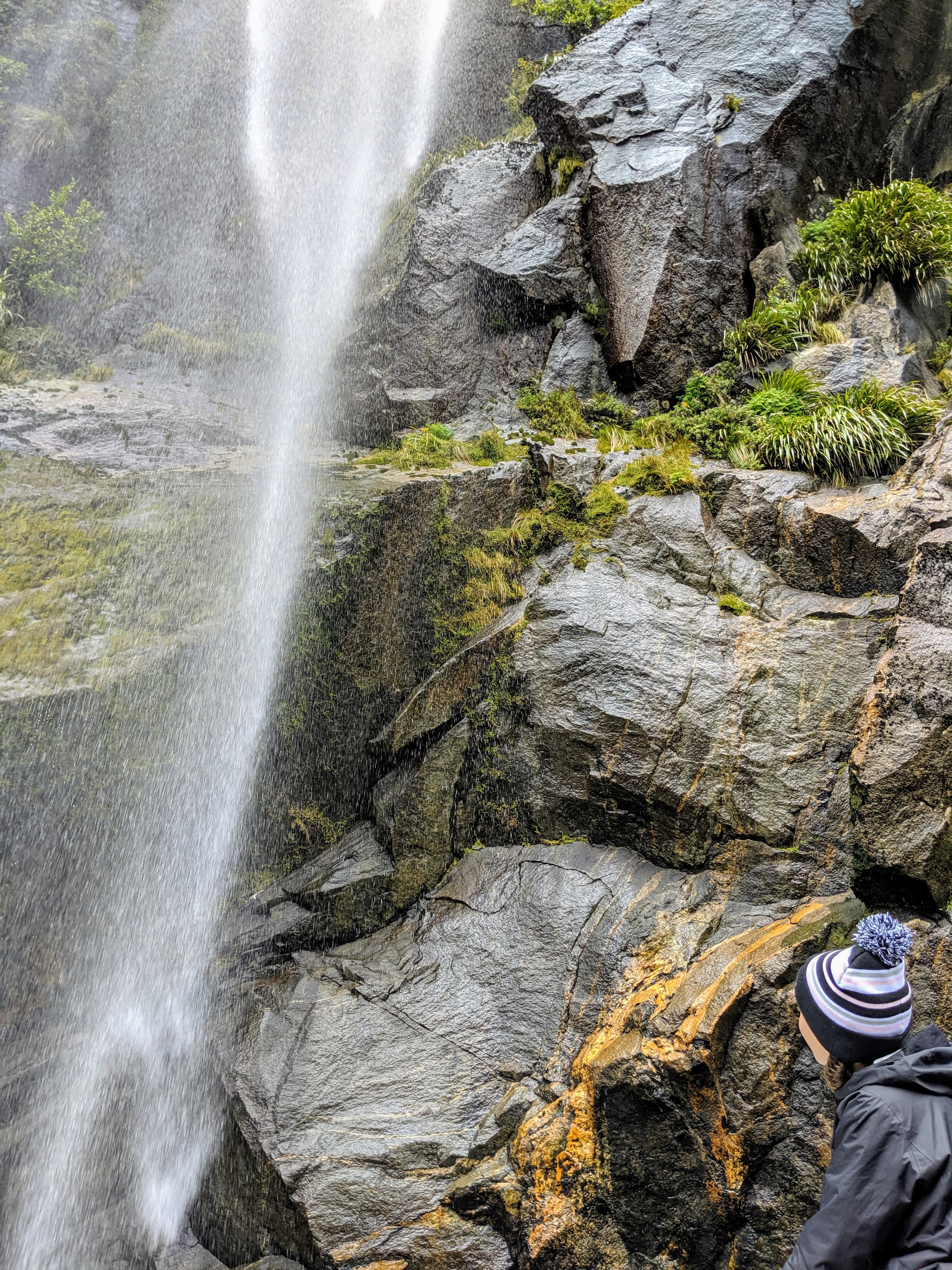
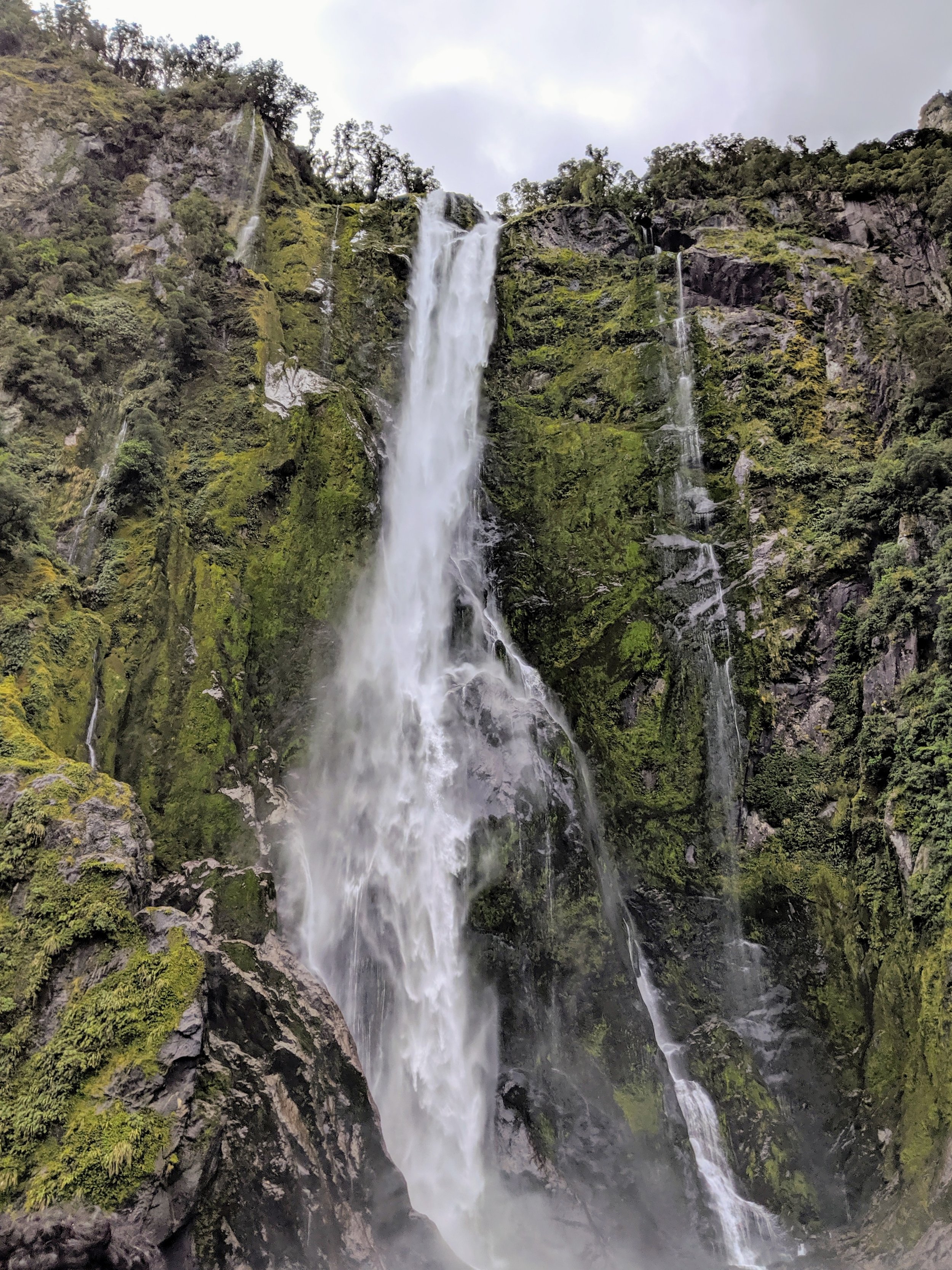
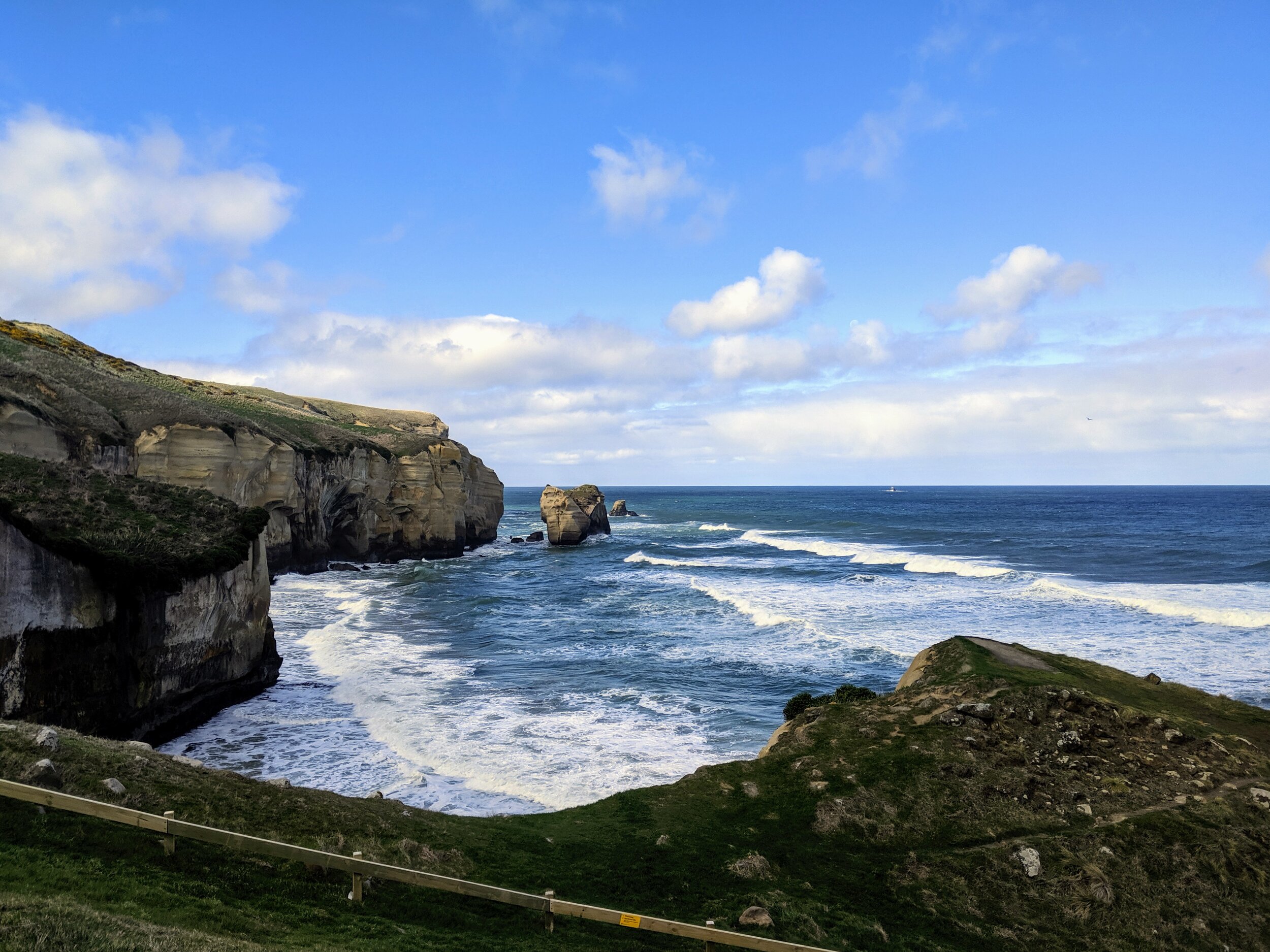
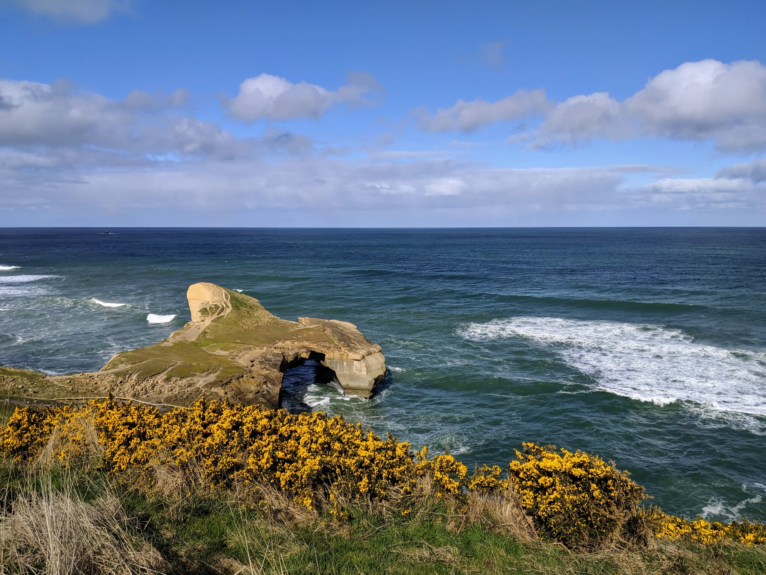
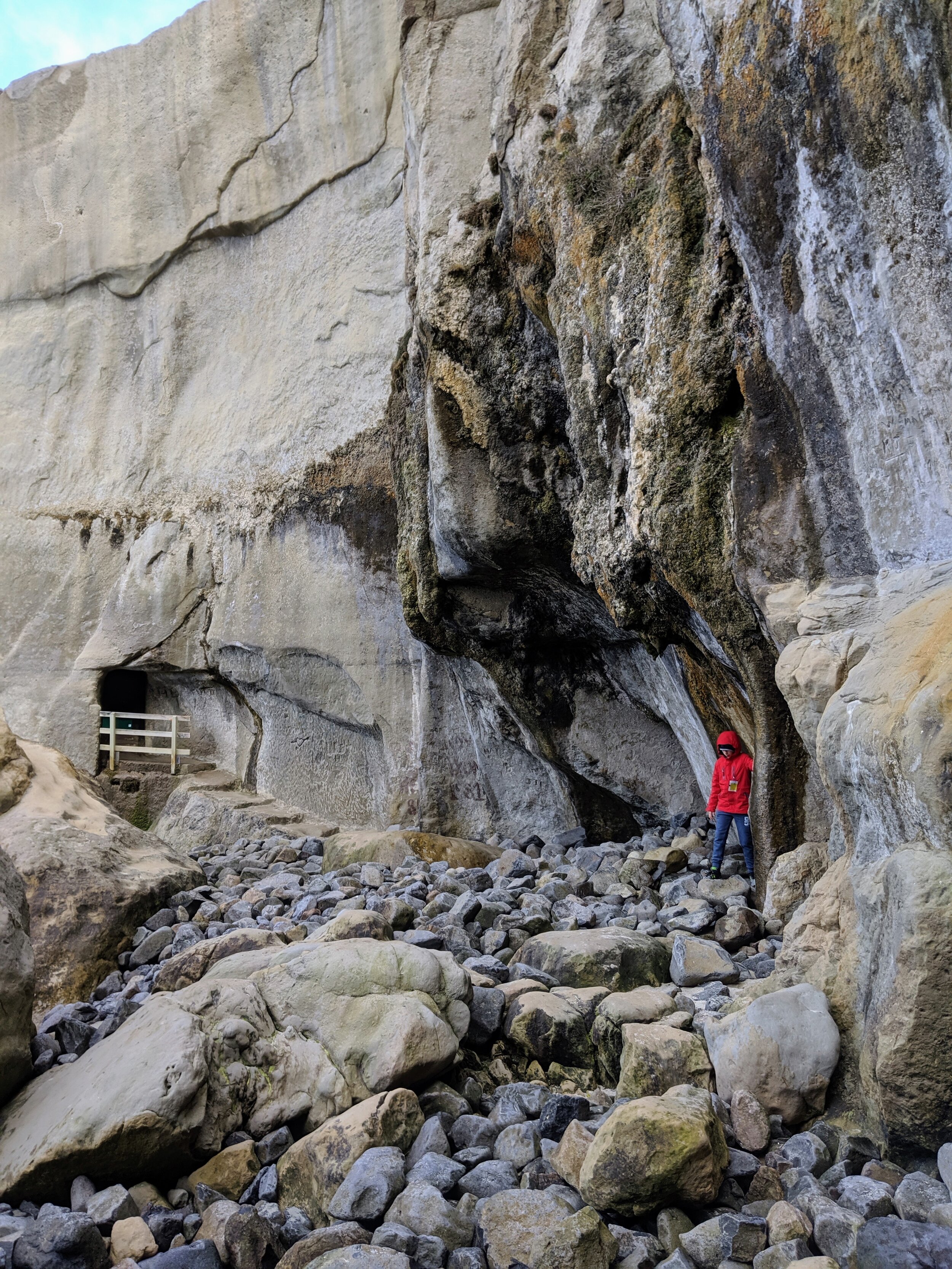
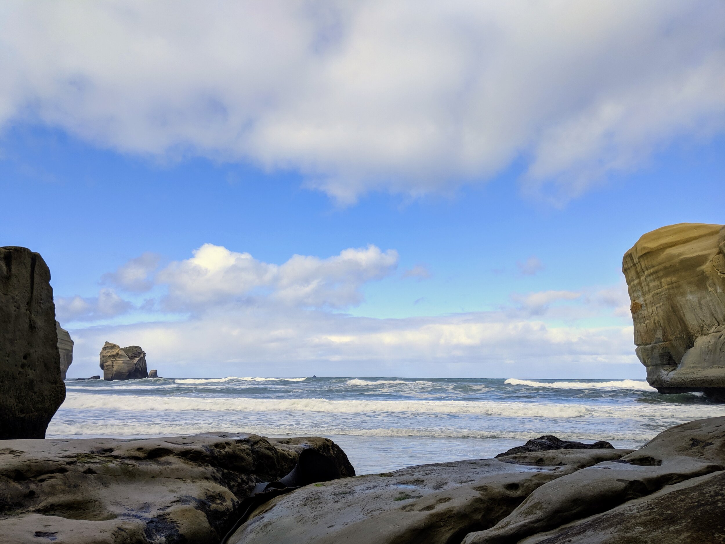
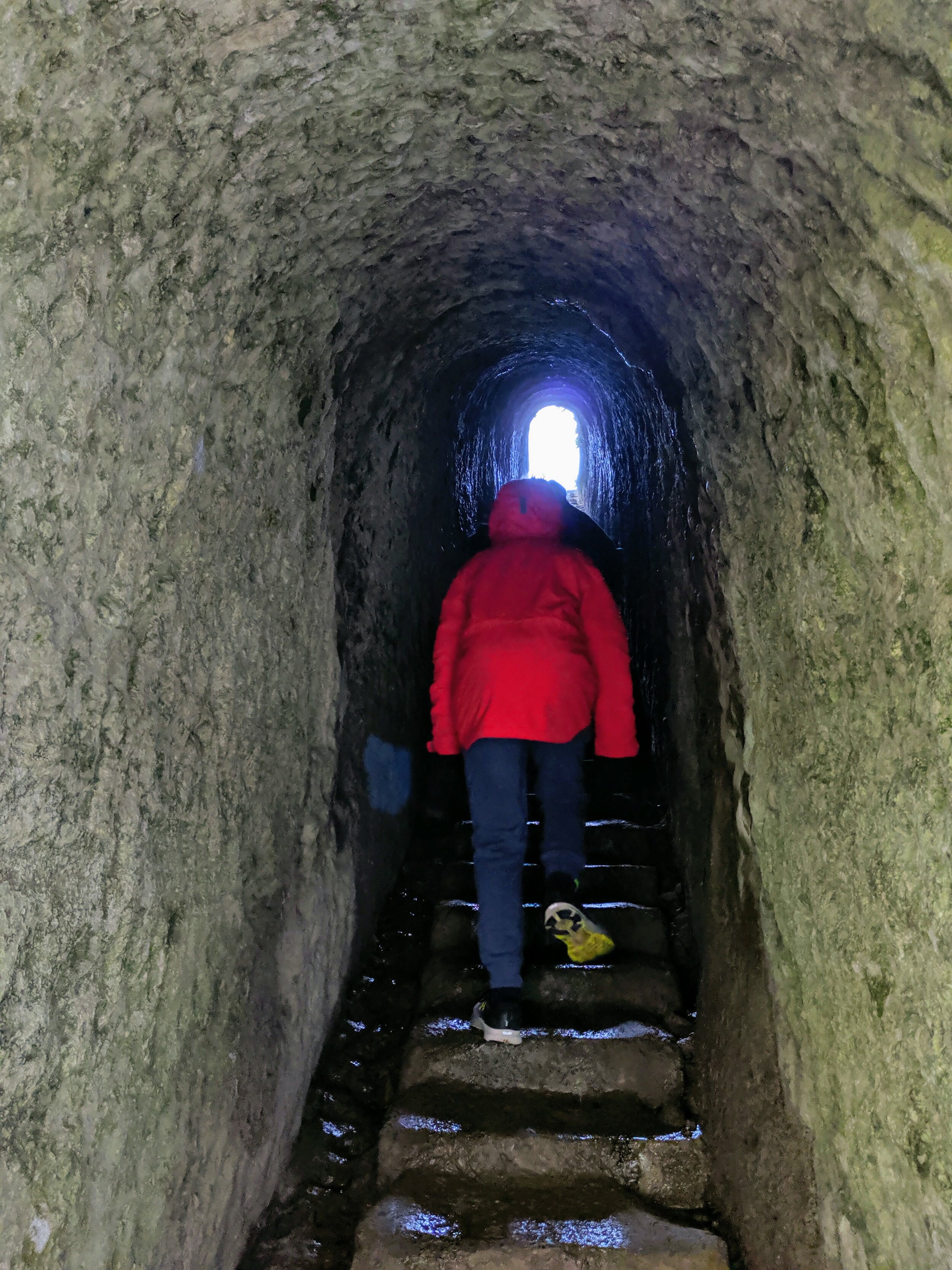
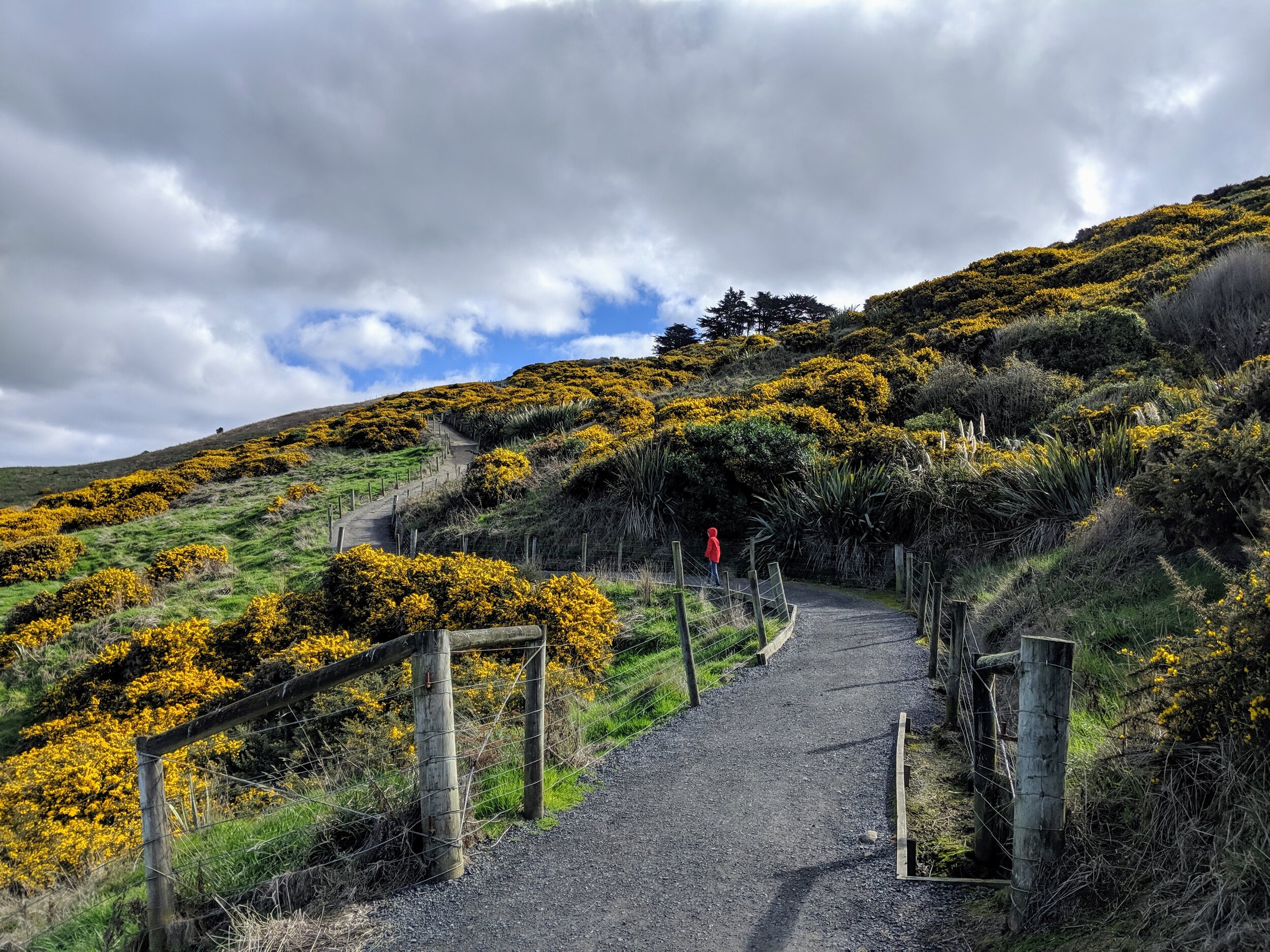
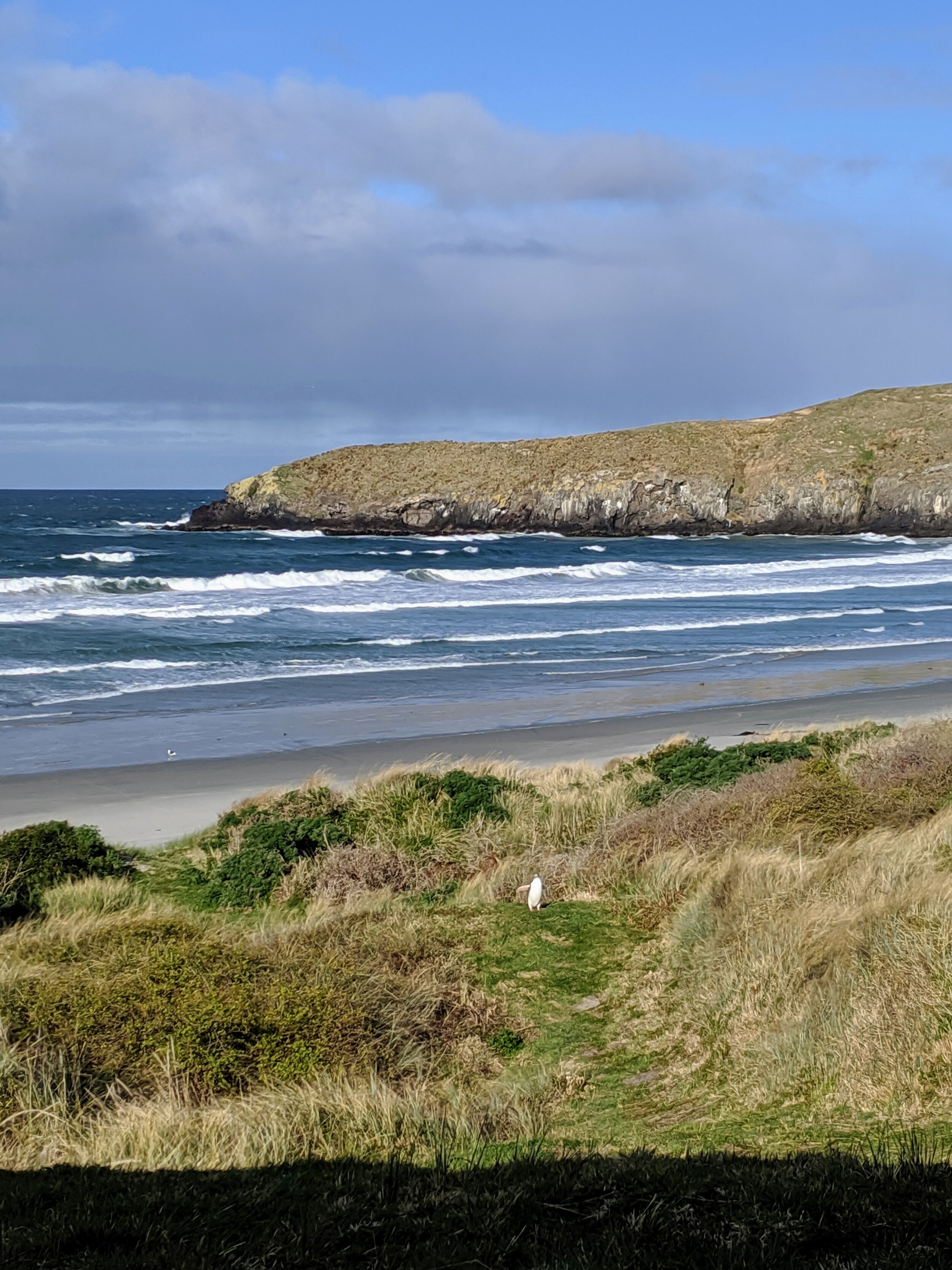
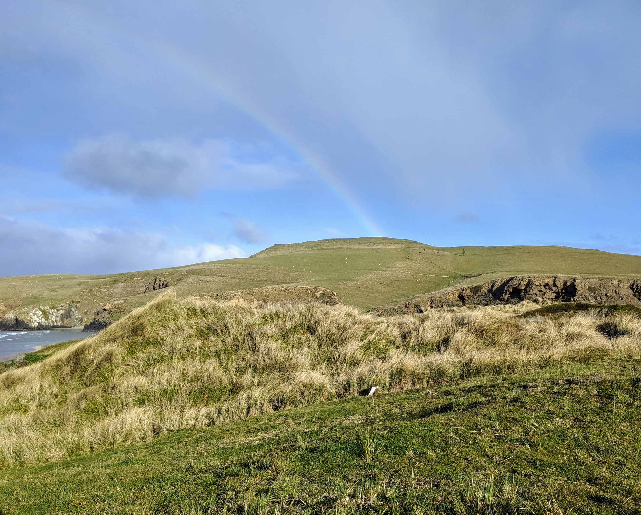
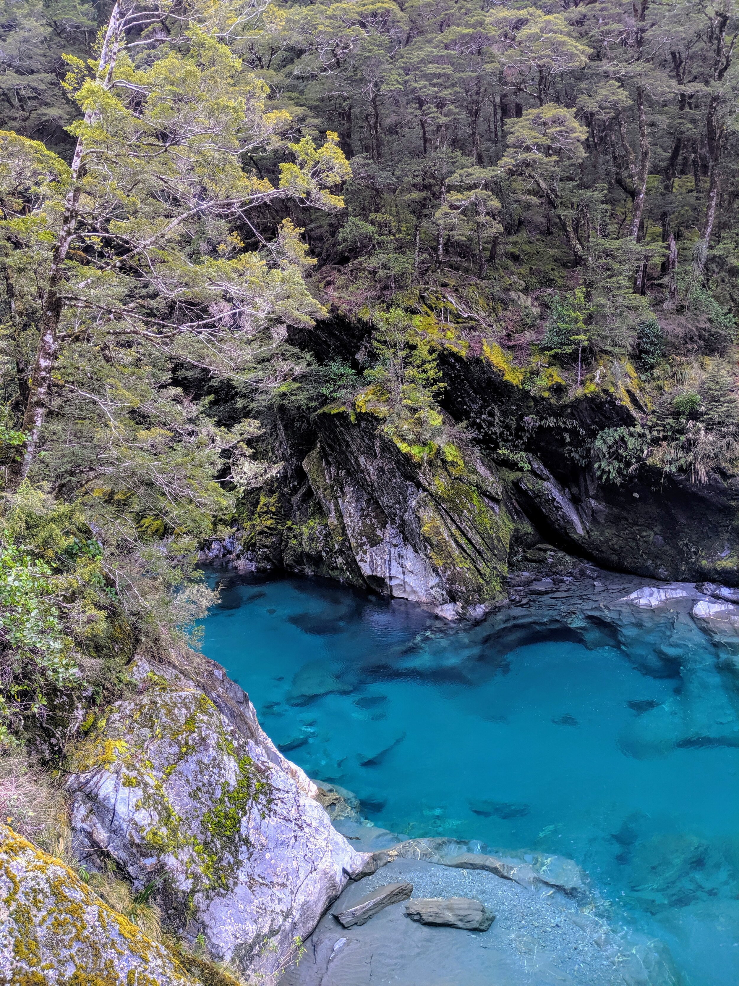
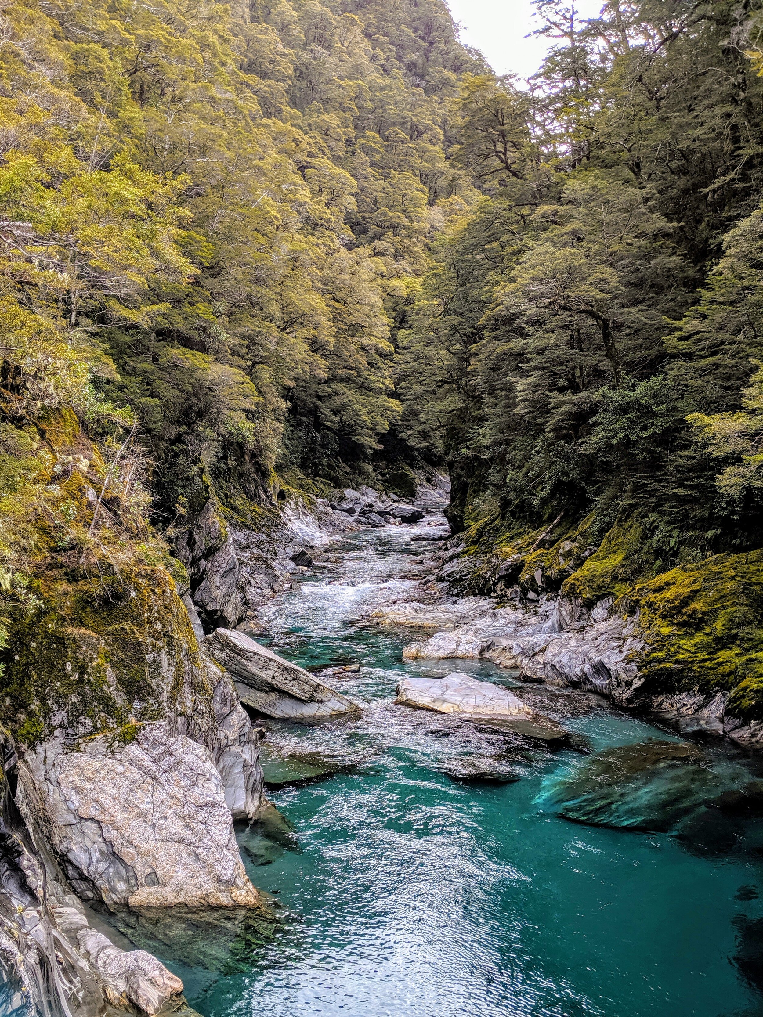
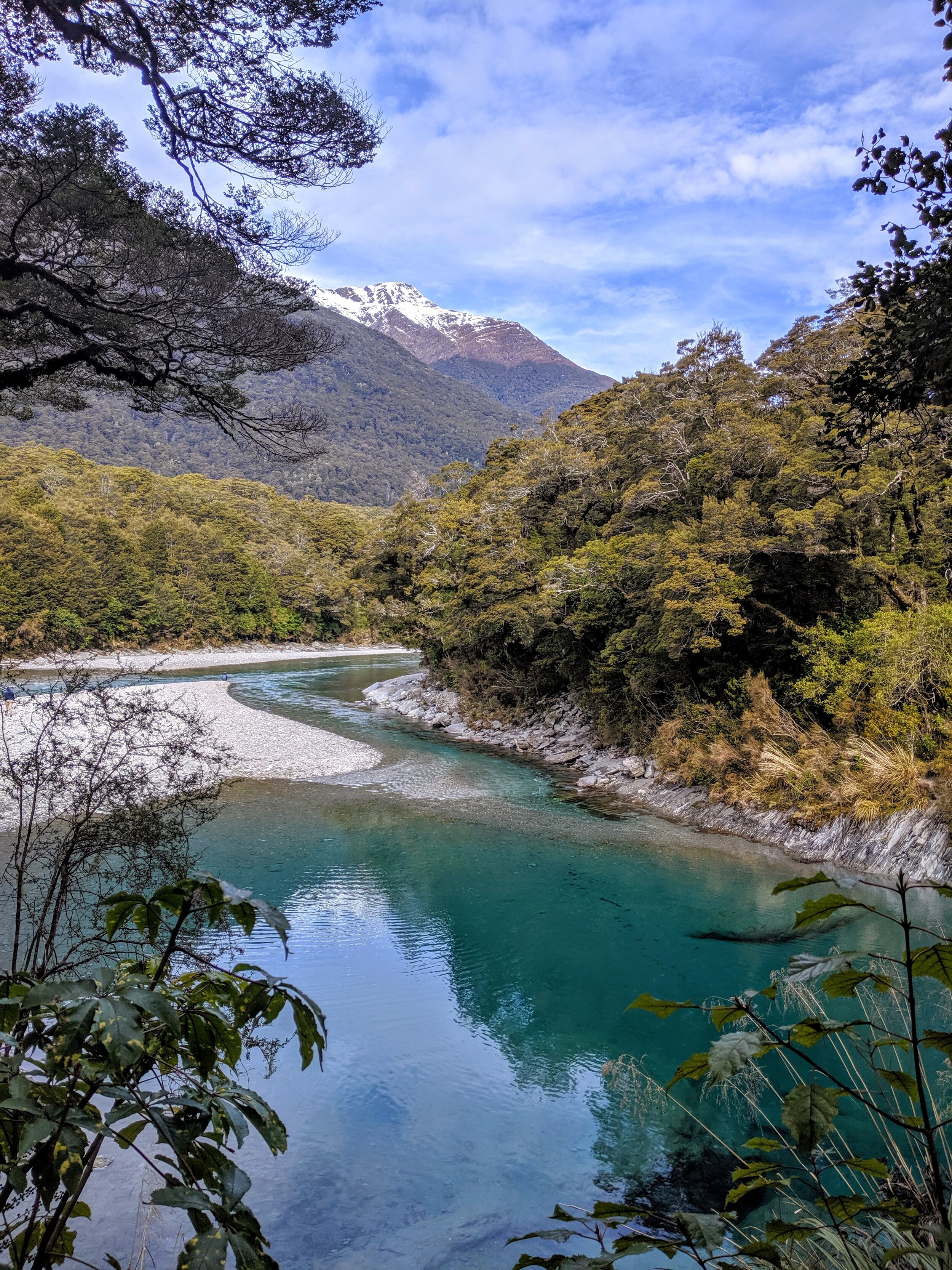
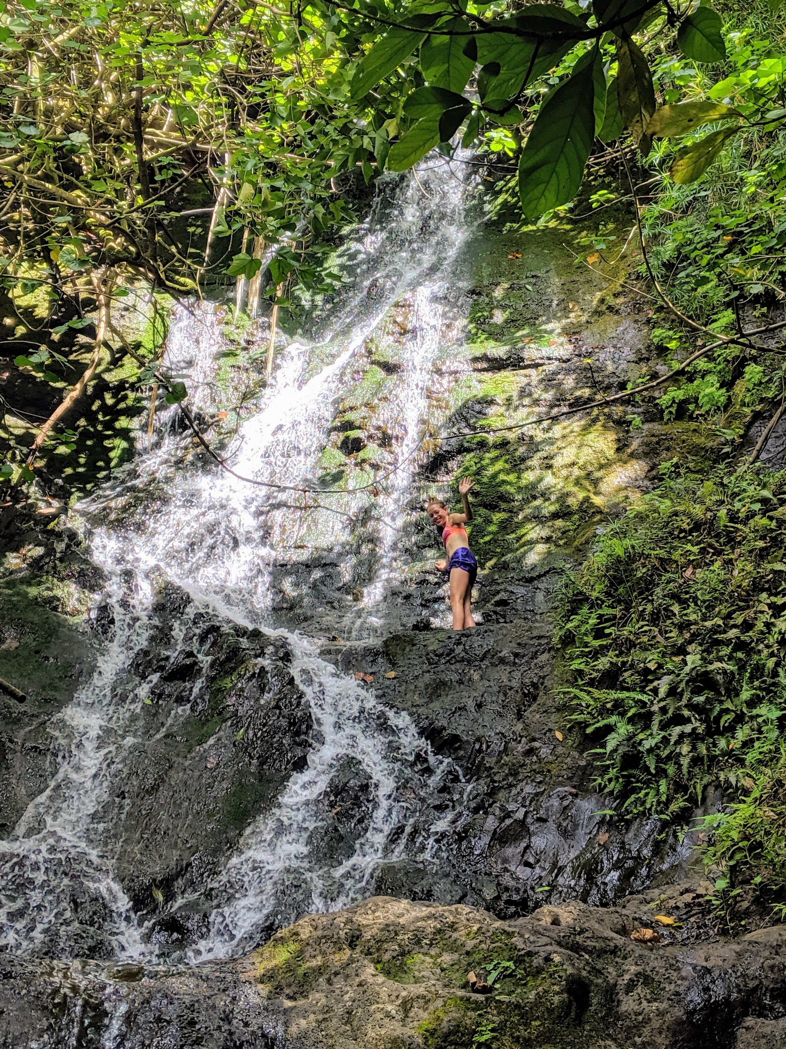
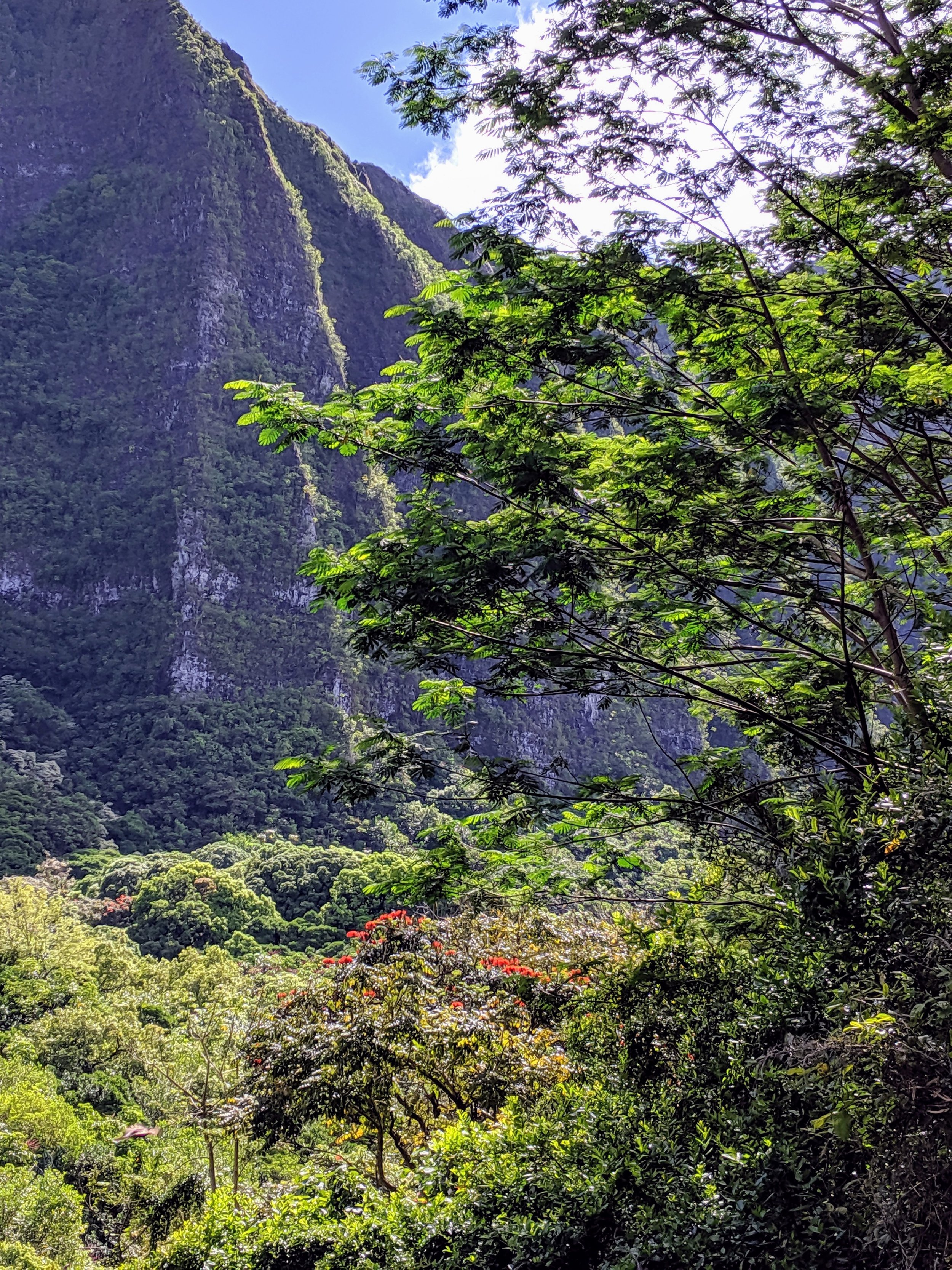
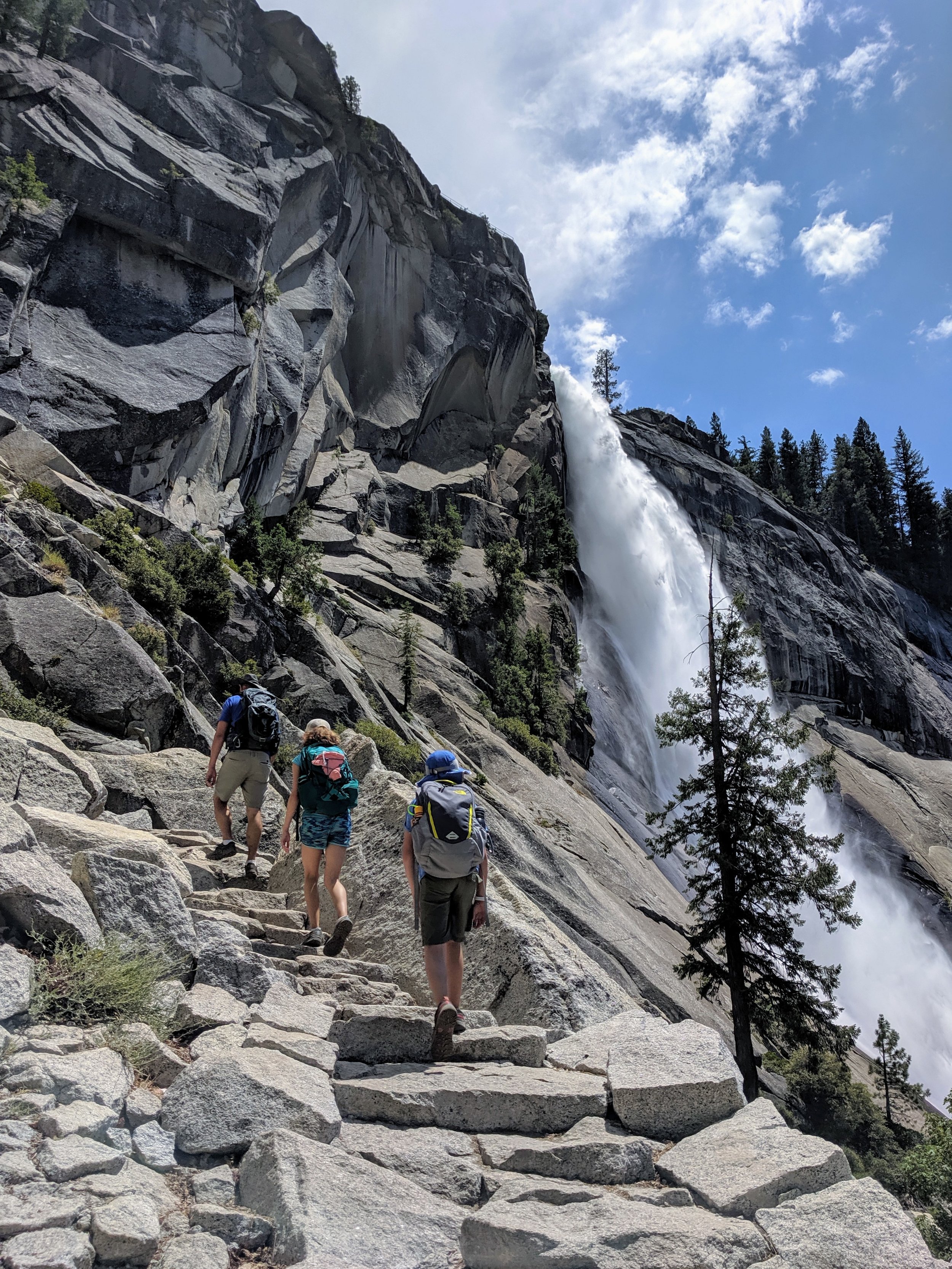
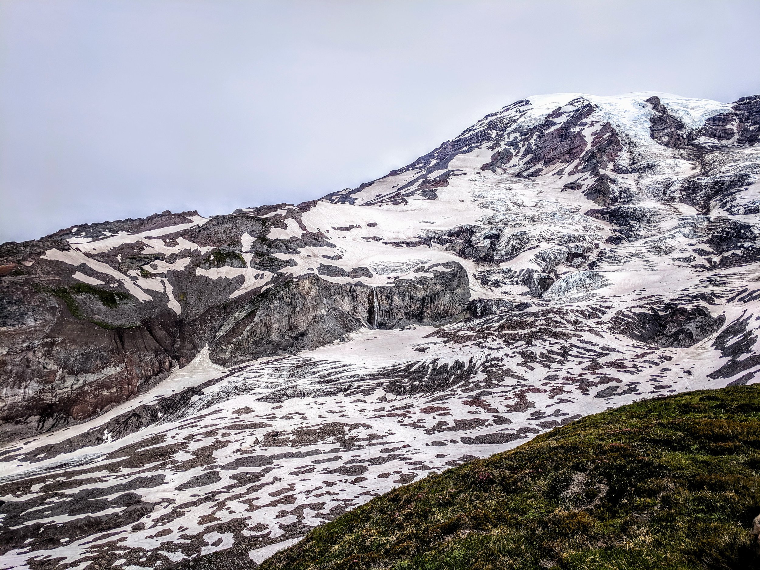
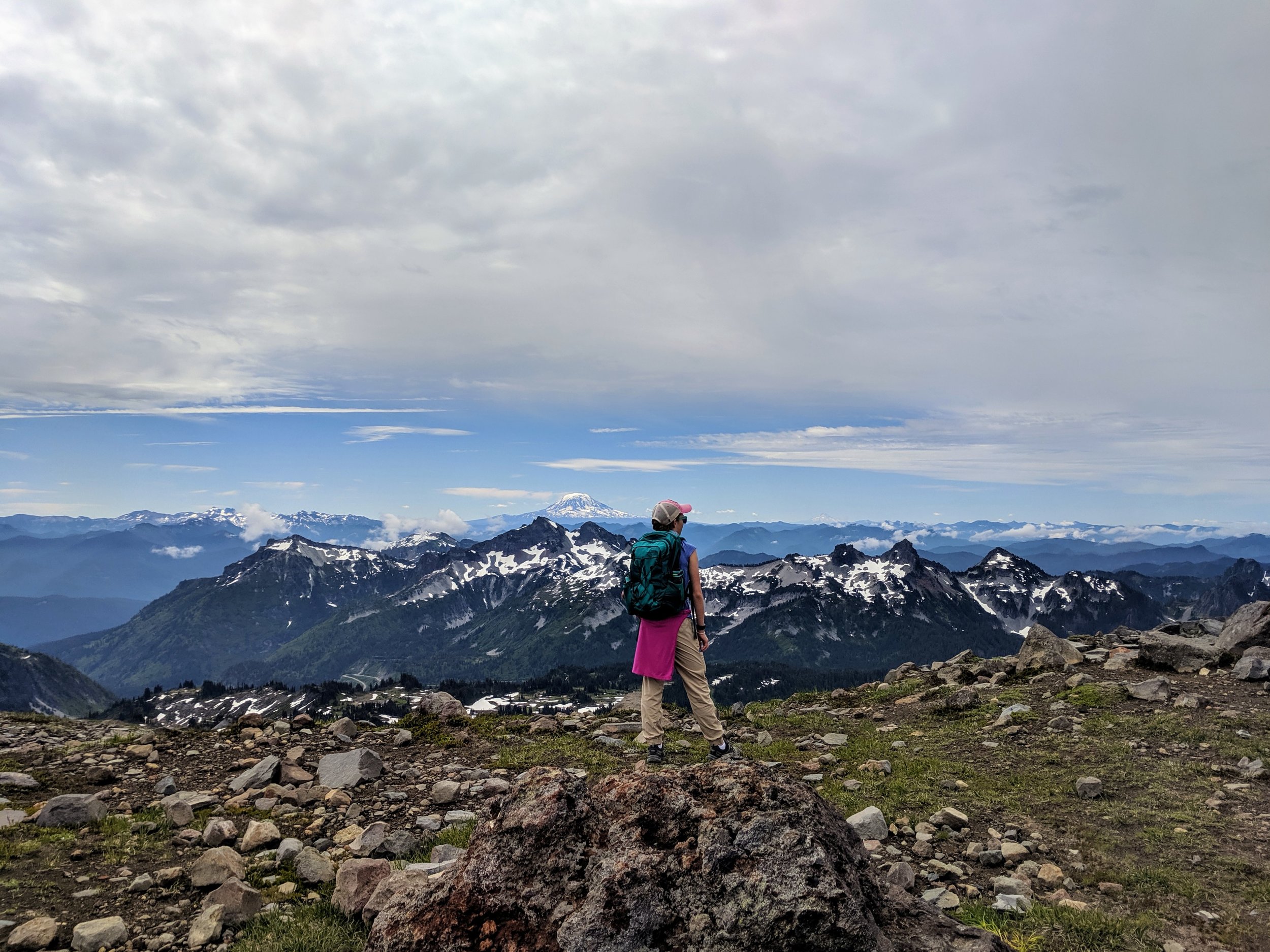
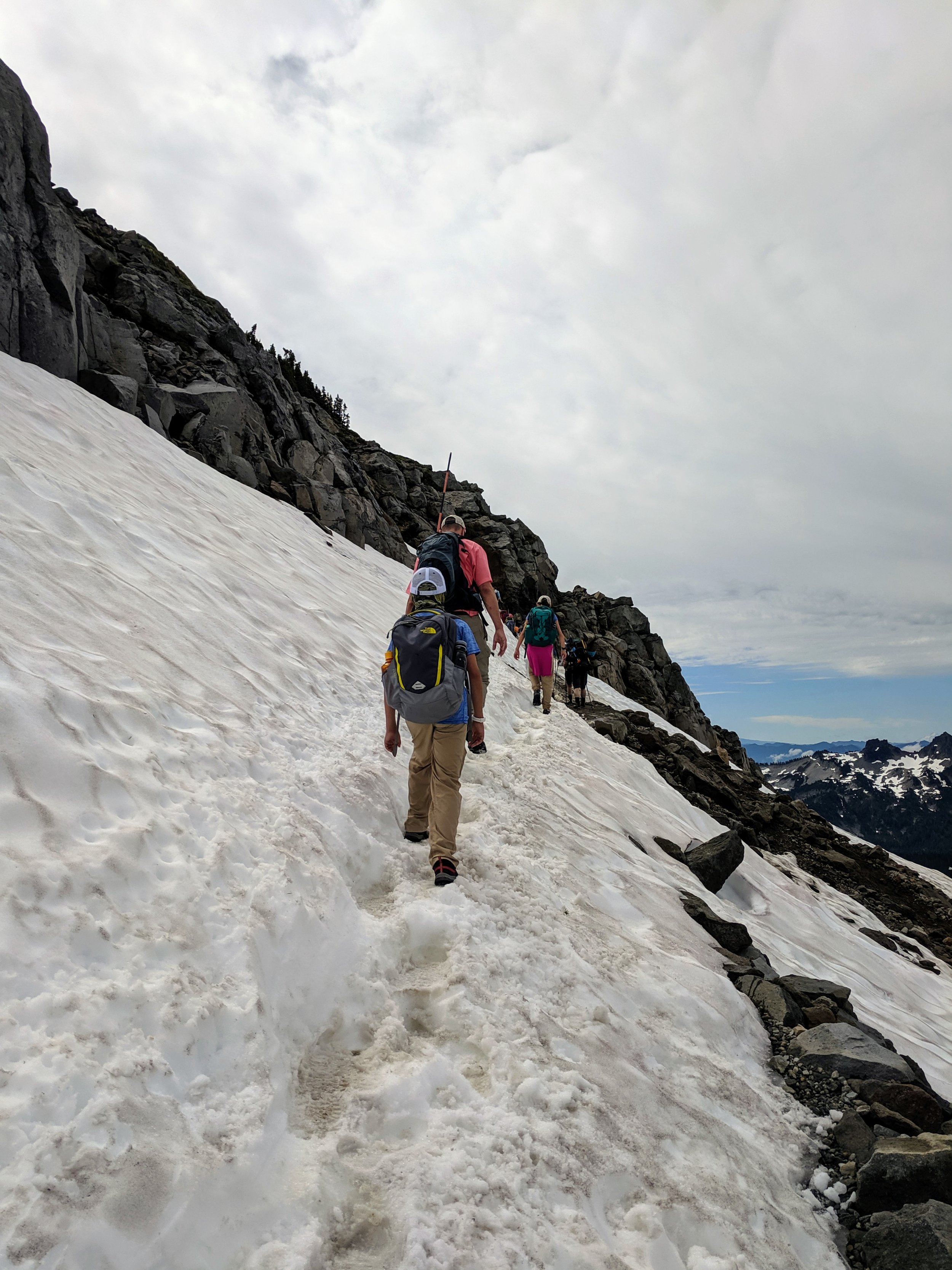
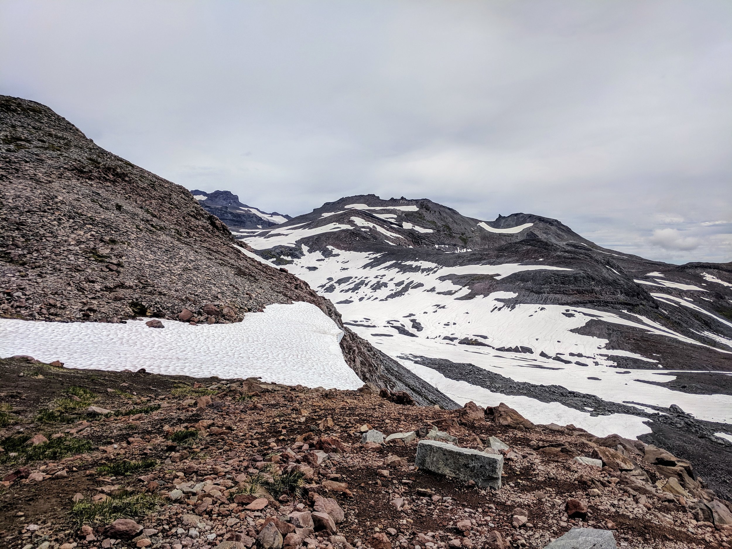
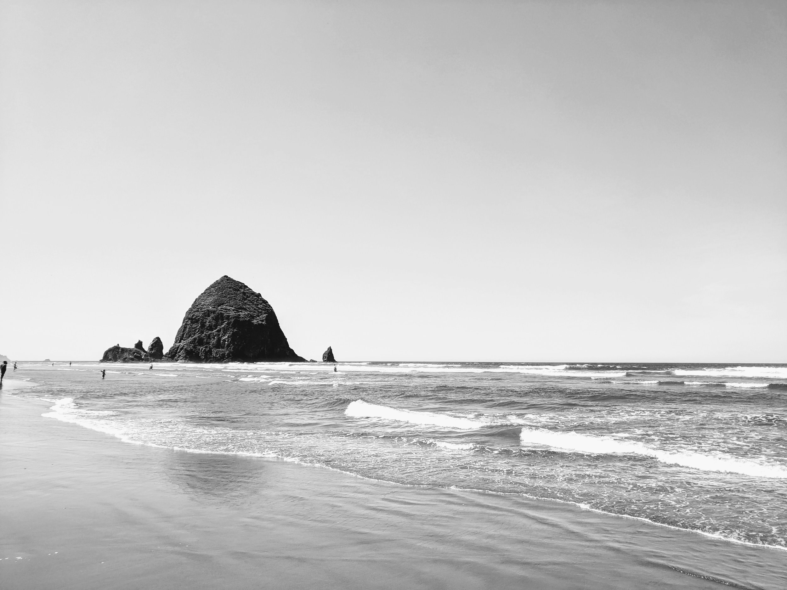
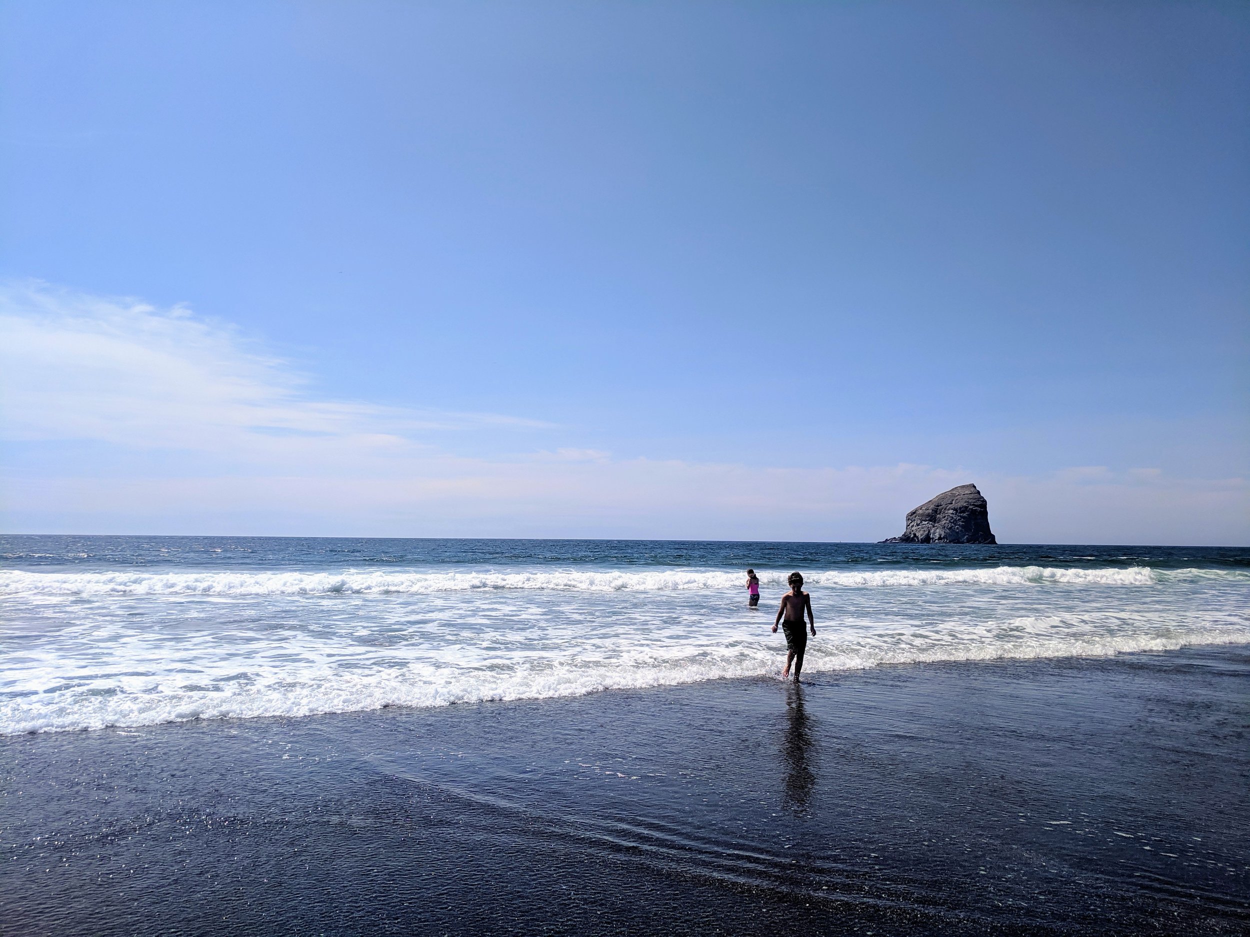
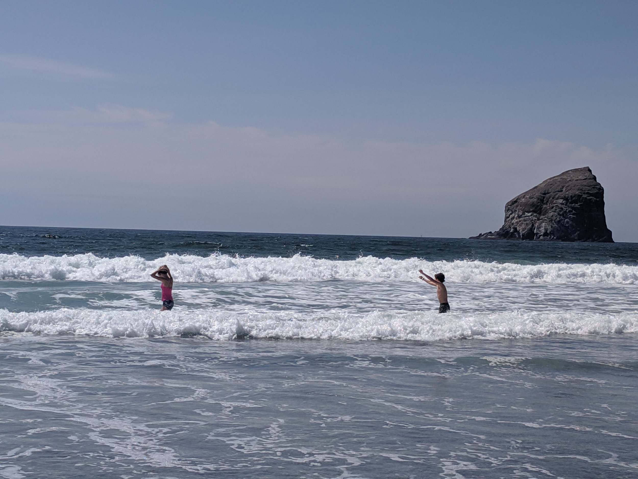
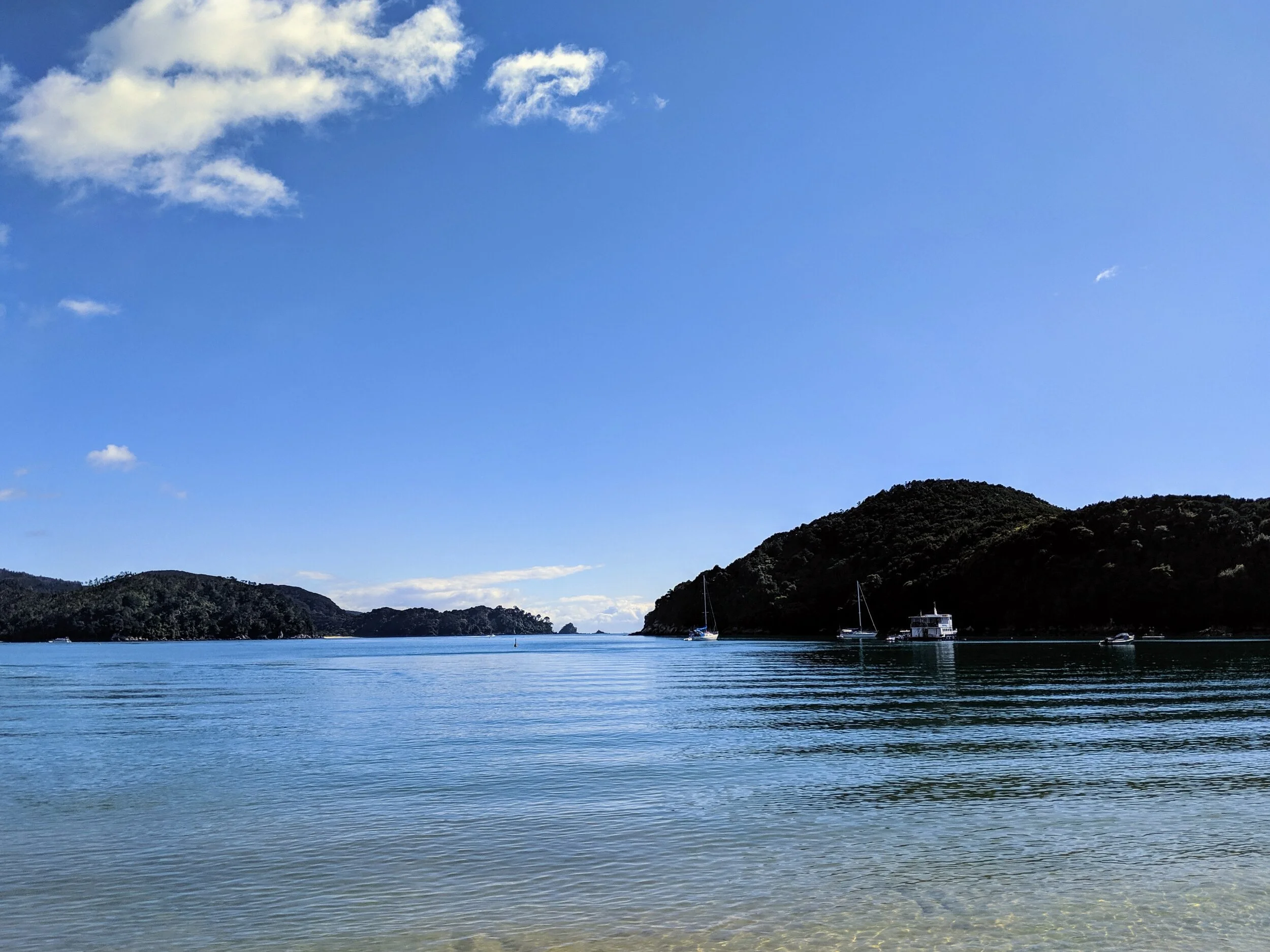
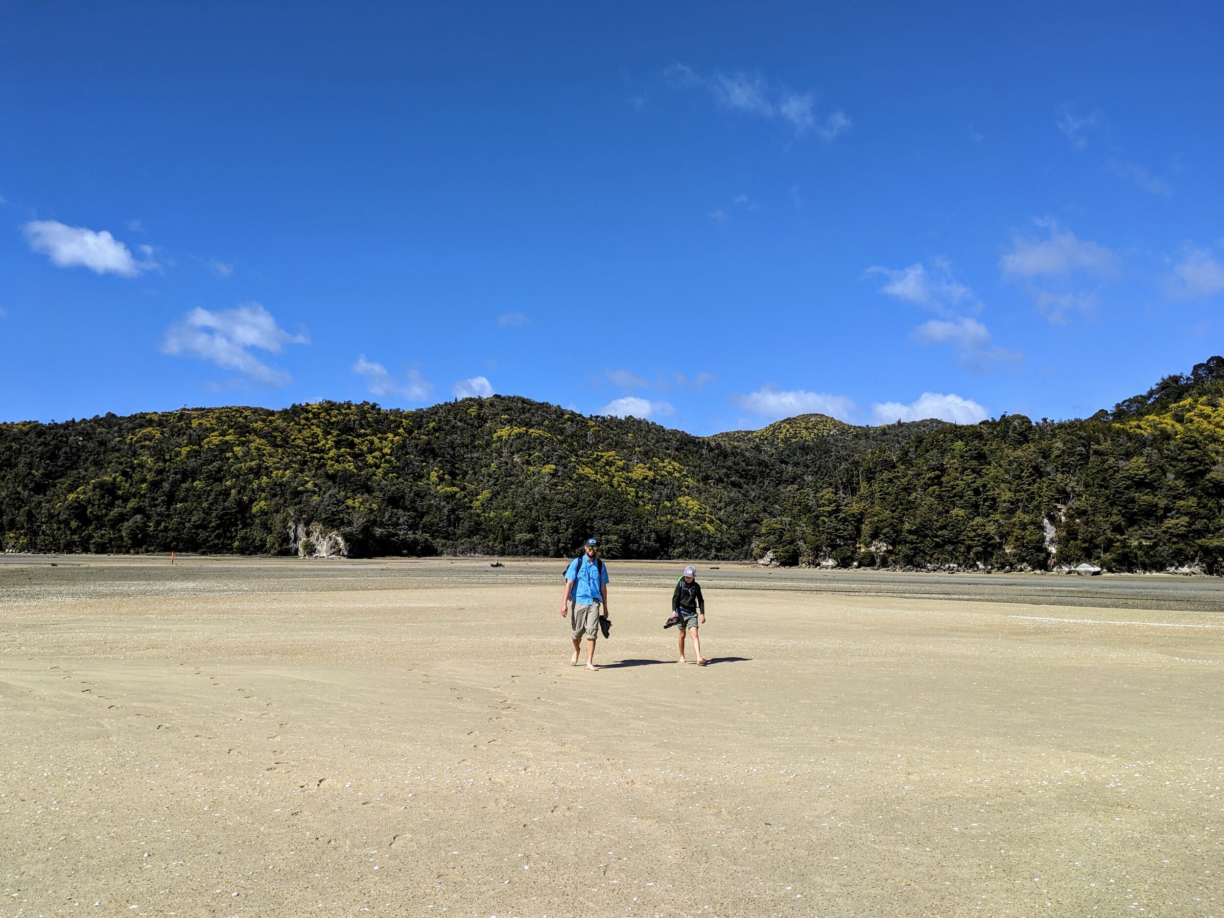
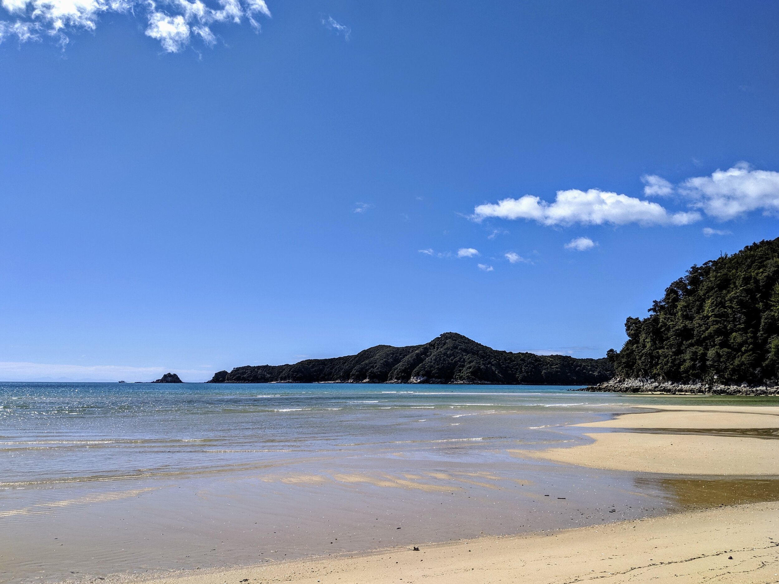
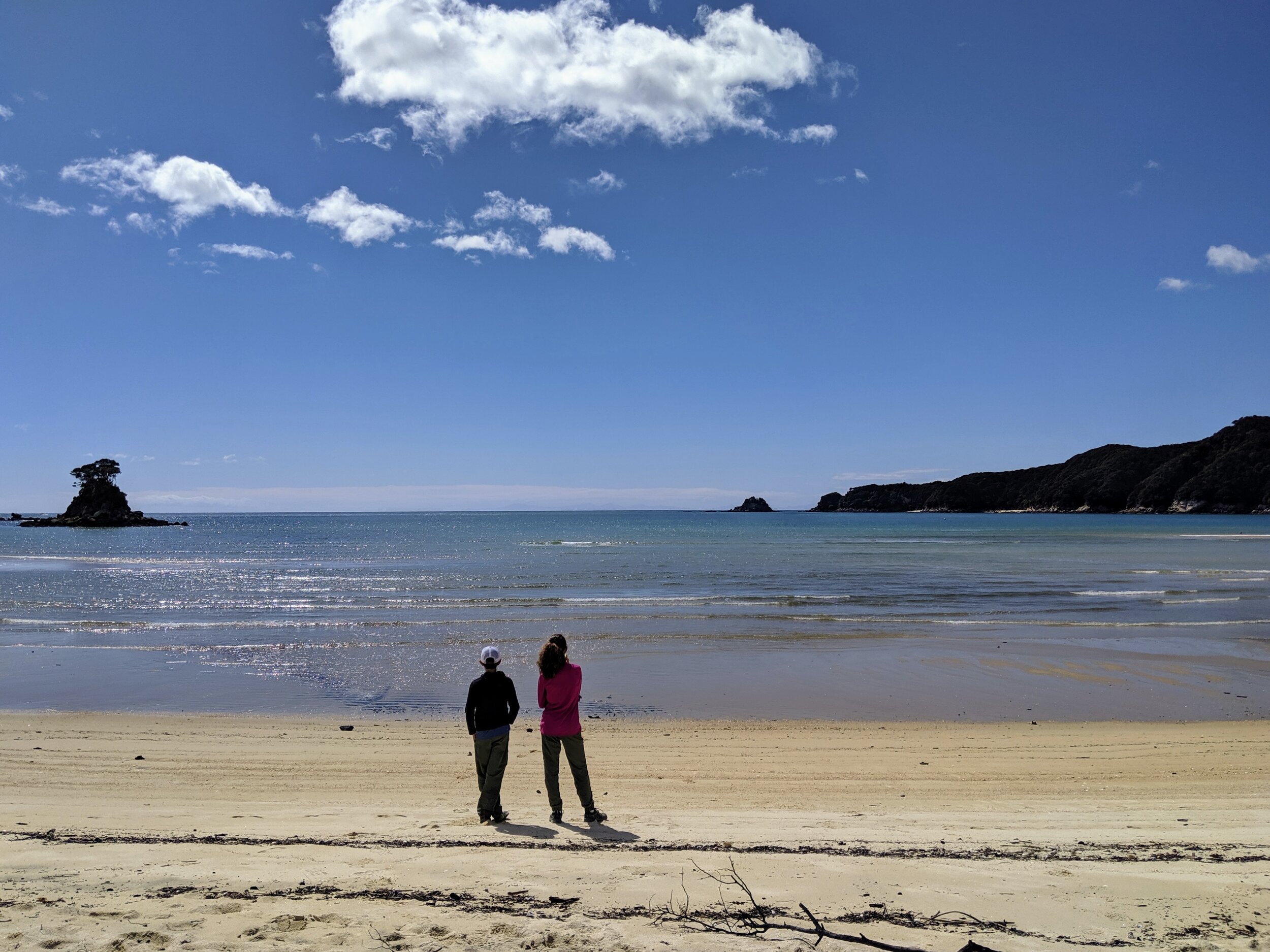
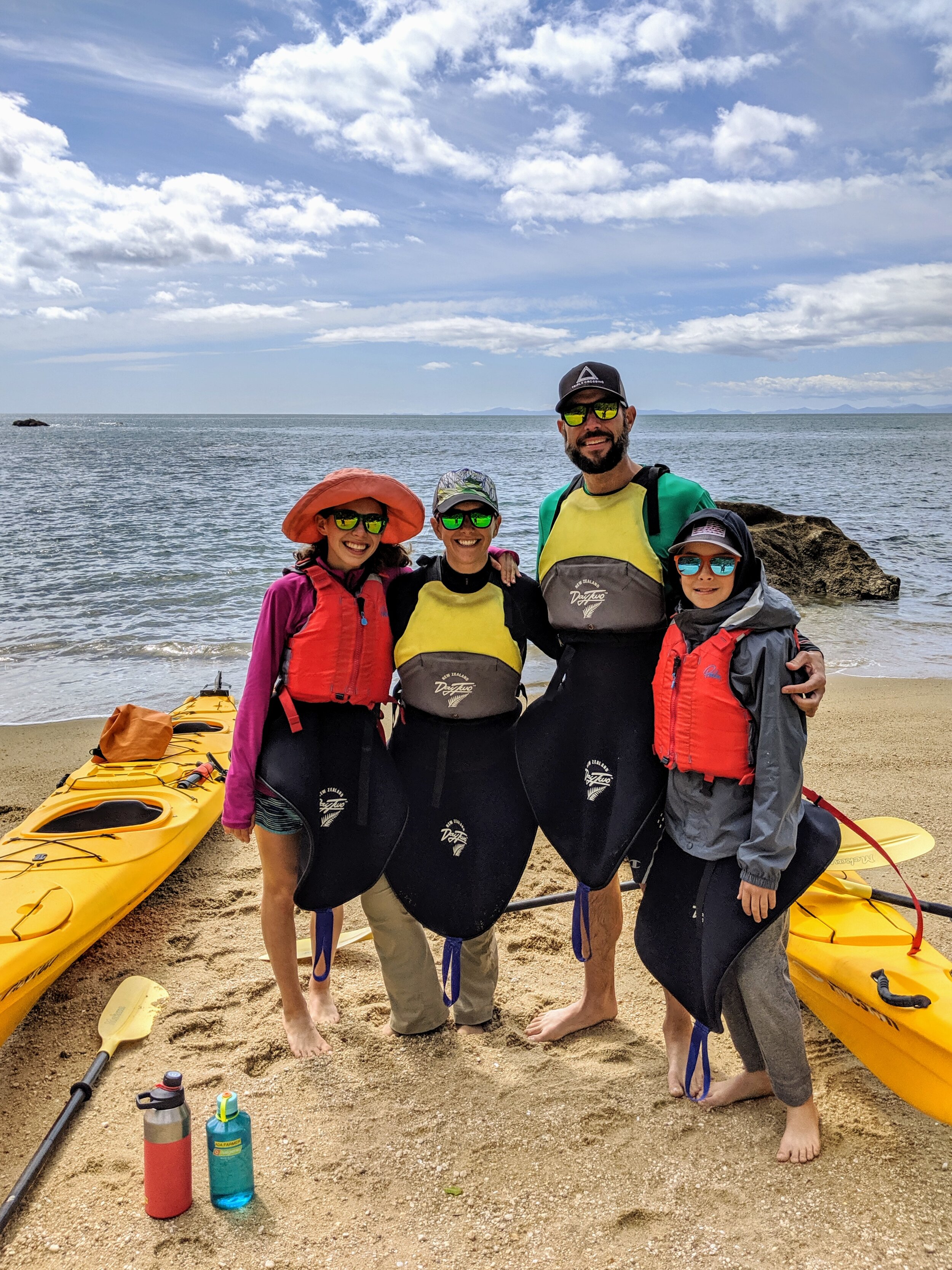
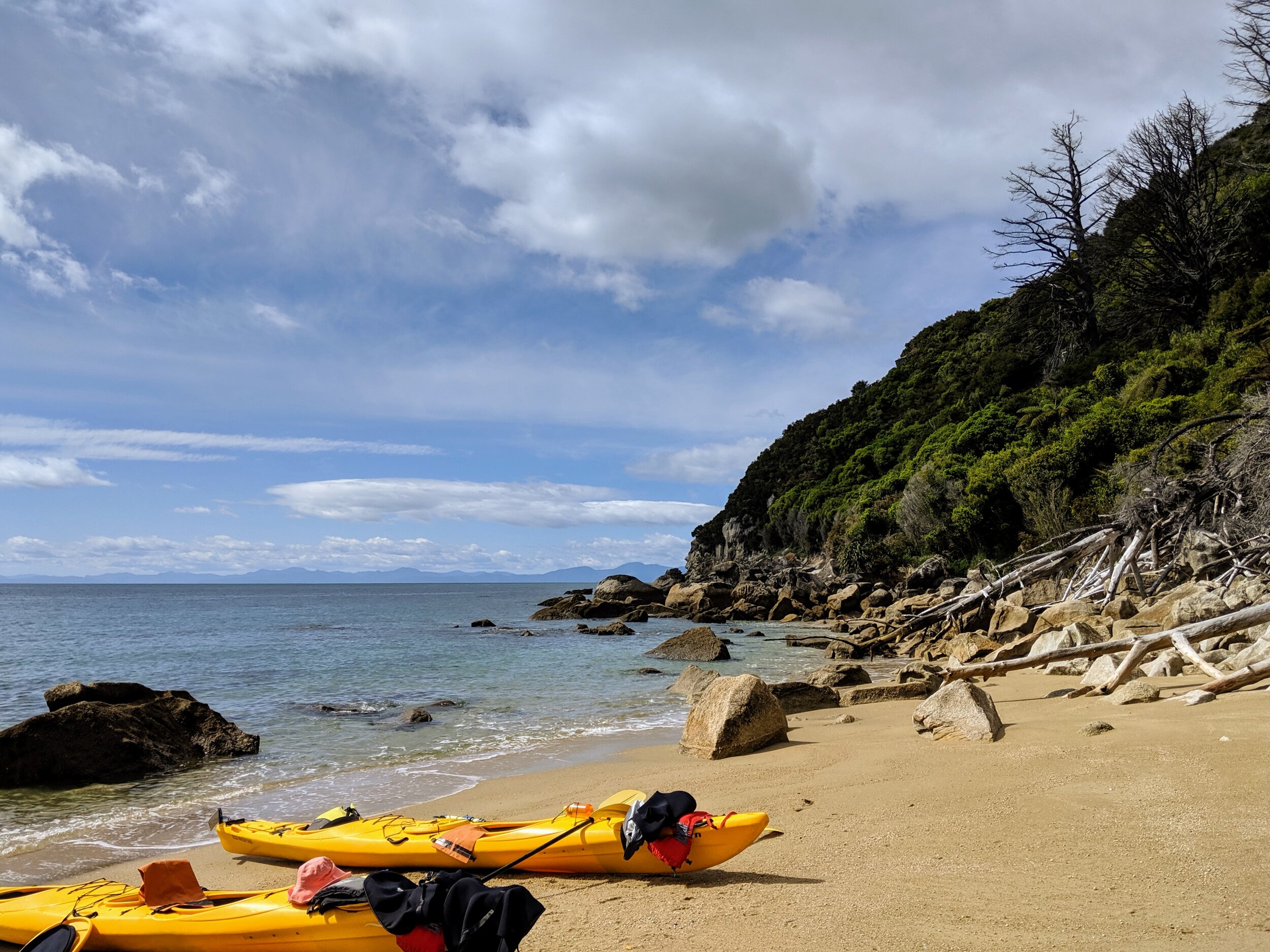
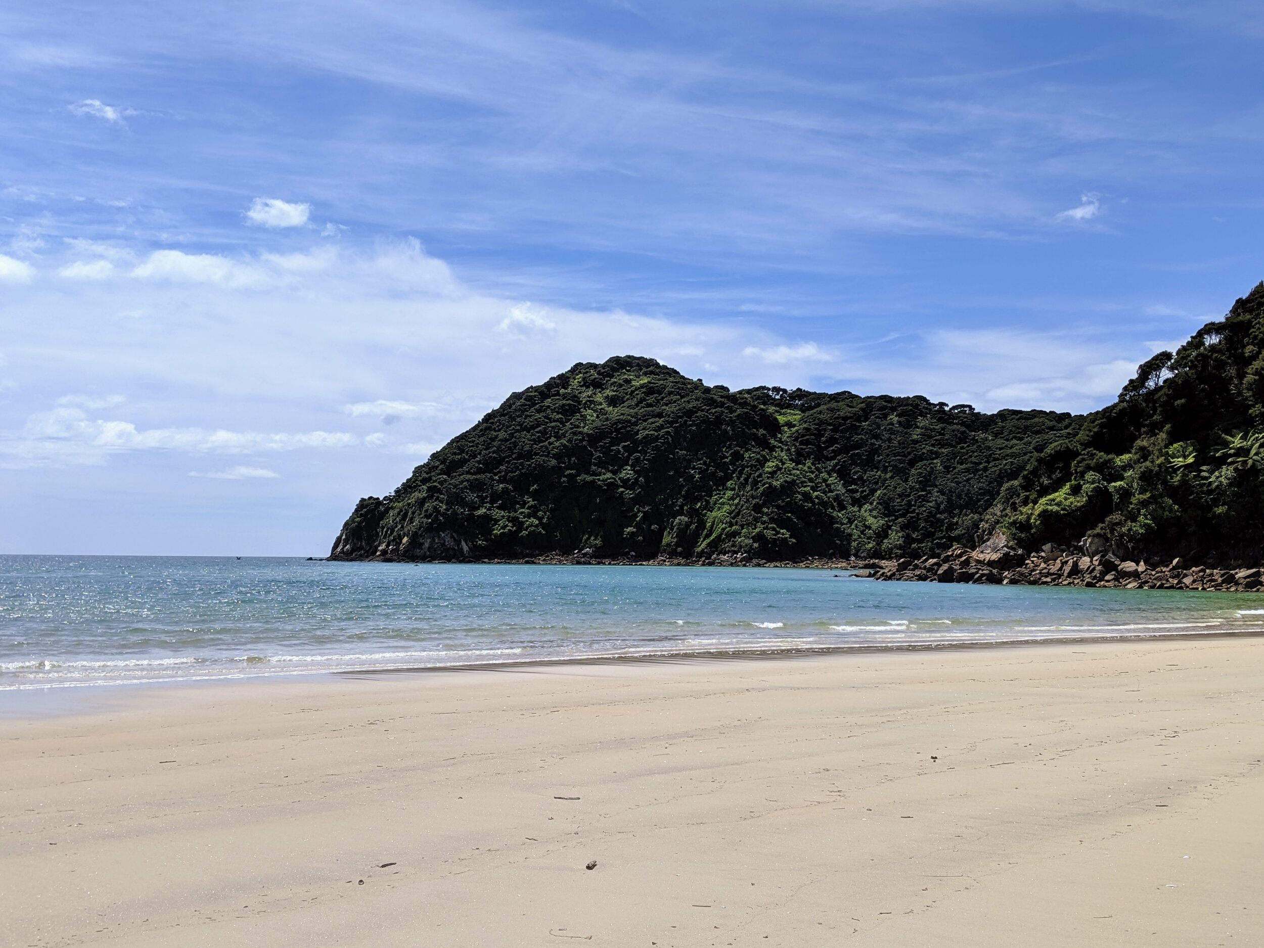
The water taxi dropped us off at Anchorage, our starting point for the section of the Abel Tasman Track that we had decided was the most intriguing. The full track takes 3-5 days to walk depending on your pace, but with the help of the water taxis it’s possible to do sections of the track in a single day. We had picked the Anchorage to Bark Bay section of the track because it covers beaches, forest, a suspension bridge and includes some of the most scenic sections of the park. Once we were off the boat and stopped to get our bearings on the beach we all took the time to take in our surroundings and were truly in awe of its beauty. I had seen many pictures of Abel Tasman in my research for our trip and it immediately lived up to all my expectations. The clear turquoise water and golden sandy beaches are deceptive because it leads one to think of a tropical climate even though the air temperature was only around 60 and the water temperature was about the same. I will let the pictures from the park tell the story of our walk, which personally will be one of my most memorable days in New Zealand.

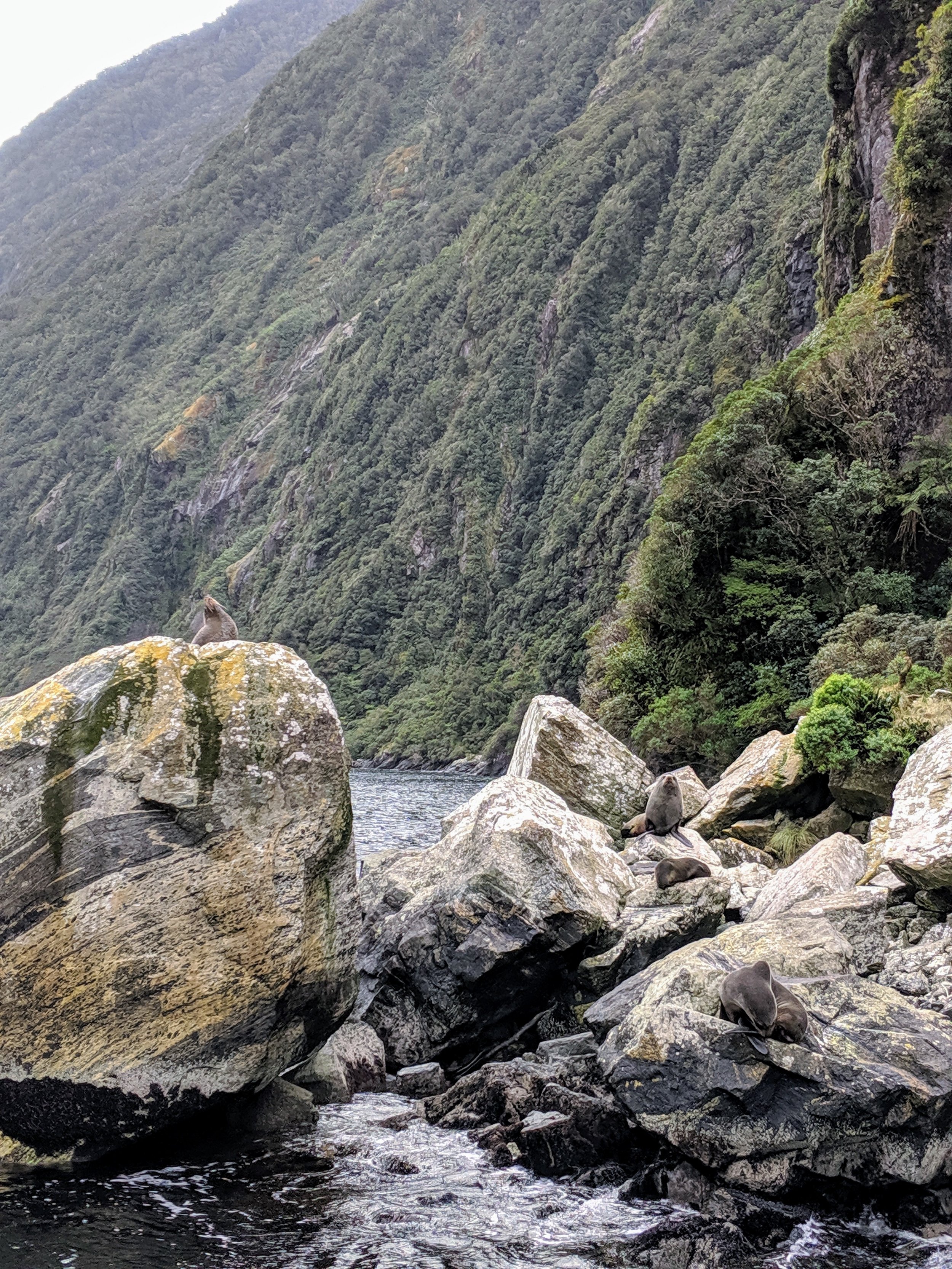
We made it to Bark Bay in mid-afternoon and caught our second water taxi that took us further north to Awaroa Bay where we were staying the night at one of the few lodging options in the park. Settled on a hilltop above the bay with regenerating wetlands right behind it, Awaroa Lodge is a welcoming and unique accommodation that truly gets you off the grid. There are no TVs, cushy amenities, or cellphone reception, but all of that is made up for with the gorgeous location, wonderful restaurant, and their dedication to the park and its many visitors. Our original plan had been to stay outside the park, back in Marahau, until I came across Awaroa Sea Kayaks who run their trips from Awaroa Lodge. They are the only vendor that offers half day kayak trips into Tonga Island Marine Reserve that worked with our schedule. The reserve was established in 1993 and covers the coastline north of Bark Bay up to Awaroa Head and stretches for one nautical mile out into the sea. It protects all marine life in its footprint so no fishing or removal of marine life is allowed there. Research completed 20 years after its establishment shows that it has been profoundly impactful on the rejuvenation of the marine life in the area.

 View of Anchorage Bay from the beach.

View of Anchorage Bay from the beach.

 Crossing Torrent Bay Estuary at low tide.

Crossing Torrent Bay Estuary at low tide.

 Pitt Head as seen from beach at Torrent Bay.

Pitt Head as seen from beach at Torrent Bay.

 Checking out Balloon Rock in Torrent Bay.

Checking out Balloon Rock in Torrent Bay.

 Looking down on Pinnacle Island from Abel Tasman track.

Looking down on Pinnacle Island from Abel Tasman track.

 View of Anchorage Bay from the beach.  Crossing Torrent Bay Estuary at low tide.  Pitt Head as seen from beach at Torrent Bay.  Checking out Balloon Rock in Torrent Bay.  Looking down on Pinnacle Island from Abel Tasman track.

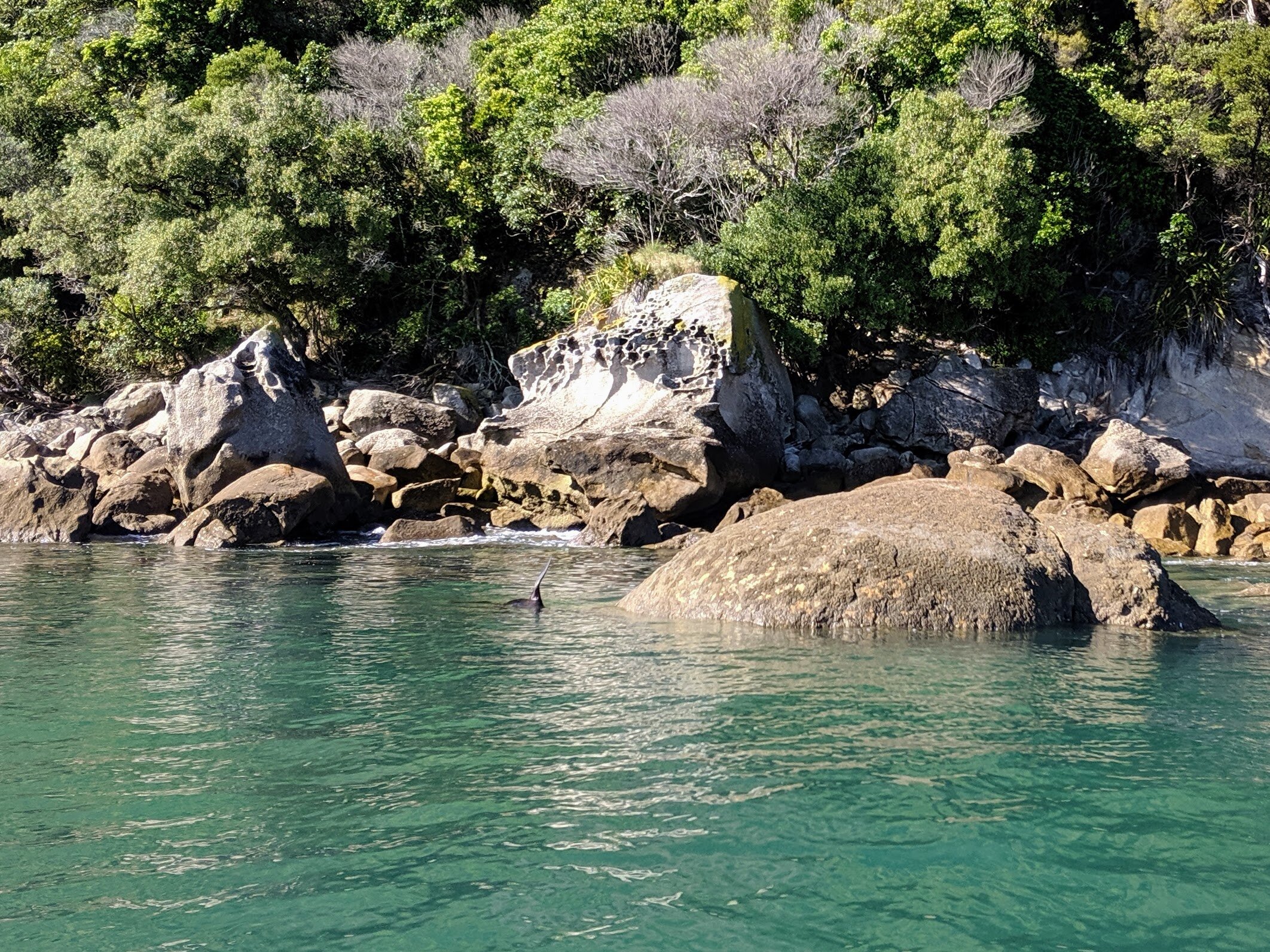
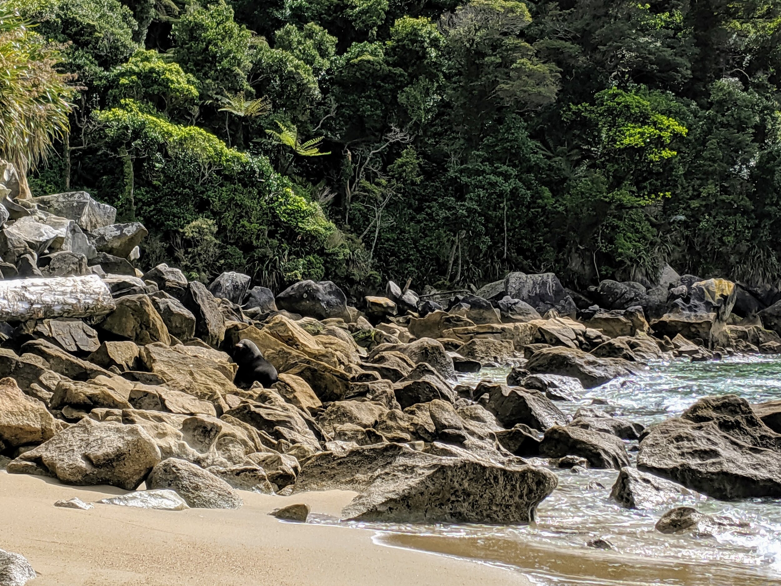
We spent our evening at Awaroa Lodge having a delicious dinner, playing Scrabble, and walking into the forest after dark to see the Glowworm Dell.  The next morning we headed out on our kayak adventure with Josh, the owner of Awaroa Sea Kayaks. The weather was cooperating and the mild winds allowed us to explore a nice portion of the Tonga Island Reserve.  We saw lots of fur seals, including some that playfully swam around our kayaks and shared the beach with us when we stopped to have the morning tea thoughtfully provided by Josh. He was a skilled and knowledgeable guide that was incredibly easy to be around and was very good with the kids as well.  

As we were pulling back into Awaroa Bay to end our trip he shared the story with us of a parcel of land on the bay that had been put up for sale by its private owners in 2015.  Like some US National Parks, there are private landowners in the park that owned their land before the establishment of the park. The unique situation at Awaroa Bay was that the private parcel of land had riparian rights, basically meaning that they owned the entire 800 yard beach in the bay. The current owners had allowed the public and the water taxi companies to use the beach for many years and it was a key component of travel through the park.  When the property went up for sale the new owners could have decided to stop any access and dramatically changed Abel Tasman forever. Fortunately, this didn’t happen because two men that are Abel Tasman devotees decided to create a crowdfunding campaign in the hopes that the people of New Zealand could raise enough money to purchase the land and donate it to the NZ Department of Conservation.  In around four weeks, over 39,000 New Zealanders donated $2.3 million (NZ) to buy the property and their offer was the one accepted by the sellers over other individuals and businesses that had made comparable offers. Six months after the sale the land officially became part of Abel Tasman. It is a remarkable and uplifting story and as a visitor to that amazing location I truly appreciate the two gentlemen that came up with the idea.  

 Kayaking in Tonga Island Marine Reserve.

Kayaking in Tonga Island Marine Reserve.

 Fur seal on the rocks next to us during our morning tea break during kayaking.

Fur seal on the rocks next to us during our morning tea break during kayaking.

 Kayaking in Abel Tasman.

Kayaking in Abel Tasman.

 Awaroa Beach looking out towards Tasman Sea.

Awaroa Beach looking out towards Tasman Sea.

 Kayaking in Tonga Island Marine Reserve.  Fur seal on the rocks next to us during our morning tea break during kayaking.  Kayaking in Abel Tasman.  Awaroa Beach looking out towards Tasman Sea.

After kayaking we got cleaned up, ate lunch, and then caught our water taxi back out of the park as we had to drive 2.5 hours to catch our ferry back to Wellington.  When we arrived in Marahau and got cell coverage again I saw that I had an email from the ferry company saying that our ferry was running four hours late and wouldn’t depart until 11:30 PM, which would have us getting to Wellington at 3:30 AM.  Trying to avoid that option for numerous reasons, I called the other ferry company that operates and they were able to get us on a ferry that was leaving at 6:45 PM. Assuming everything went perfectly on the drive we would make that ferry so we decided to take the risk and if we missed it we would take the delayed one and just be exhausted the next day.  I was doing all the driving because the rental office was closed when we picked up our car so we hadn’t been able to add Cameron as a second driver.  

We were making great time until I got pulled over as we entered a small town along our route.  I hadn’t slowed down quickly enough as we passed the speed limit sign and he clocked me going 11 KPH over the speed limit (equivalent of going about 7 MPH over in the US).  I pulled over and I think we both anticipated that I was getting ready to get a very pricey speeding ticket in another country. Instead, we got the nicest interaction with a police officer I’ve ever had in my life.  After speaking with us a bit he said he didn’t want to give me an expensive ticket that would require a return trip to the South Island and mess up our vacation. Instead, he wanted me to remember that when we are driving with our kids in the car we are modeling to them what is and is not acceptable as a driver.  And, that as a guest in the country we should be aware of and respectful of the fact that they generally drive at a slower pace, especially through small towns. He then chatted us up about our trip, made some recommendations, and sent us on our way. That is the first time I’ve ever been pulled over, regardless of the reason, that the officer explained what I did wrong not just as breaking the law, but in a way that focused on the impact it had on others.  Personally, I found that a more compelling argument than just being told I was wrong.  

Thankful to have not gotten a ticket we kept heading towards the ferry with our fingers crossed that they would let us board after the last call as we definitely wouldn’t make it by that deadline.  We went running into the terminal only to see that the boat was delayed an hour and a half and our mad dash had been unnecessary. We walked across the street to get dinner, calmly boarded the ferry around 8:30, and had a very rough crossing back to Wellington.  It took me about 24 hours once we were off the boat before I felt like I wasn’t constantly rocking back and forth. The next day was laid back as we were doing laundry and getting packed up to leave Wellington the following morning. That Saturday will forever live in infamy as the day that Cameron shaved his beard and left a mustache that lasted longer than an hour or two.  The kids do not like him with a mustache and I can’t take him seriously when he has one. He says he will shave it off before we go to Fiji so he needs to be ready for me to giggle at him a lot until then.

IMG_20191026_132229.jpg
November 22, 2019 /Brooke Farmer
1 Comment
View of Wellington from Mt. Victoria Lookout.

View of Wellington from Mt. Victoria Lookout.

Catching Up and Covering Some Miles

October 28, 2019 by Brooke Farmer

It’s been four weeks since we left Wanaka and a little less than that since I’ve taken the time to sit down and write about our trip.  I find the concept of “taking the time” to do something to be problematic because I’ve realized I don’t need to take what I have in abundance.  I’ve had more free time these past nine months than I can ever remember. It’s such a luxury. And, with that luxury comes the responsibility to better choose how I spend that time and even with my months of practice I am not getting any better at it.  I am the same procrastinator in New Zealand that I was in the United States. I know it confounds Cameron as he is the complete opposite.  

So, in the interest of being efficient and making myself feel better about not being weeks behind on blogging I am going to do a catch-up post and try and cover four weeks of our time in as concise a manner as I can manage.  First up, our final days in Wanaka and weekend in Christchurch.

Not far outside of Wanaka is Roy’s Peak, one of many mountains in the area that are on the edge of or part of Mt. Aspiring National Park.  Unlike some of the mountains we hiked this summer, Roy’s Peak is unremarkable when viewed from the ground and if it weren’t for Instagram it is unlikely we would have known about it at all.  I started following some NZ travel and blogger accounts on Instagram when we decided to do this trip and the view from the top of Roy’s Peak is one of the most photographed in the country. We set out on our third to last day in Wanaka to see if it was as phenomenal a perspective as it looked on our phone screens.  It’s a hard hike, a roundtrip of 9.7 miles with 4000 feet of elevation gain. It’s definitely the toughest hike we’ve done as a family, but goodness is it worth it. I will let the pictures speak for themselves:

 Lake Wanaka as seen from the top of Roy’s Peak.

Lake Wanaka as seen from the top of Roy’s Peak.

 View of Wanaka from halfway up the Roy’s Peak Track.

View of Wanaka from halfway up the Roy’s Peak Track.

 Roy’s Peak

Roy’s Peak

 Lake Wanaka as seen from the top of Roy’s Peak.  View of Wanaka from halfway up the Roy’s Peak Track.  Roy’s Peak

Two days after Roys Peak we packed the car, had breakfast at the same cafe we ate at our first morning in Wanaka, and then started the six hour drive to Christchurch.  Along the way we stopped at Lake Pukaki and Aoraki/Mt. Cook Village, where we were able to see NZ’s tallest mountain from its eastern side (we first saw it from the west when we went to Franz Josef Glacier).  After checking out the Visitor Centre and Museum at Mt. Cook we stopped for lunch on Lake Tekapo followed by a quick visit to the Church of the Good Shepherd, another social media darling of NZ. We made it to Christchurch around dinner time and got a good night’s sleep before spending Saturday exploring the largest city on the South Island. 

Chances are you’ve heard of Christchurch before for two horrible reasons.  First, the devastating earthquakes that occurred there in 2010 and 2011, including over 4000 small aftershocks, that killed 185 people and caused over $20 billion in damage.  Secondly, the horrendous terrorist attacks at two of its mosques this past March when an avowed white supremacist killed 51 people and injured another 49. This double dose of unthinkable horrors may have broken some cities and their citizens, but from what we saw in Christchurch they are a resilient and resolute community.  Our visit to the Transitional Cathedral (popularly known as the Cardboard Cathedral) was particularly uplifting and hopeful. This contemporary church of international architectural significance is the temporary home for the Anglican Diocese while it waits on the rebuilding of the 115 year old cathedral damaged in the earthquake. The city seems to be thriving now and on a dreary, windy day the streets and parks were full of residents and visitors out enjoying newly built playgrounds, freshly painted murals, and reopened cafes and shops. There is still lots of work to be done to physically repair the city, but its spirit seems to be intact and strong.

It wasn’t until we were walking back to our motel after a full day of sightseeing that we realized that one of the mosques from the terrorist attack was around the corner from where we were staying.  Hagley Park, which we were walking through at that moment, was where the mosques held Friday prayers a week after the shooting and 20,000 people showed up to show their support for the Muslim community, encircling those praying in a show of support and protection. That moment of realization in Hagley Park will be one of my strongest memories from this trip.  The physical proximity to such fear and healing physically affected me.

 Lake Pukaki

Lake Pukaki

 Ada running on the rocky shore of Lake Pukaki.

Ada running on the rocky shore of Lake Pukaki.

 Aoraki/Mt. Cook in the distance.

Aoraki/Mt. Cook in the distance.

 Aoraki/Mt. Cook as seen from shores of Lake Tekapo.

Aoraki/Mt. Cook as seen from shores of Lake Tekapo.

 Church of the Good Shepard on the shores of Lake Tekapo.

Church of the Good Shepard on the shores of Lake Tekapo.

 The damaged shell of Christchurch Cathedral.

The damaged shell of Christchurch Cathedral.

 Stained glass window in the Cardboard Cathedral.

Stained glass window in the Cardboard Cathedral.

 Choral stands, cross, and lecterns made from cardboard tubing in the Cardboard Cathedral in Christchurch.

Choral stands, cross, and lecterns made from cardboard tubing in the Cardboard Cathedral in Christchurch.

 Margaret Mahy Playground in Christchurch, built after the earthquake of 2011.

Margaret Mahy Playground in Christchurch, built after the earthquake of 2011.

 Christchurch Art Gallery exterior with “Everything Is Going To Be Alright” in neon lights.

Christchurch Art Gallery exterior with “Everything Is Going To Be Alright” in neon lights.

 Lake Pukaki  Ada running on the rocky shore of Lake Pukaki.  Aoraki/Mt. Cook in the distance.  Aoraki/Mt. Cook as seen from shores of Lake Tekapo.  Church of the Good Shepard on the shores of Lake Tekapo.  The damaged shell of Christchurch Cathedral.  Stained glass window in the Cardboard Cathedral.  Choral stands, cross, and lecterns made from cardboard tubing in the Cardboard Cathedral in Christchurch.  Margaret Mahy Playground in Christchurch, built after the earthquake of 2011.  Christchurch Art Gallery exterior with “Everything Is Going To Be Alright” in neon lights.

We were up very early the following morning to take the Coastal Pacific train from Christchurch to Picton where we boarded an Interislander ferry to cross the Cook Strait to Wellington on the North Island.  The train and ferry was the perfect way to travel as it allowed us to relax and enjoy the scenery. The ferry ride was quite different from ferry trips we’ve done in the US. Because the Cook Strait is very tempestuous the boats are similar in size and amenities (minus the pools) to small cruise ships.  They carry tractor trailers, train cars, and personal vehicles in addition to many walk-on passengers. After a full day of traveling we got into Wellington in the early evening, took a cab to the apartment we had rented for the month, got settled, and walked down the street for dinner.  

We had read that Wellington was a very walkable city with good public transportation so we had decided to live in the central city and forgo renting a car.  Wellington is the capital of New Zealand and has a population of around 213,000 within the city and another quarter million in the surrounding suburbs. In 2018 Deutsche Bank named Wellington the city with the best quality of life in the world.  Nicknamed “Windy Welly”, the city is by many measures the windiest city in the world because of its position on the narrow Cook Strait that connects the Tasman Sea and Pacific Ocean. On the upside, the wind clears out any air pollution very quickly and powers wind turbines that provide electricity to the area.  And, it definitely creates hardy residents as any Welly resident we talked to said they didn’t actually think it was that windy there and most people wore less layers than we needed to stay comfortable. It was by far the most fickle weather I have ever experienced and since we didn’t have a car and were walking a lot we had to learn to live with it.  

 Checking out the scenery from the open air car on the train.

Checking out the scenery from the open air car on the train.

 Atlantic Ocean outside Kaikoura, NZ.

Atlantic Ocean outside Kaikoura, NZ.

 View of Atlantic Ocean from the Coastal Pacific Train passing through Kaikoura.

View of Atlantic Ocean from the Coastal Pacific Train passing through Kaikoura.

 Checking out the scenery from the open air car on the train.  Atlantic Ocean outside Kaikoura, NZ.  View of Atlantic Ocean from the Coastal Pacific Train passing through Kaikoura.

Our  first couple of days in the city were spent getting settled and familiar with our new location. Our apartment was on the western side of Mt. Victoria, which boasts one of the best views of the city and the harbor.  We quickly fell back into the routine we started in Wanaka. Mornings are for school work, going to the gym or on a run, and any errands we need to do. Then, we try and get out and explore in the afternoons. I’m not going to give a super detailed rundown on our day to day activities in Wellington, but will just hit some of our highlights:

Wellington Botanic Garden- Sitting on a hill above the central business district (CBD) and Victoria University these beautiful themed gardens meander down the hillside.

View fullsize 00100lPORTRAIT_00100_BURST20191004160212919_COVER.jpg
View fullsize 00100lPORTRAIT_00100_BURST20191004161731730_COVER.jpg
View fullsize 00100lPORTRAIT_00100_BURST20191004162017953_COVER.jpg
View fullsize 00100lPORTRAIT_00100_BURST20191004162409906_COVER.jpg
View fullsize MVIMG_20191004_154852.jpg
View fullsize IMG_20191004_160345.jpg
View fullsize IMG_20191004_160449.jpg
View fullsize IMG_20191004_161614.jpg

Te Papa Tongarewa/Museum of New Zealand- This is one of the most beautiful museum spaces I have ever visited.  Highlights included the Gallipoli: The Scale of Our Wars exhibit that examined the most infamous failed war campaign in the country’s history through a collaboration with Weta Studios, who created 2.4 times scale sculptures of real New Zealanders who were part of the campaign.  The exhibit was designed to emphasize the immense impact that WWI and the Battle for Gallipoli had on the country and its people and it was a very raw and moving presentation. In complete opposition to the mood of that exhibit was the fun and joyful art installation “Finale: Bouquet”.

View fullsize “Finale: Bouquet”
“Finale: Bouquet”
View fullsize “FInale: Bouquet”
“FInale: Bouquet”
View fullsize Ada Kaleidoscope
Ada Kaleidoscope
View fullsize Maori Treasure House
Maori Treasure House
View fullsize MVIMG_20191008_164926.jpg
View fullsize "Gallipoli: The Scale of Our Wars"
"Gallipoli: The Scale of Our Wars"
View fullsize "Gallipoli: The Scale of Our Wars"
"Gallipoli: The Scale of Our Wars"
View fullsize "Gallipoli: The Scale of Our Wars"
"Gallipoli: The Scale of Our Wars"

The Wellington Zoo- Walkable from our apartment, this medium size zoo was an unexpected highlight for me, especially the up close interactions with the giraffes and orangutans.

Days Bay and the Pencarrow Trail- A quick ferry ride across Wellington Harbour takes you the the quaint town of Days Bay and provides access by bike to the Pencarrow Head Lighthouse, which we had previously viewed from the deck of the Interislander ferry when we first arrived in Wellington.

View fullsize Lions
Lions
View fullsize Giraffe
Giraffe
View fullsize Orangutans
Orangutans
View fullsize Pencarrow Head
Pencarrow Head
View fullsize Pencarrow Lighthouse
Pencarrow Lighthouse

Weta Workshop Tour- We got a behind the scenes peek at the creative workshop responsible for the costumes and props from the Lord of the Rings and Hobbit movies as well as many other famous films.  It was fascinating to learn about their creative process and collaborations with famous filmmakers, including one of its co-founders Peter Jackson.  Weta is part of “Wellywood”, a one-stop shop film community situated on the Miramar peninsula in Wellington that director Guillermo Del Toro said was “Hollywood the way God intended it.”

Tour of the Beehive, New Zealand Parliament House and Parliamentary Library - These iconic government buildings offer free public tours on a daily basis.  The Beehive, also known as the Executive Building of New Zealand Parliament, houses the office of the Prime Minister, Jacinda Ardern, and the ministers of the government (similar to cabinet members  in the US government). Directly next door is Parliament House (comparable to US Capitol), which includes the debating chamber, Speaker of the House offices, and committee rooms. This was a great way to learn about the structure and process of the New Zealand government and we even got to sit in and listen to some debate, which was much closer in spirit to what you see in the UK Parliament than the US Senate or House.  We also went into the basement to see the base isolation engineering system that was installed under Parliament House from 1992-1995 to insure the building could withstand an earthquake of up to 7.5 on the Richter Scale (crucial because there are multiple earthquake faults within one kilometer of the building).  

The Salted Caramel Cookie at Leed Street Bakery- I know it may seem crazy to see a cookie on the highlight list, but if you were lucky enough to taste one you would understand.  All four of us, who have very different tastes when it comes to desserts, agree that it’s the best cookie we’ve ever tasted. If we could figure out the recipe we would have a business we could start when we get back to the US.  They’re that good.

View fullsize Beehive and War Memorial
Beehive and War Memorial
View fullsize Weta Workshop
Weta Workshop
View fullsize Weta Workshop
Weta Workshop
View fullsize Weta Workshop
Weta Workshop
View fullsize Weta Workshop
Weta Workshop
View fullsize Salted Caramel Cookie
Salted Caramel Cookie

Besides the highlights above, we did lots of walking around downtown and ate at some good restaurants.  Because Wellington offers so much as a city we had decided not to do many day trips to surrounding areas like we had done in Wanaka.  Instead we did a three night trip back to the South Island to check our Marlborough wine country and Abel Tasman National Park.  I will cover those in another blog post since this one is already pretty long. We all enjoyed Wellington and living in a capital city, but I think we are all ready to move on to warmer, calmer, more consistent weather.  Personally, I’ve always known that my mood is strongly affected by weather, mostly when there’s a lack of sunshine (there’s a decent chance I have some version of Seasonal Affective Disorder), so I’m looking forward to wearing shorts and applying sunscreen as we head towards more sunshine and temps above sixty degrees.  I’m also hoping that I will be better about blogging since I will be able to do it sitting outside on our deck, overlooking Orewa Beach.


October 28, 2019 /Brooke Farmer
1 Comment
Mt. Tasman and Aoraki/Mt. Cook reflected in Lake Matheson.

Mt. Tasman and Aoraki/Mt. Cook reflected in Lake Matheson.

Franz Josef Glacier, Skiing at Cardrona, and Milford Sound

September 30, 2019 by Brooke Farmer

After our trip to Dunedin we had to wait over a week before the weather started to cooperate enough that we could go on our other two overnight trips to Franz Josef Glacier and Milford Sound.  These are both places where we would be outside a great deal so having decent weather was really important. Both spots are in the Westland region of the South Island, which accounts for 9% of New Zealand’s land mass but only 1% of the country’s population.  These two iconic natural areas are geographically isolated with only one road by which you can access them. We decided to go to Franz Josef first. The drive takes you through the Haast Pass of Mt. Aspiring National Park and all the way out to the west coast before you head north to glacier country.  Within minutes of driving through a tight mountain pass you are in a beautiful river valley that ends at a sandy ocean beach. The day we drove there the Tasman Sea was living up to its wild, raging reputation and the car was enveloped in mist as we drove along the coast.  

While there are many glaciers in New Zealand, Fox and Franz Josef Glaciers are the most well-known because of their accessibility to the public.  Located about 20 km apart, both glaciers are on the western side of Aoraki/Mt. Cook, which is New Zealand’s tallest peak at 12,600 feet. Franz Josef is unique because it descends from the top of the Southern Alps into a riverbed surrounded by a sea level rainforest.  The glacier is only 5 km from the township that shares its name and its only a 45 minute walk to a scenic viewpoint at its terminal end. The only way to safely get on the glacier is to book a helicopter tour that lands you safely on it. Franz Josef and Fox are both quick-moving (for glaciers) so it is highly discouraged to hike and climb on either without guides.  We decided to do a longer hike, the Roberts Point Track, to get a closer view of the glacier instead of just doing the shorter walk to the main viewpoint. There were also supposed to be some great views of the river and waterfalls along the way. The national park website listed the hike as 11 km in length, five hour return trip, and strenuous. On paper, this seemed similar to hikes we had done this summer in the states so it seemed manageable.  The kids had proven they could handle harder hikes and we were all excited at the prospect of hiking where there weren’t a ridiculous amount of people on the trail with you.

We arrived to the trailhead a little later than we had hoped and didn’t set off until 1:00 PM.  Assuming the five hour return was accurate we would get back before dusk, which is around 6:30.  Immediately, the trail was beautiful as we were in a lush temperate rainforest nurtured by lots of rainfall and consistently moderate temperatures.  The ferns here dwarfed the ones we saw in Muir Woods and Redwoods National Park. Not long after the start we crossed the Waiho River on a suspension bridge and started to ascend.  We knew from the trail map that we would be slowing working our way up the western bank of the river to get to the glacier lookout. What we didn’t expect, but ultimately really enjoyed, was the number of suspension bridges and stairs that helped us get across and around many creek ravines.  The trail started out wide and well-maintained and I think we were all hopeful it would stay that way. Instead, after about a mile, it became narrow, mossy, and rocky. We were still able to manage well and were enjoying being in the rainforest and the great views when the trail would open out onto a rocky outcrop overlooking the wide riverbed.  

Our plans started to change when a consistent rain began and dampened the trail.  Now the rocks and moss we were navigating started to get slick. Not long after this the trail also became much more difficult with us having to consistently use all four limbs to make it safely up and across steeper rock outcrops.  After we had been going for a little over two hours and still didn’t seem close to seeing the glacier we made the decision to go ahead and turn around. The rain had continued so now everything was wet and slick and we were going to have to get down all the rock outcrops we had climbed up not long before.  And, we hadn’t packed headlamps and definitely didn’t want to be on the trail after dark. The kids were especially disappointed to miss seeing the glacier up close, but as we started back down the trail and there were some slips and falls they quickly realized that we had made the right call. We got back to the car with a bit of daylight left and headed to the town of Fox Glacier to get checked into our motel and grab a late dinner. 

 Tasman Sea as seen from Knights Point Lookout.

Tasman Sea as seen from Knights Point Lookout.

 Alpine rainforest at beginning of Roberts Point Track.

Alpine rainforest at beginning of Roberts Point Track.

 Suspension bridge over ravine on the Roberts Point Track at Franz Josef Glacier.

Suspension bridge over ravine on the Roberts Point Track at Franz Josef Glacier.

 View of Waiho River valley from Roberts Point Track.

View of Waiho River valley from Roberts Point Track.

 Descending the Roberts Point Track on slippery rocks.

Descending the Roberts Point Track on slippery rocks.

 Wooden stairs on side of ravine on Roberts Point Track.

Wooden stairs on side of ravine on Roberts Point Track.

 Fox Glacier as seen from the town named after it.

Fox Glacier as seen from the town named after it.

 Tasman Sea as seen from Knights Point Lookout.  Alpine rainforest at beginning of Roberts Point Track.  Suspension bridge over ravine on the Roberts Point Track at Franz Josef Glacier.  View of Waiho River valley from Roberts Point Track.  Descending the Roberts Point Track on slippery rocks.  Wooden stairs on side of ravine on Roberts Point Track.  Fox Glacier as seen from the town named after it.

The next morning, on the recommendation of our host at the motel, we drove west from the hotel to get a great view back towards the Southern Alps mountain range.  There was a plane table (surveying tool) there that the kids were able to use to identify all of the peaks of the Southern Alps. It was a very handy and practical instrument that I am surprised we never came across in any of the US National Parks this summer.  We then went to Lake Matheson Cafe for a great breakfast and then took an hour to do the Lake Matheson walk to see the legendary reflection of the Southern Alps in the mirror-like surface of the small lake. Ada had field hockey training that afternoon so we started back to Wanaka after we left Lake Matheson, making a couple of quick stops in Mt. Aspiring National Park to check out the river and some waterfalls.  

Trying to take advantage of the first burst of good spring weather, we decided to pack as much in as we could and went skiing Friday, the day after we returned from Franz Josef.  Cardrona Alpine Resort is only 30 minutes from Wanaka and is considered more family-friendly than the other area resort, Treble Cone. It was a very different experience than skiing we have done in the states.  There are no trees on the mountains so it is very exposed and I definitely wouldn’t want to be up there on a blustery day. Instead of trees there are boulders of all sizes. The 360 degree views were incredible and we all really liked the skiing.  The snow was similar to what we are used to on the east coast, but we didn’t have to worry about ice as there were no shady spots. Unlike the east or west coast skiing we had done in the US, it wasn’t crowded at all and we typically only had a 2-3 minute wait to get on the lifts.  Because of the openness and lack of trees the runs were usually nice and wide and therefore safer. I only had one instance of almost getting run into by an out of control snowboarder, which back in the states seems like a constant possibility. We also really liked the way you got on the lifts.  Instead of the rope lines that we are used to there were numbered gates that you went through that automatically scanned your lift ticket. These were very similar to the turnstiles you might go through to get on a subway. The whole process seemed more orderly than having staff scan lift tickets and ensured there were always the proper number of people trying to board the lift at any one time.  

 Skiing at Cardrona.

Skiing at Cardrona.

Skiing at Cardrona.
Skiing at Cardrona.
 Skiing at Cardrona. Skiing at Cardrona.

We finished skiing mid-afternoon and then started the drive to Te Anau, our overnight stop for a visit to Milford Sound the next day.  We made it there in the early evening, got checked into our hotel, and walked to town for a warm dinner. Milford Sound had been on my must-see list ever since we decided to come to New Zealand.  Located in Fiordland National Park, Rudyard Kipling called it the “Eighth Wonder of the World” and it is about as remote as you can get in this country. It’s 2.5 hours from Te Anau, which is the closest sign of civilization.  While it is called a sound, Milford is actually a fiord. A fiord is a narrow, steep-sided glacial valley that is below sea level and therefore is flooded by seawater. Since the valley is below sea level the mountains descend directly into the water until they reach the valley floor.  It would be as if the Shenandoah Valley where I grew up were flooded with water going a thousand feet up the side of the mountains.  

There are multiple ways to get to Milford Sound.   You can hike in (a 3 day journey), drive by car, take a tour coach, or fly in on a small plane or helicopter.  We decided to drive ourselves over doing a tour coach so we could stop at various scenic spots on our own time. My favorite stop on the way was at The Chasm, where a wildly rushing river plunges through a narrow mountain crevice.  When the chasm floods it stirs up river rock that spirals in a whirlpool as the flood drains, creating this remarkable pothole features in the rock. I normally am not fascinated by geological occurrences, but I found these rock features quite intriguing.

 Pop’s View Lookout on road to Milford Sound.

Pop’s View Lookout on road to Milford Sound.

 “Potholes” at The Chasm.

“Potholes” at The Chasm.

 Cleddau River plunging through The Chasm.

Cleddau River plunging through The Chasm.

 Pop’s View Lookout on road to Milford Sound.  “Potholes” at The Chasm.  Cleddau River plunging through The Chasm.

Once you arrive at Milford Sound most people opt to do a boat tour as it affords the most access.  Because the mountains are so steep and there is no beach or shore it is very difficult to hike around the sound. There are multiple boat tour operators there that operate in collaboration with the Dept. of Conservation (NZ’s version of Dept. of Interior).  We chose one of the smaller boats as it allows you to get closer to the waterfalls and other natural features. While the sky was cloudy at times and the wind was fierce in the narrow spots of the fiord, the scenery on the boat tour was stunning. It felt otherworldly in its grandeur and serenity.  

After we got off the boat we stopped at the small cafe in Milford for a late lunch before hitting the road back to Wanaka.  We had a five hour drive in front of us and wanted to make it at least to Queenstown before dark. We stopped there for dinner at a renowned burger joint, Fergburger, which was definitely worth enduring the crowd and long wait before driving back to Wanaka in the dark.  We had packed a lot into five days and spent most of that Sunday resting, watching college football (still Saturday in the US), and catching up on school work. We had four full days remaining in Wanaka with one agenda item, a hike up Roy’s Peak, to complete in that time.  The weather was being difficult again with rain or snow in the forecast for Wednesday and Thursday so we decided that Tuesday would be our last shot to do the iconic hike.  

 Bowen Falls at Milford Sound.

Bowen Falls at Milford Sound.

 Mitre Peak hidden by clouds.

Mitre Peak hidden by clouds.

 Ada checking out a waterfall and copper deposits in Milford Sound.

Ada checking out a waterfall and copper deposits in Milford Sound.

 Milford Sound.

Milford Sound.

 Cruising Milford Sound.

Cruising Milford Sound.

 Fur seals at Milford Sound.

Fur seals at Milford Sound.

 Stirling Falls in Milford Sound.

Stirling Falls in Milford Sound.

 Bowen Falls at Milford Sound.  Mitre Peak hidden by clouds.  Ada checking out a waterfall and copper deposits in Milford Sound.  Milford Sound.  Cruising Milford Sound.  Fur seals at Milford Sound.  Stirling Falls in Milford Sound.
September 30, 2019 /Brooke Farmer
Comment
Tunnel Beach in Otago, New Zealand.

Tunnel Beach in Otago, New Zealand.

Dunedin and the Otago Peninsula

September 21, 2019 by Brooke Farmer

When we made the decision to come to New Zealand I went and bought a couple of guide books.  While there is an immense amount of information available online, I still find that using an actual book is often easier than clicking back and forth between a bunch of tabs in Google Chrome.  It also narrows the scope of author and reader. The author is definitely well-versed in the country they are writing about and the intended reader is someone who has most likely never been to the country.  Whereas there are definitely some websites about New Zealand that are written by people that have spent very little time there. The guidebooks also cover topics that are only important to outsiders, such as should you tip at restaurants, what is a roadside bathroom like, and how much do milk and bread cost.  

One of the big things that all the NZ guidebooks emphasized was how different it is to drive and go on road trips there compared to the US.  First, you have the immediate change to driving on the left side of the road, which also entails the driver sitting on the right side of the car and all the instrumentation and controls also being flipped around.  Even after three weeks of driving here I still occasionally turn on the windshield wipers instead of my turn signal. Then, you have the change to metric measurement so everything is in kilometers instead of miles.  Going 100 kph is the equivalent of going 62 mph and 120 kph is 74 mph. Beyond those two changes, the other huge difference is the type of roads you find in NZ, especially outside the major cities. We have been here for three weeks now and I have yet to see a four lane road.  State roads (NZ version of an interstate) are two lane roads that rarely are straight. They occasionally go to three lanes wide for passing, but otherwise for Cameron and I it’s no different than driving on the two lane rural roads where we grew up. That familiarity of a winding, rolling, two-lane road made it an easier transition for us than it may have for someone who grew up in a city.  But, the part that we are really not used to is driving four hours on a road like that to travel 180 miles all while exercising immense self-control to keep your eyes on the road and not take in all the amazing scenery. The final big warning the guidebooks give is to avoid driving unfamiliar roads at night. Since the sun sets around 6:30 in Wanaka that shortens our potential travel time. It may seem overly cautious to not drive at night, but the thought of having to deal with the consequences of something bad happening when we’re far from home makes us that way.  

So, when a guidebook warns that you can’t plan your travel in NZ with an American mindset it really means it.  Trusting that the guidebooks knew what they were talking about we had to rethink the scope of our travel while in NZ.  Back home in North Carolina we wouldn’t think twice about doing a 300 mile day trip, driving the back half home after dark in order to extend the day.  Applying that logic to NZ we could do a ton of day trips from Wanaka and visit lots of the highlights of the South Island. Adjusting for the reality of driving in NZ meant that our day trip radius was cut in half.  To compensate for that change we decided to do some overnight trips to places we really wanted to visit and also had to accept that we would have to cut some places off our list. We decided that we would do three one night trips to Dunedin, Fox/Franz Josef Glacier, and Milford Sound.  Once we were settled in Wanaka we started to watch the weather for those places and make tentative plans.  

Not long after we got to Wanaka an unusual weather pattern developed that pulled subantarctic air away from Antarctica and swirled it up over all of New Zealand.  Even though it was the first week of spring here it still felt a lot like winter with temps in the lower 40’s and gusty winds. All three of the overnight trips we wanted to do involved extensive time outside so we knew we needed to hope and wait for things to warm up.  We kept a close watch on forecasts and things were looking okay in Dunedin so we went ahead and booked a hotel and kept our fingers crossed that the weather would hold out for us.  

 View of Pacific Ocean from above Tunnel Beach.

View of Pacific Ocean from above Tunnel Beach.

 Natural arch near Tunnel Beach.

Natural arch near Tunnel Beach.

 Rocky beach and tunnel exit at Tunnel Beach.

Rocky beach and tunnel exit at Tunnel Beach.

 View out from Tunnel Beach.

View out from Tunnel Beach.

 Hand-carved tunnel to access Tunnel Beach.

Hand-carved tunnel to access Tunnel Beach.

 Heading back up the hill from the beach.

Heading back up the hill from the beach.

Dunedin is a harbor city of 117,000 people on the southeast coast of the South Island.  It is home to a large port and the University of Otago. It is protected from the Pacific Ocean by the Otago Peninsula, which is a remarkably serene and undeveloped stretch of land that is the home to some of New Zealand’s most precious wildlife.  Dunedin and the Otago Peninsula deserve at least 3-4 days to truly appreciate, but since we had about 36 hours available we packed in as much as we could. The drive to Dunedin is about 3.5 hours through Central Otago, which is largely an agricultural region.  That drive certainly reinforces the euphemism that the sheep outnumber the people in NZ (in fact the latest data shows the sheep to person ratio is 7:1). It’s beautiful country and reminded me a little of the area in the Shenandoah Valle of Virginia where I grew up.  We left Wanaka mid-morning and made it to our first stop, Tunnel Beach on the southern end of the Otaga Peninsula, early in the afternoon. After a short, but steep, walk down a brush-covered hillside we made it to the tunnel for which the beach is named. Built by a man who wanted his family to be able to access the beautiful, isolated spot the tunnel is a narrow set of stairs carved through the hillside that opens onto a sheltered, rocky section of beach around 40 yards wide.  We were there on a cool, windy day at high tide so the water was quite rough and not a spot I’d think of as appropriate for kids, but I’m sure at low tide on a calmer day that sheltered cove makes it feel like you’re the only people in the world.  

After hiking back up to our car we turned north and started the drive out to the northern tip of the Otago Peninsula where we were going on a guided tour of a reserve for endangered yellow-eyed penguins.  These penguins, along with Albatross, Sea Lions, Fur Seals, Blue Penguins, and many other wildlife, find refuge on this little stretch of land at the bottom of the world. There is great pride in Dunedin and the surrounding area that as a people they have decided to protect and preserve the peninsula for its wildlife inhabitants instead of allowing it to be developed and exploited.  Penguin Place is a preserve on the peninsula that is completely funded by tourism and is the sole rehabilitation facility for any injured yellow-eyed penguin in New Zealand. The tour started with an information session on the penguin and the current state of its precarious existence. While the preserve is certainly doing everything it can to protect this species, the prognosis is not good, especially if there isn’t change in the fishing industry or a slowdown in the rise of the water temperature where the penguins find food.  After the information session we went into the reserve where we hoped to observe some of these penguins from blinds that are built into the side of hills and hidden by vegetation. Our guide had told us he hoped we would see 1-3 penguins and that if we saw five or more we were quite lucky. We ended up spotting seven yellow-eyed penguins and they were as adorable and impressive as you would imagine. I encourage you to read Ada’s blog for more details on our visit to Penguin Place as it had quite an impact on her. 

 Yellow-eyed penguin at Penguin Place on Otago Peninsula.

Yellow-eyed penguin at Penguin Place on Otago Peninsula.

 A yellow-eyed penguin at the end of the rainbow.

A yellow-eyed penguin at the end of the rainbow.

 Male yellow-eyed penguin standing guard outside a nesting hut while his mate rests inside.

Male yellow-eyed penguin standing guard outside a nesting hut while his mate rests inside.

 Fur seals lounging at Penguin Place.

Fur seals lounging at Penguin Place.

 Yellow-eyed penguin at Penguin Place on Otago Peninsula.  A yellow-eyed penguin at the end of the rainbow.  Male yellow-eyed penguin standing guard outside a nesting hut while his mate rests inside.  Fur seals lounging at Penguin Place.

After our tour we drove back down the peninsula into Dunedin to our hotel for that night.  Not long after making it into the city Jackson commented that Dunedin reminded him of San Francisco because it was so hilly.  While the harbor and downtown are right on the water, the city spreads out and up around it. Some the streets are so steep that we were actually laughing at how ridiculous it was as we drove up them.  We got checked into our room and then went in search of a warm meal after spending all afternoon outside in the cold and wind. The next morning we went down to the Octagon, the city center of Dunedin, for breakfast and then worked our way through some of the must see spots in the city.  We started at the Dunedin Rail Station and the New Zealand Sports Hall of Fame. We then visited the Dunedin Art Gallery and the Otago Museum on the university campus. 

My favorite part of the Otago Museum, which is a natural history museum with a particular focus on the South Island, was the section on the Maori, who are the indigenous people of New Zealand.  I had learned a bit about them from my research before this trip and our time in the museum piqued my interest even more. We were all surprised to learn that New Zealand, or Aotearoa (it’s original Maori name), is the last significant land mass outside the Arctic and Antarctic to be settled.  The first humans on the islands, descendants of the Maori that came from Polynesia, didn’t arrive on these islands until around 1250-1300 AD. In the grand scheme of human history that wasn’t that long ago. We have commented many times since being here that the country feels very untouched and undeveloped compared to the US and now knowing that humans didn’t even set foot here until 750 years ago we better understand why.  My American eyes keep seeing all this untouched beautiful country and being shocked and relieved at how little of it has been developed. Protecting the environment is a constant conversation here and there doesn’t seem to be much of a debate about the effects of climate change. I think when you literally see and feel its effects happening all around you it’s harder to ignore. Changing human habits and making sacrifices in an effort to counteract its effects is part of everyday conversation here.  In fact, on our way back from Dunedin we stopped to get gas in a tiny farm town in the middle of nowhere. When I went in to pay the older gentleman at the counter started talking about the odd weather and said he was worried about the rising sea temperatures on the east coast of NZ and how that was impacting weather patterns. I told him that we had just visited Penguin Place and that they were predicting that the yellow-eyed penguins wouldn’t be able to survive much more of an increase in water temperatures and he sadly shook his head.  I really appreciate being in a place where most people and communities view themselves as the stewards of the natural world and not the owners who can use it as they please. As with other things, I am curious if these observations hold as we head north and into more populated parts of the country.

 Dunedin Railway Station with New Zealand Sports Hall of Fame on second floor.

Dunedin Railway Station with New Zealand Sports Hall of Fame on second floor.

 A waka taua (Maori war canoe) at the Otago Museum.

A waka taua (Maori war canoe) at the Otago Museum.

 View of Otago Peninsula (left) and Dunedin (right) from Signal Hill Lookout.

View of Otago Peninsula (left) and Dunedin (right) from Signal Hill Lookout.

 Dunedin Railway Station with New Zealand Sports Hall of Fame on second floor.  A waka taua (Maori war canoe) at the Otago Museum.  View of Otago Peninsula (left) and Dunedin (right) from Signal Hill Lookout.
September 21, 2019 /Brooke Farmer
Comment
View towards Queenstown from the Crown Pass.

View towards Queenstown from the Crown Pass.

A Different World in Wanaka

September 13, 2019 by Brooke Farmer

Our three "home bases" in New Zealand

Wanaka, Otaga on the south island of New Zealand is our home for the first month of our international travels.  We’ve been here since the last hours of Aug. 30th, but I am just now getting my thoughts together for a blog post.  I’ve sat down to write a couple of times in the past week and haven’t gotten very far. I’m suffering from an odd combination of not feeling like I have much to say and having so much running through my head that I don’t even know where to begin.  A nine minute meditation at the end of BodyBalance class this morning helped me sort it out a bit so we’ll see which of my contradictory thoughts wins out.  

Unlike our travels this summer, we are intentionally settled in one spot for a month at a time while we spend our 90 days in NZ (the max without getting a visa).  After Wanaka we will go live the city life in Wellington, the capital, and then spend November living in a small beach town north of NZ’s biggest city, Auckland. Then, we will spend 17 days covering as much of eastern Australia as we can by plane and car before heading home just in time for Christmas.  

We ended up in Wanaka, a small lakeside town of around 9,000 people, largely because of its location (mountains, lakes, and ski resorts) and the rave reviews I had read about it on some New Zealand travel blogs.  Within 3-4 hours drive of Wanaka are most of the must see places on the lower half of the South Island so we will do lots of day trips and one-nighters while we are here. By having a home base to work from we are able to plan those shorter visits when the weather looks promising because some of them are places you would not want to be in the cold or rain.  We will use the same strategy of day trips and one-nighters when we are living in Wellington and Orewa. I’m really glad we decided to do it that way as I think we all wanted to be more settled than we were after our summer travels in the US.

 Jackson looking out on Lake Wanaka and Mt. Aspiring National Park after a morning run.

Jackson looking out on Lake Wanaka and Mt. Aspiring National Park after a morning run.

 Wanaka, Lake Wanaka, and Roy’s Peak as seen from Mt. Iron.

Wanaka, Lake Wanaka, and Roy’s Peak as seen from Mt. Iron.

 Lake Hawea, just east of Lake Wanaka

Lake Hawea, just east of Lake Wanaka

 Jackson looking out on Lake Wanaka and Mt. Aspiring National Park after a morning run.  Wanaka, Lake Wanaka, and Roy’s Peak as seen from Mt. Iron.  Lake Hawea, just east of Lake Wanaka

Obviously, the kids are missing school back in NC so we have set up and enrolled them in a homeschool, Kiwi Academy, and so far it is working out pretty well.  Since their teachers at their middle school in Winston-Salem know they are returning in January they have been very generous and accommodating by allowing the kids to follow along online with what their classmates are doing each day.  For Ada, this works perfectly as she is competitive (heaven forbid she’s “behind” when we get back) and has the drive and initiative to work independently for hours at a time. We’ve realized that Jackson needs a different approach. He loves to learn and enjoys school, but so much of that is rooted in the interactions and relationships he has with his peers and teachers.  For him, sitting and working independently is like doing homework for hours. So, Cameron and I are doing more actual “teaching” with Jackson than we are with Ada.  

Since homeschooling requires a few hours most weekdays we quickly settled into a routine.  If we are planning to stay in town for the day, Cameron and I take turns going to the gym in the morning while the kids knock out their school work.  If the weather is cooperating we usually try and do something outside in the afternoon. That could be as simple as going to the park across the street or something more involved like driving an hour to do a day hike or explore another town.  On bad weather days the kids can get their energy out at the recreation center by swimming or playing basketball and they really like the small rock climbing gym in town. Ada is getting to train with a local field hockey club once a week and she is really enjoying it.  It’s a mixed group (boys and girls) and they play in a different style than she does at home so we think it’s a great opportunity for her and hope to find another group she can train with in Wellington.  

In the interest of keeping our expenses in check we are mainly eating at home and have found the grocery store here has almost everything we could possibly need.  Our only complaints are the lack of flavored coffee creamer or the kind of peanut butter that we all prefer (with just a bit of sugar). On the upside, the sauvignon blanc that I like to drink at home is considered a bad one down here so it’s super cheap at around $6.50 a bottle compared to the $15 I normally paid at home.  Don’t worry, I’m also checking out lots of the wonderful wines produced in this country. Wanaka is in the heart of their pinot noir region so I’m sampling those at the moment.

 Blue Pools in Mt. Aspiring National Park

Blue Pools in Mt. Aspiring National Park

 Blue Pools in Mt. Aspiring National Park.

Blue Pools in Mt. Aspiring National Park.

 Blue Pools feeding into the Makarora River in Mt. Aspiring National Park.

Blue Pools feeding into the Makarora River in Mt. Aspiring National Park.

 Blue Pools in Mt. Aspiring National Park  Blue Pools in Mt. Aspiring National Park.  Blue Pools feeding into the Makarora River in Mt. Aspiring National Park.

 So far, the few restaurants we have visited have all been really good.  The food portions here are smaller than we are used to and that aligns with some other differences we’ve noticed so far between NZ and the US.  Houses and other buildings are designed more for function than aesthetics. Homes are situated to take advantage of the heat from sunlight, not to present their best side to the street. We see clotheslines outside million dollar homes. Similarly, people seem to dress more for practicality, not to make a fashion statement. Most women don’t wear a lot of jewelry or makeup. I’m interested to see if these observations hold when we travel to other parts of the country or if it is more specific to the region we are in now. Personally, I’m thrilled to not feel the pressure to dress a certain way and the makeup that I packed will likely never leave its bag.  

Cameron and I have both adjusted to driving on the left side of the road.  It came a little quicker to me and we both think it might have to do with me being very left-handed.  It was pretty weird at first, but after a couple of road trips we’ve gotten the hang of it. On the upside it makes you much more aware when you’re behind the wheel so I’m probably the safest driver I’ve been since I first learned to drive.  So far, we have done a day trip to Queenstown and the Blue Pools and an overnight trip to Dunedin, which I will blog about separately. We’re hoping to ski a couple of times and also want to do overnights to Milford Sound and Fox Glacier over the next couple of weeks.  There is also a big hike, an all-day climb up Roy’s Peak, on the agenda for a sunny day before we leave. While in some ways it feels like we have all the time in the world to do all those things, we are already halfway through our time in Wanaka so the clock is ticking.  

So far, the Kiwis, as New Zealanders refer to themselves, have been as kind and welcoming as we were told to expect.  While we have figured out how to watch American TV and sports by using a VPN and our Amazon Fire Stick, we try and watch the New Zealand national morning show each day.  Today we watched as they recognized the six month anniversary of the horrible terrorist attacks in Christchurch and Cameron and I were both touched by the humanity and compassion that was exhibited by the media and the public officials and victims that they were interviewing.  There is a deep pride in this country for those that deem themselves a Kiwi, regardless of if or when they were born here or the way they look or the god they worship. It’s a stark contrast to what we left in the United States. I realize we are somewhat getting an outsiders, romanticized view of New Zealand and that it’s size and location alone probably make it easier to have a less contentious society.  Whether my perception is real or not, when I compare it to the craziness occurring at the local, state, and national level back at home, I will enjoy this alternate reality while I can.  

 Ada training with the Upper Clutha Hockey Club.  Enjoying Clip ‘n Climb at Basecamp Wanaka.
September 13, 2019 /Brooke Farmer
1 Comment
Sea Turtle Napping on Aki’s Beach, Waianae, Hawaii

Sea Turtle Napping on Aki’s Beach, Waianae, Hawaii

A Couple Days In Paradise Before Turning South

September 03, 2019 by Brooke Farmer

Our time back home in Winston-Salem (15 days) was a bit of a whirlwind. Between planning and packing for the second leg of our adventure, making sure the kids saw friends (and Cameron and I did too), and a quick trip to Bald Head Island for our NC beach fix, it ended up not feeling like enough time at home. But, at the same time, had we stayed a day longer the kids would have had to start school and it would have pushed our return right into or past Christmas. When we planned this part of our trip we wanted to fit it in between the beginning of school and the holidays and still maximize our 90 day allowance to be in NZ without a visa. And, since we were going to be right next door to it we wanted to hop over to Australia for a couple weeks because who knows if we will ever make it to that part of the world again. With those parameters in mind our stopover in Hawaii was much shorter than we would have liked. Enough time to start to acclimate to the time change ahead of us in NZ, but not nearly enough to really explore Oahu.

Our reasoning for stopping in Hawaii was twofold. My Aunt Cheryl (my dad’s little sister), her husband Dave, and their two kids, Ashley and Josh, all live there and we rarely get to see them. In fact, Ada and Jackson had never even met my cousin Josh. The last time I saw him was at our wedding in 2003. Almost my entire childhood, I spent weeks with them every summer when they would come stay with my grandparents in Virginia Beach. Our second reason for stopping was to break up the flight to NZ a bit since it would be the longest any of us had spent in the air at one time. Had we gone directly to NZ, we would have had a minimum 14 hours straight in the air and I was a little tentative to dive right into that not knowing how any of us would handle it. By stopping in Hawaii, we trimmed our longest flight down to 9 hours, which would get us from Honolulu to Auckland. On top of those two reasons, our resident WWII historian Jackson really wanted to visit Pearl Harbor and it’s Hawaii, so at the least it’s a beautiful place to spend a couple of days.

My Aunt Cheryl recommended that we stay away from the hustle and bustle of Honolulu and Waikiki so we booked an Airbnb in Waianae on the west coast of Oahu. We drove to Raleigh on Sept. 25th to spend the night before our early flight on the 26th. Coincidentally, our flight to Hawaii that morning was leaving within minutes of the 2019-20 school year starting at the kid’s middle school. We had two easy flights to get to Honolulu. Seat back televisions with on-demand movies and television shows was all Cameron and the kids needed to survive the 11 hours of travel. I was the only one that slept on either flight. We landed in Hawaii shortly before 2 PM (local time) and were greeted by Cheryl and Josh who placed beautiful leis around our necks, gave us a backpack full of local snacks and treats, and helped us lug our eight bags to our rental car. Knowing it was going to be an early night for our family with the inevitable jet lag, they sent us on our way and we made plans to get together the next day. Cheryl has easily filled the shoes that my grandmother left empty when she passed away in 2008- always wanting to make everyone comfortable, offering hospitality, and appreciative of every moment with family. Josh, now in his mid-30’s, is still the sweet, gentle soul that I remembered. My newly sentimental self was thrilled to see both of them again and excited to see Dave and Ashley in the next few days.

 Ada and Jackson at the top of Gorilla Mountain, Waianae.

Ada and Jackson at the top of Gorilla Mountain, Waianae.

 Snorkeling with a sea turtle at Aki’s Beach.

Snorkeling with a sea turtle at Aki’s Beach.

 Snorkeling at Aki’s Beach

Snorkeling at Aki’s Beach

 Stand-up Paddleboarding in Pōkaí Bay.

Stand-up Paddleboarding in Pōkaí Bay.

 Ada and Jackson at the top of Gorilla Mountain, Waianae.  Snorkeling with a sea turtle at Aki’s Beach.  Snorkeling at Aki’s Beach  Stand-up Paddleboarding in Pōkaí Bay.

On Tuesday morning we got up and went out for breakfast at a local spot. The west coast of Oahu is less developed than many other parts of the island so there aren’t a lot of restaurant options. As we did on our summer travels, we relied on the recommendations of our Airbnb hosts and they did not disappoint. After breakfast we went a little further down the road to do a quick hike up Gorilla Mountain and get a panoramic view of the coast. It had been an unseasonably warm week so we were probably a little late getting started on the hike to beat the heat. There was an almost constant breeze that made it bearable and the view from the top was awesome. Jackson, who didn’t love the heat going up, was excited to see that there were “pillboxes” at the top that we were able to go in. These are military bunkers that were built after the attack on Pearl Harbor in Dec. 1941 and were to spot Japanese planes and/or ships trying to attack again. Since the planes that attacked Pearl Harbor flew in from the north and right over that location they were important elements of defense. Instead of tearing them down, these pillboxes, along with others on the island, have become centerpieces of some of the most popular hikes on the island.

After our hike we went back to our place and then walked a couple of minutes down the road to Aki’s Beach, a small neighborhood spot we had briefly checked out the night before and that is known for being a favorite of sea turtles. It’s a narrow beach that is meant more for sunning and snorkeling than swimming. Our Airbnb had lots of snorkeling gear we could borrow and Cameron and the kids made good use of it. Ada and Jackson were blown away by the number, size, and exoticness of the fish right off the beach. They snorkeled for a couple of hours with only brief stops. Not long after we arrived on Tuesday I spotted a big dark spot in the water near Jackson and Ada that turned out to be a sea turtle. The sight of something that big in the water shocked both kids and they quickly ran out of the water. Once they realized it was something that wouldn’t hurt them they got back in the water in the hopes of getting an underwater view of it. Not long after that the turtle swam up on shore, walked out of the range of the water, and settled in for a long nap. About thirty minutes later we saw another sea turtle enter the cove, feeding on the reef that lined the shore. This time the kids were able to snorkel near it and they were thrilled. By the time we left the beach there was a third, smaller turtle also swimming around. We then spent the afternoon at Pōkaí Bay where the kids and I paddle-boarded for a little while. That night we met Dave, Cheryl, and Josh for a delicious dinner in Kapolei and made plans to spend time together on Wednesday.

 USS Arizona Memorial at Pearl Harbor

USS Arizona Memorial at Pearl Harbor

 Jackson and Uncle Dave at Navy Marine Golf Club.

Jackson and Uncle Dave at Navy Marine Golf Club.

 Ada climbing Likeke Falls.

Ada climbing Likeke Falls.

 View towards Pali from Likeke Falls hike.

View towards Pali from Likeke Falls hike.

 USS Arizona Memorial at Pearl Harbor  Jackson and Uncle Dave at Navy Marine Golf Club.  Ada climbing Likeke Falls.  View towards Pali from Likeke Falls hike.

We started Wednesday by visiting Pearl Harbor. Unfortunately, the USS Arizona Memorial was closed because of repairs being made to its dock so we were only able to drive by it on a boat. I had visited the memorial when I went to Hawaii with my grandparents when I was 15. The thing I remember the most about that visit was that it made by grandfather visibly upset. He had been too young to fight in the war so he worked in the naval shipyards in Norfolk, Virginia instead. Even in 1993, almost 60 years later, his memories of that time were still so visceral that the calmest, sweetest man I’d ever known couldn’t hide his anger. Our tour guide on the boat, a marine veteran himself, did an outstanding job conveying the significance of the memorial and we all were moved by his words. I encourage you to read Ada’s blog post about our visit to Pearl Harbor as she was able to convey our reaction to it much better than I ever could.

After visiting Pearl Harbor, Ada and I dropped Cameron and Jackson off at the Navy Marine Golf Club to play a round with Uncle Dave, who is one of the golf pros at that course. While they played eighteen, Ada, Cheryl, Ashley and I went to Kaneohe on the southeast corner of the island to do a short hike to Likeke Falls. Ada was thrilled to climb up the falls and I was excited to get some time to catch up with Ashley. After our hike we went back to Cheryl’s place so Ada could play with their sweet dog Hope and we could spend a little more time together. When we went back to pick Cameron and Jackson up we all tried some delicious poke that Dave had brought for us to sample. After saying our goodbyes we headed back to our rental, already planning for our next trip to Hawaii (perhaps even on our way back from New Zealand). That night we packed and had a short night’s rest as we got up at 4:30 to try and get to the airport before Honolulu morning traffic set in. We made it to the airport in plenty of time, checked all our bags, and got our minds right for the nine hour flight to Auckland on Air New Zealand. Without question, that was the best flight I’ve ever been on and it didn’t feel close to nine hours long. It wasn’t a full flight so we had room to stretch out and the food and entertainment options were wonderful. That flight to Auckland, our process through customs and immigration, and our final flight to Queenstown all made a great first impression of New Zealand. Kiwis are so welcoming to visitors and really are the nicest people.

After gathering our luggage and getting our rental car in Queenstown we tackled our first drive on the “wrong” side of the road as we drove an hour to Wanaka, our home for the month of September. Cameron did a great job driving the dark, winding roads and we got unloaded into our rental house and snuggled into warm beds (courtesy of heated mattress pads). We were all exhausted, but content, and excited for what the next three and a half months brings for our family.

Lake Wanaka as seen from the end of our street.

Lake Wanaka as seen from the end of our street.

September 03, 2019 /Brooke Farmer
Comment
Jackson, Eleanor E., and Ada climbing at Ubërgrippen in Denver, CO.

Jackson, Eleanor E., and Ada climbing at Ubërgrippen in Denver, CO.

The Long Road Home

August 10, 2019 by Brooke Farmer

The drive east from Lake Tahoe to Park City, Utah was the first time that it felt like we were heading back home.  Along with the physical movement towards home my thoughts are turning more and more to what will need to be done in the 16 days we are home before we go to New Zealand.  I don’t like that I am less able to be in the moment now, but at the same time I appreciate that I put off thinking about our quick travel turnaround until we were three-quarters of the way through our summer trip.  

We got into Park City late on Tuesday night.  We had booked a condo at a resort a few miles from the downtown area in the interest of having more space and not spending a ridiculous amount of money.  The weather forecast for Wednesday wasn’t great with a good chance of rain for the afternoon. We started the day driving to Provo Pass and stopping to see Bridal Veil Waterfall.  We realized that we were pretty close to Sundance so we took a short detour to check out Robert Redford’s mountain resort and artist haven. I honestly didn’t know a lot about its origins so it was nice to walk around and learn more of its story. After Sundance, we went to check out downtown Park City.  At that point it was raining consistently so it wasn’t the best time to be walking around.  We did a little shopping and had an overpriced lunch before going back to our condo for the evening.  

On Thursday we drove to Vail where Cameron and Jackson were having the eighth round of their match play golf tournament.  On the way we made a quick detour to Dinosaur National Monument because it was only a few miles off the highway. We only took the time to go through Quarry Hall and see the “logjam” of dinosaur fossils embedded in the prehistoric river bed floor.  After leaving Dinosaur we drove the rest of the way to Vail through western Colorado. I was so surprised by how unpopulated it was until we got the Rockies and its resort towns. We were only in Vail for about 18 hours so we didn’t get to experience much of it, but I don’t know that I have much of an interest in going back.  After the guys finished their golf match (Cameron tied the series at 4-4 and forced a ninth round) we made the short drive to Denver.

 
A “logjam” of dinosaur bones in Quarry Hall at Dinosaur National Monument.

A “logjam” of dinosaur bones in Quarry Hall at Dinosaur National Monument.


We were looking forward to staying with the Ekedahl family, who had also hosted us for part of our Colorado ski trip in Jan. 2018.  David, a dear friend from college, and his wife Katie are wonderful human beings and very gracious hosts. Ada and Jackson also get along really well with their two daughters, Eleanor and Zoe, so it makes for a fun and easy stay.  We really loved Denver when we were there in the winter and were looking forward to spending some time there in the summer. I think we could definitely live there if we ever wanted to move west.  

We got to their house on Friday evening and I headed right back out the door to be Katie’s plus one at the Sabor Food and Wine Festival.  It was nice to get to dress up (a little bit), have adult conversation, and enjoy some amazing food and drinks. David and Cameron hung out at the house with kids and played Mario Kart.  That evening was the beginning of a four day back and forth Mario Kart competition between Jackson and David, which Jackson would probably say was the highlight of our time in Denver. Late Friday night Patrick Patten, another dear college friend, arrived from New Jersey and we all sat up way too late catching up. 

Saturday was a day full of runs in the park, walking to lunch, the kids making chocolate, time at the pool, playing tennis, and then a relaxing dinner at the house.  On Sunday morning I went with Katie to a Body Pump class and then we were honored to be guests at Zoe’s Wizard of Oz/Narwhal sixth birthday party. They had rented a bounce house for the whole day and almost everyone (adults included) got in some serious jump time.  It was fun to be at a younger child’s birthday party again as we haven’t had one of those at our house in a while. Zoe was beaming all day and it was a great reminder of the simple joy that comes when family and friends gather to celebrate. Covered in glitter tattoos, we ended the day with a movie, more Mario Kart, and an impromptu family olympics.  The innate competitiveness of the Farmer and Ekedahl families came out that night as we divided into teams and competed in Mario Kart, board games, a foot race, and an arm circle competition. From start to finish, it was a great day and we were all happy and exhausted.  

While David and Katie worked on Monday morning, we hung out at the house and then walked with all the kids to Devil’s Food Bakery for a late breakfast.  After that, our family went to the Denver Central Market for lunch and ice cream and then Cameron and I took Ada, Jackson, and Eleanor to a climbing gym for the afternoon.  We ended our last night in Denver with dinner out, more Mario Kart, and a never-ending game of Catan. Many, many thanks to David, Katie, Eleanor, and Zoe for hosting us. We are trying to convince them to come to NC so we can return the favor.  

 Cameron and Jackson playing doubles against David and Patrick.

Cameron and Jackson playing doubles against David and Patrick.

 Cameron and Jackson wrestling in the bounce house.

Cameron and Jackson wrestling in the bounce house.

 Jackson, Ada, Zoe, and Eleanor in Denver.

Jackson, Ada, Zoe, and Eleanor in Denver.

 Cameron and Jackson playing doubles against David and Patrick.  Cameron and Jackson wrestling in the bounce house.  Jackson, Ada, Zoe, and Eleanor in Denver.

We got an early start on Tuesday because we had an almost nine hour drive to Kansas City.  My Great Uncle Bobby (the youngest and only surviving of my paternal grandmother’s eight siblings) lives there, as do his four kids (my dad’s first cousins).  Growing up, I spent many summers at my grandparent’s house in Virginia Beach and I remember Uncle Bobby and his family coming to visit many times. It was always an event when they came.  Uncle Bobby and Aunt Kate were definitely favorites of their nieces, nephews, and the rest of the family. As an adult, I had only seen any of their family at a handful of family reunions and at my sister’s wedding four years ago.  Bobby’s daughter Leanne and her family graciously offered to host us even though we barely knew each other. For anyone that knows my dad and his family, this is no surprise as family always comes first. Some of my fondest memories of my summers in Virginia Beach are of family members that would stop by, taking a seat at the kitchen table to visit with my grandparents, inevitably commenting on how much us kids had grown since they last saw us.  

Leanne and her family have a beautiful home in the Northland area of greater Kansas City.  Our first night there we enjoyed dinner with them and then the kids swam in their pool until after dark while Cameron and I sat and chatted with Leanne and her husband Chris, catching up as much as we could in those couple of hours.  Ada and I got up early Wednesday morning to go to Jazzercise with Leanne at one of the two studios she owns in the KC area. We had a great time, especially Ada. That afternoon Cameron and Jackson had their ninth and final golf match while Leanne took Ada and I to lunch and to see some of the highlights of downtown KC.  We were joined by Reese, Leanne’s daughter, and her boyfriend Luke. I didn’t know what to expect of Kansas City, but in our whirlwind tour it seemed like a very fun place that I definitely want to come back and explore more (in the spring or summer). I liked that the urban part of town was spread out in little pockets and it didn’t feel oppressive and congested the way it does in some other large cities we have visited.  

Leanne graciously had arranged for her dad, her brothers Reid and Chad, and her sister-in-law Doris to come over that night for a cookout so we could all have time together.  Her brother Josh couldn’t make it because he was flying in late that night from a work trip. Even though it was only a couple of hours together with all of them I really appreciated having that time and I really want to go back out there again in the next couple of years.  I am also really glad that Ada and Jackson got to know them and will be able to remember it well now that they’re older. Uncle Bobby definitely had them laughing just like he used to do to me when I was their age. They also all enjoyed ribbing us for being Denver Bronco fans. Being with them reminded me of family get-togethers in Virginia Beach as a child and it was comforting to me.  As everyone left that evening we made arrangements with Doris to stop by the next morning on our way to Nashville so we could have a little time with Josh since he would be back in town. Josh is the cousin that I probably remember the most of all of Uncle Bobby’s kids. He had been a career FBI agent, which to an impressionable young person was very cool, and Doris and he had always been very nice to me when I saw them.

 The Parthenon in Nashville, TN.

The Parthenon in Nashville, TN.

 Brooke and the kids with her extended family in Kansas City.

Brooke and the kids with her extended family in Kansas City.

 Ryman Auditorium in Nashville, TN.

Ryman Auditorium in Nashville, TN.

 The Parthenon in Nashville, TN.  Brooke and the kids with her extended family in Kansas City.  Ryman Auditorium in Nashville, TN.

After getting in a short visit with Josh and Doris on Thursday morning at their lovely lake house we started the long drive to Nashville.  We have been spoiled in this last week of our travels to have stayed with family and friends instead of being in hotels or Airbnbs. Jason Oschwald, another great friend from college, and his son Ryman hosted us in Nashville.  Unfortunately, his wife Alissa and their baby son McRae were out of town on a work trip so we didn’t get to hang out with them this time around. The last time we saw Jason was almost seven years ago when we had driven through Nashville on our way to a wedding in Mississippi.  We spent Thursday night catching up on all the time that had passed. While Ryman was in school on Friday Jason took us to downtown Nashville where we had a great lunch, enjoyed watching all the bachelorette parties pass by, and then did a tour of Ryman Auditorium followed by a quick stop at the Country Music Hall of Fame to see the Hatch Print Shop at work.  After getting Ryman from school and chilling at the house for a bit we went to the 12 South area to walk around, have dinner, and then get our last dose of ice cream for the summer part of our travels.  

As I’ve been typing this we are driving down I-40 headed back to Winston-Salem.  I’m excited to be home, not excited to have to deep clean the house after it sat for 8 weeks, and definitely feeling a little stressed about getting ready for New Zealand.  Cameron and I are going to make some lists to try and feel better prepared and then will start working our way through the to-do’s tomorrow. My mom is bringing our dog Scout home today so she can be with us for a couple of weeks before she goes back to live with them this fall while we’re gone.  The kids are definitely most excited to see the dog and their friends. They’ve been messaging them as we drive trying to get plans made for this week or next. This first part of our grand adventure has been amazing and honestly went much better than I expected. We all got along really well, had very few snafus in our itinerary, and it was all highlighted by the places and people we got to spend time with along the way.  Many thanks for following along this summer. We leave for Hawaii (three day stop on the way to NZ) on Aug. 26th so I will pick the blog back up sometime after then.

August 10, 2019 /Brooke Farmer
Comment
Liberty Cap and Nevada Falls as seen from the John Muir Trail in Yosemite National Park.

Liberty Cap and Nevada Falls as seen from the John Muir Trail in Yosemite National Park.

Revisiting Some Favorites

August 03, 2019 by Brooke Farmer

We had gotten into Mariposa, CA late on Tuesday night with plans to spend the next two days in Yosemite.  We lolly-gagged around the house on Wednesday morning and then made the hour long drive into Yosemite Valley that afternoon.  Our first stop was to see El Capitan. In preparation for our visit, Jackson and my mom had started watching the documentary Free Solo, which follows climber Alex Honnold as he prepares for and (spoiler alert!) ultimately succeeds at free climbing El Capitan.  Cameron and I had watched Free Solo and after seeing it I thought that free climbing (no ropes or safety mechanisms at all) was ludicrous.  Seeing El Capitan in person again only reinforced that opinion. I am intrigued by anyone that would stand at the bottom of that 2000’ foot sheer granite rock face and think they should try and climb it with or without any equipment.  That’s a level of self-confidence mixed with arrogance that I will never know or understand. After marveling at the grandiosity of El Cap, we popped in the Visitor Center and then walked over to Lower Yosemite Falls. My parents and the kids all seemed impressed with the grandeur of Yosemite that surpasses any other park we have visited so far.  

Just like Yellowstone and Glacier National Parks, there were a lot of people visiting Yosemite.  I have found it hard at times to focus on the natural wonders around me and not get distracted by the hoards of people.  As I have previously mentioned in this blog, I have been thinking a lot about the relationship between man and nature. Visiting these many national parks has only affirmed my belief that nature will ultimately win out despite man’s best efforts to bend its will to suit our needs and desires.  Over and over again we have witnessed people completely ignoring rules and warnings so that they can satisfy a personal want, like getting a selfie on the edge of a cliff or being able to say they swam above a huge waterfall. And, each time, I look the other way and hurry on in the hopes that we won’t be witness to a horrible accident.  We probably saw more of this type of behavior in Yosemite than anywhere else. Thankfully, our kids think its stupid and disrespectful so we don’t have to worry about it with them. I selfishly resent the way it detracts from our experience. I am interested if we will see similar behavior in New Zealand or if it’s a distinctly American characteristic.

 Upper Yosemite Falls

Upper Yosemite Falls

 Lower Yosemite Falls with lots of visitors crossing the fence to get in the water.

Lower Yosemite Falls with lots of visitors crossing the fence to get in the water.

 Tunnel View of Yosemite Valley.  El Capitan on the left, Half Dome in far distance, and Bridal Veil Falls on right.

Tunnel View of Yosemite Valley. El Capitan on the left, Half Dome in far distance, and Bridal Veil Falls on right.

 El Capitan as seen from Tunnel View.

El Capitan as seen from Tunnel View.

 Upper Yosemite Falls  Lower Yosemite Falls with lots of visitors crossing the fence to get in the water.  Tunnel View of Yosemite Valley.  El Capitan on the left, Half Dome in far distance, and Bridal Veil Falls on right.  El Capitan as seen from Tunnel View.

Yosemite would be our last chance to do a big hike so we decided to spend Thursday tackling the Vernal and Nevada Falls trail.  My parents decided to skip the hike and explore more of the park on their own. Because of where we had to park, a 7 mile hike turned into a 8.5 mile trek.  Combining that distance with a 1900’ foot elevation gain made this the hardest hike of the summer. The first section to the top of Vernal Falls was extremely crowded, but that was offset by getting enveloped in the mist from the falls as we climbed up its side and getting a great view back down towards the valley.  The trail from Vernal Falls to the top of Nevada Falls and then back down along the John Muir Trail had a lot less people so I think we all enjoyed that section the most. We didn’t know it at the time, but my parents had driven up to Glacier Point at the same time we were at the top of Nevada Falls and were looking down on us as they gazed over at the back of Half Dome.  As we descended the trail we started to hear thunder and by the time we made it to Curry Village to meet my parents we were in a downpour. We tried to wait the storm out inside, but ultimately decided to make a run for it, only to sit in traffic for an hour just to get to the park entrance. Grimy, wet, and tired, we ate dinner at our Airbnb that night.  

Friday was a travel and errand day for us on our way to Lake Tahoe.  My parents decided to take the long route to Tahoe that included going back through Yosemite on the Tioga Pass Rd. and then coming north through western Nevada.  This gave them another perspective on the park as the landscape and terrain is quite different there from Yosemite Valley. We had to go a different route to Tahoe so that we could pick up some parts for our car.  While in San Francisco we continued to have trouble with the air-conditioning and were able to get it looked at by a mechanic. There were two leaks in two different hoses. They weren’t able to get the parts ordered and work done before we needed to leave for Mariposa.  We decided to order the parts from a Hyundai dealer we’d drive by on our way to Tahoe and then have the repair done while we were there.

 Vernal Falls as seen from the Mist Trail in Yosemite

Vernal Falls as seen from the Mist Trail in Yosemite

 Nevada Falls as seen from Mist Trail in Yosemite.

Nevada Falls as seen from Mist Trail in Yosemite.

 Half Dome (left) and Liberty Cap as seen from John Muir Trail in Yosemite.

Half Dome (left) and Liberty Cap as seen from John Muir Trail in Yosemite.

 Vernal Falls as seen from the Mist Trail in Yosemite  Nevada Falls as seen from Mist Trail in Yosemite.  Half Dome (left) and Liberty Cap as seen from John Muir Trail in Yosemite.

When Cameron and I spent a week at Lake Tahoe in June 2014 there weren’t a lot of people there so it wasn’t a problem getting into restaurants or finding a parking spot at the beach.  Apparently, that all changes in July. Because of the route we chose and our timing we ended up there over a late July weekend and it was a zoo. We got into town Friday evening and there was traffic backed up in the opposite direction for miles for no apparent reason.  We were both a little disappointed as we knew it would alter our experience of a place we’d really enjoyed five years ago.  

Cameron and I both went on runs on Saturday morning while the kids hung out with my parents.  We both noted the difference running at the higher elevation. It didn’t affect my breathing as much as it made it feel like I was running with weights around my ankles.  We then decided to go to Pope Beach on the south side of the lake because the drive there would take us by Emerald Bay, one of the most scenic spots in Lake Tahoe. By the time we navigated all the traffic, gave up on getting lunch, and walked half a mile to get to the beach I regretted our plan.  The beach was just as crowded as Myrtle Beach on July 4th. We talked to some locals next to us and they said that it was unusually crowded because there was a heat wave in the Sacramento Valley so lots of people had come to the lake to get some relief. Despite water temps around 60 degrees, there were lots of people in the water and our kids, Cameron and my dad all got in and swam.  Annoyed with such a crowded beach I rallied everyone to leave and head back to the cabin we were renting near Tahoe City. Ada really wanted to try stand up paddleboarding and Jackson wanted to solo kayak so we walked down to the marina near us and snuck in an hour of paddling before dinner. Ada was a natural on the paddleboard despite some choppy water, while Cameron, Jackson, and I were all able to stand up and paddle for short stints.  It is definitely something we want to try again on some calmer waters.

 Lake Tahoe from the western shore.

Lake Tahoe from the western shore.

 Ada and Jackson at Pope Beach in Lake Tahoe.

Ada and Jackson at Pope Beach in Lake Tahoe.

 Emerald Bay and Fannette Island in Lake Tahoe.

Emerald Bay and Fannette Island in Lake Tahoe.

 Sunset at Lake Tahoe

Sunset at Lake Tahoe

 Lake Tahoe from the western shore.  Ada and Jackson at Pope Beach in Lake Tahoe.  Emerald Bay and Fannette Island in Lake Tahoe.  Sunset at Lake Tahoe

On Sunday, Cameron, my dad, and the kids played golf together while my mom and I spent the afternoon shopping and wandering around Truckee, a really cool town in the Donner Pass about 15 miles from Lake Tahoe.  My parents left on Monday morning to get back to San Fran for their Tuesday morning flight. It was great having them with us for ten days, especially for the kids who don’t get to see them for such long stints.  There are lots of inside jokes, including a new dictionary of words, made over those ten days that Cameron and I may never be allowed to know. Also, a big thanks for my sister and brother-in-law for watching our dog Scout while my parents came to see us.  I know Scout was in heaven as my sister Jess loves dogs as much as she loves people. 

After dropping my car off to get the A/C repaired and picking up our rental car, we decided to spend our last day in Tahoe being lazy on top of a mountain.  We took the aerial tram to the top of Squaw Valley (8200’ elevation and site of the 1960 Winter Olympics) where we had a great lunch, laid around the pool, and soaked in the hot tub.  The kids also checked out the Olympic Museum, tried roller skating, and played some corn hole. The disc golf course was closed because of snow. Apparently, they were still skiing there until early July. Since it was a Monday it wasn’t overly crowded, which of course made it more enjoyable for all of us. 

 Olympic Rings at Squaw Valley.

Olympic Rings at Squaw Valley.

 View from High Camp at Squaw Valley with Lake Tahoe in distance.

View from High Camp at Squaw Valley with Lake Tahoe in distance.

 Pool and hot tub at High Camp.

Pool and hot tub at High Camp.

 Olympic Rings at Squaw Valley.  View from High Camp at Squaw Valley with Lake Tahoe in distance.  Pool and hot tub at High Camp.

We came down from the mountain in time to pick up my car only to find out that it wasn’t ready and they would need part of Tuesday to get it fixed.  This wasn’t ideal as we had an 8.5 hour drive to Park City on the agenda for Tuesday. This was the first real hitch in our plans we had encountered so far this summer.  Since it was out of our control we knew we would just have to leave whenever it was ready and hope the drive wasn’t too difficult. Luckily, they got the repair done by early afternoon and we were able to hit the road by 2:00.  The drive to Park City ended up being the easiest 8 hours I’ve ever spent in the car. The only downside to leaving so late was that we didn’t have time to stop and check out the sites we drove by and it was dark when we drove by Great Salt Lake so we didn’t actually see it.  The best part of the drive was going through the Bonneville Salt Flats as the sun set behind us. That’s a place I would have wanted to stop had we had the time. It was pretty crazy as the salt flats went on for over fifty miles on both sides of the highway. Definitely the flattest place I’ve ever been.  

Sunset over the Bonneville Salt Flats in Utah.

Sunset over the Bonneville Salt Flats in Utah.

August 03, 2019 /Brooke Farmer
2 Comments
Golden Gate Bridge as seen from the Presidio.

Golden Gate Bridge as seen from the Presidio.

Catching our Breath in the Bay Area

July 26, 2019 by Brooke Farmer

The six nights we spent in the San Francisco Bay Area is the longest amount of time we will spend in one place over the course of our summer travels.  Like the cost of living in SF, the cost of accommodations is really high, especially in the summer. We knew we wanted to do an Airbnb so that we could spread out a little, do laundry, and be able to eat in for some of our meals.  We ended up booking a great place in Alameda, which is an island off of Oakland that has ferry access to downtown SF and was less than an hour from Stanford where Ada was spending three days at field hockey camp. We had dropped her off on Wednesday afternoon and would be picking her back up on Saturday.  She was worried about what she would miss while she was at camp so we promised not to do anything too exciting in her absence. It gave us a great excuse to slow down for a couple of days and it also allowed for Jackson and Cameron to watch a lot of the British Open.  

The only thing on the agenda for Thursday was a round of golf that afternoon for Cameron and Jackson at TPC Harding Park in San Francisco.  As some of you may have noticed on Cameron’s Instagram or Jackson’s blog, they are having a match play competition this summer at nine different golf courses.  They have named it the Pacific Cup and currently pride and bragging rights are the only prize for the winner. TPC Harding Park will host the PGA Championship in 2020 so they were both interested in playing it while we were in the area.  It will be the first time a municipal golf course has hosted the PGA since Tanglewood (outside Winston-Salem) hosted it in 1974. After a great lunch at Original Joe’s in Westlake I dropped them off at the course for their round. I had planned to walk the course with them, but the only option was for me to rent a cart and follow along.  Since that defeated the purpose I decided to check out some of the local shopping instead.  

As I wandered around a store in search of some comfortable walking sandals I realized it was the first big chunk of time I had been alone in over a month.  Having been together almost non-stop for almost five weeks it would certainly make sense for any of us to be craving some alone time. But, it was an odd feeling to be by myself. I had no sense of relief or appreciation for it. Cameron and I have both noticed that I am a much more patient and relaxed person since we have been on this trip. Things that would have gotten me worked up two months ago don’t bother me at all. So, maybe the stress relief that being alone can often provide was just not something that I need right now. I’m interested to see if I stay this way for the couple of weeks we are home before we leave for New Zealand. My guess is that I will not.

 Hoover Tower as seen from the Quad at Stanford.

Hoover Tower as seen from the Quad at Stanford.

 Stanford Memorial Church on the Quad.

Stanford Memorial Church on the Quad.

 Jackson hitting a tee shot at TPC Harding Park.

Jackson hitting a tee shot at TPC Harding Park.

 Hoover Tower as seen from the Quad at Stanford.  Stanford Memorial Church on the Quad.  Jackson hitting a tee shot at TPC Harding Park.

My parents got into San Francisco really late on Thursday night.  They’ve come out to join us for ten days of our trip as we go from the Bay Area, to Yosemite, and then to Lake Tahoe.  Neither of them have ever been in this area so they jumped at the chance to see it with their grandchildren. After letting my parents sleep in and start to adjust to the time change from Virginia, we took the ferry into San Francisco on Friday afternoon.  We visited the Ferry Building and then walked a bit up the Embarcadero before taking a streetcar to Fishermans Wharf. Not long after we got there, Jackson saw that there was a WWII Liberty Ship, the Jeremiah O’Brien, docked nearby and open for tours. The stars had aligned.  We had come upon something that Jackson would love to do and Ada could care less about missing since she was still at camp. My parents took Jackson on the tour and he was thrilled to get to experience that with them.  

We were scheduled to pick Ada up from camp on Saturday around noon, but she had asked if we could come early and watch some of the scrimmages and we were more than happy to oblige.  I really enjoy watching her play field hockey because she so clearly loves to have that stick in her hand. It’s the only sport that she’s ever played that when the opportunity arises to do it more she always jumps at the chance.  Cameron was proud to see that she had chosen to wear her WFU field hockey pinnie on the last day while almost everyone else was wearing their Stanford pinnie. She had a really good time at camp and I think being there has piqued her interest in Stanford as a potential college choice. After we picked up her up we got lunch and then drove up to explore the Presidio in San Francisco and get a good view of the Golden Gate Bridge. We then headed back to our place to cook dinner because Ada was exhausted.  

 Jackson and Grumpy sharing some oysters along the Embarcadero in San Francisco.

Jackson and Grumpy sharing some oysters along the Embarcadero in San Francisco.

 Ada scrimmaging on final day of field hockey camp at Stanford.

Ada scrimmaging on final day of field hockey camp at Stanford.

 Ada scrimmaging on final day of field hockey camp at Stanford.

Ada scrimmaging on final day of field hockey camp at Stanford.

 Final thoughts from Coach Danielson in Stanford’s field hockey stadium.

Final thoughts from Coach Danielson in Stanford’s field hockey stadium.

 Mom, Ada, and Jackson after climbing the Lyon St. Steps in San Francisco.

Mom, Ada, and Jackson after climbing the Lyon St. Steps in San Francisco.

 In front of the Quad at Stanford.

In front of the Quad at Stanford.

 Jackson and Grumpy sharing some oysters along the Embarcadero in San Francisco.  Ada scrimmaging on final day of field hockey camp at Stanford.  Ada scrimmaging on final day of field hockey camp at Stanford.  Final thoughts from Coach Danielson in Stanford’s field hockey stadium.    Mom, Ada, and Jackson after climbing the Lyon St. Steps in San Francisco.  In front of the Quad at Stanford.

Sunday was another pretty laid back day.  Ada got to sleep in and then do a Skype lesson with her flute teacher.  That afternoon we tried to go to lunch in Oakland, but there was a festival of some sort going on at Lake Merritt so traffic was horrible and we gave up on exploring that area.  So, we headed north to Berkeley instead. After having lunch at a roadside seafood stand near the waterfront we decided to check out the campus of UC Berkeley. While it was not as aesthetically pleasing as Stanford it had its own unique appeal.  

That evening the kids went with my parents to swim at their hotel and then play putt-putt.  Cameron and I had the pleasure of having dinner with an old friend from Wake Forest. Tom was a fraternity brother of Cameron’s that was a year younger than us.  The last time we saw Tom was when we were in SF five years ago and he took us to a great Korean restaurant. This time he and his girlfriend, Andrea, treated us to dinner at a Burmese restaurant near us in Alameda.  It was the best meal I have had so far on this trip and we both enjoyed catching up with Tom and meeting Andrea. It was also a treat for Cameron and I to have a night out with another couple and talk about our middle-age problems and achievements.

Monday was our last full day in the Bay Area and the guys had a tee time that afternoon at Half Moon Bay on the coast south of San Fran.  Ada, my mom, and I decided to get in a visit to an art museum since we’d be able to take our time there without worrying about the guys being entertained.  We ended up at the San Francisco Museum of Modern Art and got to see their Andy Warhol exhibit in addition to some of their permanent collection. Ada enjoyed it and endured the slow pace at which my mom and I work our way through a museum.  We then walked over and caught a cable car to Chinatown, which Ada had specifically wanted to visit. After exploring some shops there we took the ferry back to Alameda. I then took mom and Ada to dinner at Burma Superstar, the same restaurant we’d gone to the night before with Tom and Andrea.  I had talked about the food so much they both wanted to try it and I was happy to eat there again.

On Tuesday we packed and got the car loaded for our trip to Mariposa, California outside Yosemite National Park.  We took a pretty big detour and went to Muir Woods first, which was the opposite direction of Mariposa.  After seeing the giant redwoods at Redwood National Park I thought my parents would really appreciate getting to experience a redwood forest.  A couple of people on our camping trip had raved about Muir Woods and since it was so close to San Fran we decided it was worth the extra driving.  While the trees there aren’t as big as the ones we saw in Redwoods it was still a great spot to explore. They have done a great job there at controlling the crowds and thus improving the health of the forest. My parents live in the woods so my dad was joking about making a special trip to look at some trees, but I could tell he really enjoyed it.  And, my mom enjoys anything that is interesting visually, especially if its in nature, so I wasn’t surprised when she was in awe of Muir Woods. I’m looking forward to seeing what my parents and the kids think of Yosemite. I remember being blown away by it when Cameron and I spent an afternoon there five years ago. It was the first national park I had visited of that size and stature so that may have played into the impression it made on me. Since the kids have already seen Yellowstone, Grand Teton, Glacier, Mt. Rainier, and Redwoods I wonder if their sensory response to new places has been dulled down at all.

 Bell Tower at UC Berkeley.

Bell Tower at UC Berkeley.

 Ada sketching in the Andy Warhol exhibit at SF MOMA.

Ada sketching in the Andy Warhol exhibit at SF MOMA.

 Hanging off the side of the Powell St. cable car in San Francisco.

Hanging off the side of the Powell St. cable car in San Francisco.

 Cathedral Grove at Muir Woods.

Cathedral Grove at Muir Woods.

 Hillside Trail in Muir Woods.

Hillside Trail in Muir Woods.

 My dad admiring the redwoods in Muir Woods.

My dad admiring the redwoods in Muir Woods.

 Bell Tower at UC Berkeley.  Ada sketching in the Andy Warhol exhibit at SF MOMA.  Hanging off the side of the Powell St. cable car in San Francisco.  Cathedral Grove at Muir Woods.    Hillside Trail in Muir Woods.  My dad admiring the redwoods in Muir Woods.
July 26, 2019 /Brooke Farmer
Comment
Cathedral Creek Trail in Prairie Creek Redwoods State Park

Cathedral Creek Trail in Prairie Creek Redwoods State Park

Gaining Perspective from the Mountains to the Sea

July 18, 2019 by Brooke Farmer

After our great experiences at Grand Teton and Glacier National Parks we weren’t expecting to be overly impressed with Mt. Rainier.  While it’s the tallest peak in all the US parks we will visit, it is also a really small national park and one that we hadn’t heard a great deal about before our trip.  The only reason it got added to our itinerary is because it was close to the route from Seattle to Oregon and also close to Mt. St. Helens, which we had wanted to visit.  We stayed in Packwood, a small town on the south side of the park which did not have the same energy as other small towns we’d stayed in near national parks. Cameron had picked out a hike, the Skyline Trail, for us that was supposed to offer great views of Mt. Rainier, its glaciers, and some vistas of the surrounding mountains.  It was cloudy again on Friday morning as we left Packwood so we weren’t hopeful of getting to see much of the peak of Rainier. As we made the one hour drive to the Paradise Visitor Center, our starting point for the hike, we were happy to see that the clouds were clearing. As we came around a curve on the winding road, Mt. Rainier rose up before us, dwarfing the mountains on all sides of it.  Unless you’re used to seeing mountains of this size, it is awe-inspiring the first time you see it in person. Rainier is also an active volcano, which adds to the mystique.    

The Skyline Trail is a Rainier favorite because it takes you through different landscapes while also offering great views in all directions.  It starts with a lot of elevation gain through an alpine meadow showcasing an assortment of wildflowers, plants, and precocious rodents. Before long you are above the snow line and working along the ridges of the lower part of Rainier’s south slope.  This is when you get the first good looks at the glaciers on Rainier, which radiate a cool blue glow in the morning light. The highlight of the hike is Panorama Point. The skies had remained clear so we were able to see Mt. Adams, Mt. Hood, and Mt. St. Helens when facing south, our backs to Rainier.  The trail is a loop and the descent takes you down and around a rockier side of the mountain. It’s not as scenic as the alpine meadow on the ascent, but is more reminiscent of the terrain you’d expect on the side of a volcano. We all ended up loving Mt. Rainier and the hike and are so glad that we took the time to visit it.  

View south from Panorama Point; from left to right you can see Mt. Adams, Mt, Hood (more distant), and Mt. St. Helens.

View south from Panorama Point; from left to right you can see Mt. Adams, Mt, Hood (more distant), and Mt. St. Helens.

 First view of Mt. Rainier

First view of Mt. Rainier

 Nisqually Glacier on  Mt. Rainier

Nisqually Glacier on Mt. Rainier

 Panorama Point with Mt. Adams in the background.

Panorama Point with Mt. Adams in the background.

 Ada checking out views from Panorama Point

Ada checking out views from Panorama Point

 Skyline Trail above the snow line at Mt. Rainier

Skyline Trail above the snow line at Mt. Rainier

 Skyline Trail descent.

Skyline Trail descent.

 First view of Mt. Rainier  Nisqually Glacier on  Mt. Rainier  Panorama Point with Mt. Adams in the background.  Ada checking out views from Panorama Point  Skyline Trail above the snow line at Mt. Rainier  Skyline Trail descent.

We ended up deciding to skip our planned stop at Mt. St. Helens Visitor Center.  Ada wasn’t feeling great and it would have added time onto our drive to Newberg, OR.  Plus, the Visitor Center doesn’t get you very close to the mountain and we had been able to get some good views of it from our hike on Rainier.  We were all starving so we stopped at a bar and grill in a tiny mountain town. It definitely qualified as a dive bar, but the food was good and it was a reminder that stepping out of my comfort zone often works out just fine.  

Perhaps the hardest part of planning our trip was figuring out what to do in the few days we had in Oregon.  It’s a big state with so many possibilities. The entire coast looked amazing, Portland seemed like a cool city, and the mountains and rivers had a great deal to offer as well.  I selfishly wanted to spend some time in the Willamette Valley and visit some wineries. Realizing we would need a return trip of at least a week to really do Oregon the right way, we settled on two nights in wine country and then one night in Eugene.  We had an Airbnb in Newberg and the kids had their own rooms so they were thrilled with the setup.  

We started our Saturday with a visit to an urgent care (for Ada’s sore throat) and a Meineke (to get freon added to my car).  Oregon was the first time we’d hit temps over 80 since we left home so a poorly functioning AC was more noticeable and needed to be addressed for all our sakes.  Ada tested negative for strep and instead appeared to be suffering from allergies to the hundreds of things currently blooming in Washington and Oregon. She felt well enough to be out and about for the day so we picked a couple of family friendly wineries to visit.  We picked up a picnic lunch and went to Stoller Family Estate. The kids played disc golf and tried out a tire swing while Cameron and I sampled some rosé and pinot noir.  

After Stoller we stopped to check out McMinnville before going to Brooks Wines.  We nixed our final winery stop in favor of picking up some charcuterie supplies for dinner in at our Airbnb.  It was the first time since Bozeman that we’d taken it easy for an entire day. That night, Cameron and I made the decision to take a big detour to the coast on our way to Eugene the next day.  It would double our driving time, but we’re so used to four and five hour drives that it wasn’t a big deal to us.

 Tasting Room at Stoller Family Estate

Tasting Room at Stoller Family Estate

 Vineyards, tire swing, and disc golf at Stoller Family Estate

Vineyards, tire swing, and disc golf at Stoller Family Estate

 Rosé and lemonade at Brooks Wines

Rosé and lemonade at Brooks Wines

 Brooks Wines gardens and tasting room

Brooks Wines gardens and tasting room

 Tasting Room at Stoller Family Estate  Vineyards, tire swing, and disc golf at Stoller Family Estate  Rosé and lemonade at Brooks Wines  Brooks Wines gardens and tasting room

On Sunday morning we got packed up and headed northwest towards Cannon Beach.  Cameron is a movie buff and the Haystack Rocks at Cannon Beach have been featured in many iconic movies, including The Goonies and Point Break, so he wanted to make sure we stopped there.  Like the Washington coast, you are driving through mountains right before you hit the beach in Oregon.  It’s a much prettier, though more tedious, drive to the beach than what we are used to in NC. Cannon Beach, probably because of the Haystack Rocks, is a popular spot so it was really crowded and we had trouble finding parking.  It was also about 10 degrees cooler at the shore than it was inland due to the consistent wind. Despite the throngs of people on the beach, the Haystack Rocks were impressive. We then continued to head south, stopping at a historic Coast Guard Boathouse in Garibaldi and taking in the gorgeous coastal views as we drove part of the Three Capes Scenic Loop.  Our last stop was at Pacific City where the kids decided to swim in the 60 degree water. I will admit that I am spoiled by NC’s gulf stream waters and don’t like being in the ocean enough to ever want to swim in water that temperature. But, to each their own. I will hold your towel and cheer you on from the warm sand.  

We left the coast and made our way to Eugene, Oregon by dinner time.  Neil, who was with us on our camping trip, lives in Eugene and offered to give us a walking tour of his alma mater, the University of Oregon.  It was a really pretty campus with lots of large trees, including some redwoods. There was lots of new construction, largely at the benefit of Phil Knight, the co-founder of Nike who ran track at Oregon.  Thankfully, most of the newer buildings on campus were less flashy than the yellow and green football and basketball uniforms that Nike produces for the Ducks each season. After checking out campus, Neil kindly treated us to dinner at McMenamins and then we all enjoyed the line-worthy ice cream at Prince Pucklers.  Since it’s just the four of us on this trip, it’s nice to spend time with other people so it was a treat to get to see Neil. We really enjoyed getting to know him on our camping trip and appreciated that he took the time to hang out with us in Eugene. We hope to see him again when we make our return trip to the state.

 Haystack Rock at Cannon Beach

Haystack Rock at Cannon Beach

 Venturing into the Pacific Ocean  at Pacific City.

Venturing into the Pacific Ocean at Pacific City.

 Beach in Pacific City, Oregon

Beach in Pacific City, Oregon

 Knight Library at University of Oregon

Knight Library at University of Oregon

 Haystack Rock at Cannon Beach  Venturing into the Pacific Ocean  at Pacific City.  Beach in Pacific City, Oregon  Knight Library at University of Oregon

On Monday morning we were up early and our destination was Bandon Dunes, which is a somewhat remote resort on the southern Oregon coast that consists of four 18-hole golf courses.  Cameron and Jackson both love to play golf and Bandon is home to some of the highest-rated public courses in the country. Multiple people that had played there before told Cameron that if we were going to be close that we really should stop so they could play. Cameron had gotten them a tee time for Pacific Dunes, which along with the rest of the resort, is situated up on a bluff above the coast. The golf course was exceptional, with views out over an empty beach below.  It was also really quiet. Ada and I walked the first 7 holes with them and then went into the town of Bandon for lunch at Tony’s Crab Shack. We then came back to Bandon Dunes and did a short hike down to the beach. When we’d left the golf course to go get lunch it was sunny, but when we returned the fog had set in. We found some gigantic seaweed that had washed up that Ada enjoyed jumping on to burst the pod.  The Oregon coast sand is very fine and there are very few shells. We met back up with Cameron and Jackson after their round. Jackson played really well and had the most pars he’d ever had in a round and Cameron played better than he had expected. I’m so glad that we added Bandon to our itinerary as I know it is an experience that they will both never forget.

Our drive from Bandon to our next destination, Eureka, California, was four hours along the coast and through redwood forests.  The southern Oregon coast was just as beautiful as the northern part we had visited the day before. I admire the foresight of Oregon’s governor Oswald West, who in 1913 declared that the Oregon coast up to the high tide line was a highway, which was a predecessor to the Beach Bill of 1967 that preserves 362 miles of the beach for the “public’s uninterrupted use”.  While West was problematic in many other ways, he was an early preservationist and without him the Oregon coast could look quite different today. It’s such a contrast to the commercialization of the beaches on the east coast to which we are accustomed. If the water was only a little warmer it would be perfection.  

 First tee at Pacific Dunes.

First tee at Pacific Dunes.

 Fourth hole at Pacific Dunes.

Fourth hole at Pacific Dunes.

 Green on the fourth hole at Pacific Dunes.

Green on the fourth hole at Pacific Dunes.

 Gigantic seaweed on beach at Bandon Dunes.

Gigantic seaweed on beach at Bandon Dunes.

 Southern Oregon Coast

Southern Oregon Coast

 First tee at Pacific Dunes.  Fourth hole at Pacific Dunes.  Green on the fourth hole at Pacific Dunes.  Gigantic seaweed on beach at Bandon Dunes.  Southern Oregon Coast

Our hotel in Eureka was a pleasant surprise as it had a heated outdoor pool, sizeable hot tub, and adjoining patio designed for spending time outdoors.  We all slept in on Tuesday and took our time making plans for the day. Cameron and I took turns watching the kids in the pool and we set aside the afternoon for a short hike in Redwoods National Park.  To be honest, I had pretty low expectations for this park. I was wrong. Our short hike through the redwoods was breathtaking.  It wasn’t a crowded trail so we were able to fully appreciate the silence created by the sound-absorbing trees and thick undergrowth of ferns. I’m a short person anyway and the scale of everything in the forest makes you feel so small. It was just another moment in this trip where I’ve realized that nature trumps man every single time.  My assumptions of what nature offers are always exceeded and man’s perception of how they can control and manipulate nature is always underestimated. Anyone that thinks that man can bend nature to its will just needs to go spend some time in any one of our many state and national parks to gain a little perspective. 

We spent the evening after our hike at Redwoods hanging around the pool and getting Ada packed up for field hockey camp at Stanford University.  It was a 5.5 hour drive from Eureka to the campus and it was hard to leave her there after being with her almost nonstop for almost five weeks. I’m so glad that our timing worked out for her to go to the camp and spend time on the beautiful Stanford campus.  She misses playing field hockey on a regular basis so I know she will love these next three days. And, we think it’s important for the kids to see that there are a lot of options out there when it comes to going to college. Cameron and I both stayed relatively close to home when we went to Wake, but we want them both to know that there is a big world out there if they want to take the leap.

 Cathedral Creek Trail at Prairie Creek Redwoods State Park

Cathedral Creek Trail at Prairie Creek Redwoods State Park

 Prairie Creek Redwoods State Park

Prairie Creek Redwoods State Park

 Banana Slug

Banana Slug

 Prairie Creek Redwoods State Park where they filmed Moon of Endor scenes in Return of the Jedi

Prairie Creek Redwoods State Park where they filmed Moon of Endor scenes in Return of the Jedi

 Prairie Creek Redwoods State Park

Prairie Creek Redwoods State Park

IMG_20190716_164453.jpg
IMG_20190716_173543.jpg
 Main Quad at Stanford University

Main Quad at Stanford University

 Stanford Memorial Church at Stanford University

Stanford Memorial Church at Stanford University

 Ada with Hoover Tower in the background

Ada with Hoover Tower in the background

 Cathedral Creek Trail at Prairie Creek Redwoods State Park  Prairie Creek Redwoods State Park  Banana Slug  Prairie Creek Redwoods State Park where they filmed Moon of Endor scenes in Return of the Jedi  Prairie Creek Redwoods State Park IMG_20190716_164453.jpg IMG_20190716_173543.jpg  Main Quad at Stanford University  Stanford Memorial Church at Stanford University  Ada with Hoover Tower in the background
July 18, 2019 /Brooke Farmer
Comment
  • Newer
  • Older

Powered by Squarespace